lockdown storm-chasing in June
BACK TO WEATHER-BLOG MENU
The Welsh Weather & Dyfi Valley landscapes Image-Library - Click HERE
Greetings from a soggy Wales on June 18th 2020. I've just enjoyed an amazing multi-day spell of convective activity with all sorts going on in the skies hereabouts. It's not often in the UK that one hears thunder 4 days in a row!
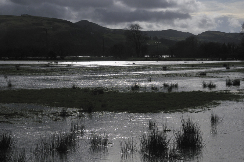
Winter 2020 was an uneventful one, bar the frequency of flooding on the Dyfi during February. This shot across the flood-plain was taken on February 23rd, but in reality, similar views could have been obtained on many days, although the light in this case was enough to stop me in my tracks. I was returning home having given a talk at a meeting that morning - on the way there I had to be met by someone with a 4x4 and taken around the diversion, since Dyfi Bridge was closed. On the way back the water was less than welly deep and it was wadeable - definitely not recommended if it's any deeper than that but I'm used to the place.
In March, the viral pandemic was well-established in many countries and, firmly believing in the precautionary principle, I started restricting my own movements and strictly avoiding crowded places early in the month. So by the time "lockdown" arrived in earnest, I was kinda getting used to the idea already. As an author, very used to working alone for long periods, the isolation was not the problem it clearly has been for many. Fortunately, too, I live somewhere where extensive views are accessible and I've spent a lot of time recently simply looking at the landscape, the skies and the wildlife. Even more so after being locked-out of Facebook due to a glitch in their two-stage authentication process - and it seems I am not alone in that.
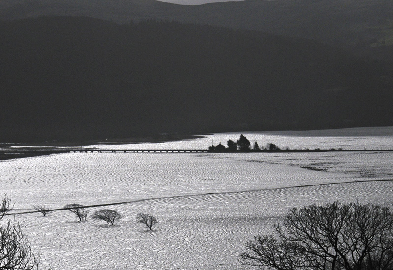
On the morning of March 12th, one of several huge spring tides coincided with perfect light on the Dyfi Estuary, here massively expanded over the fields:
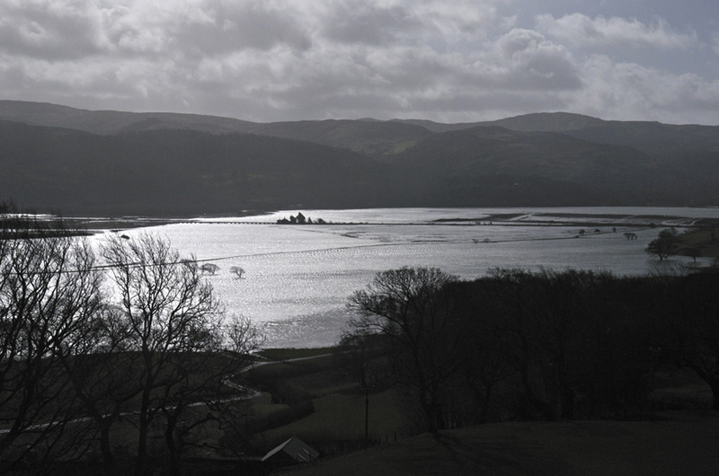
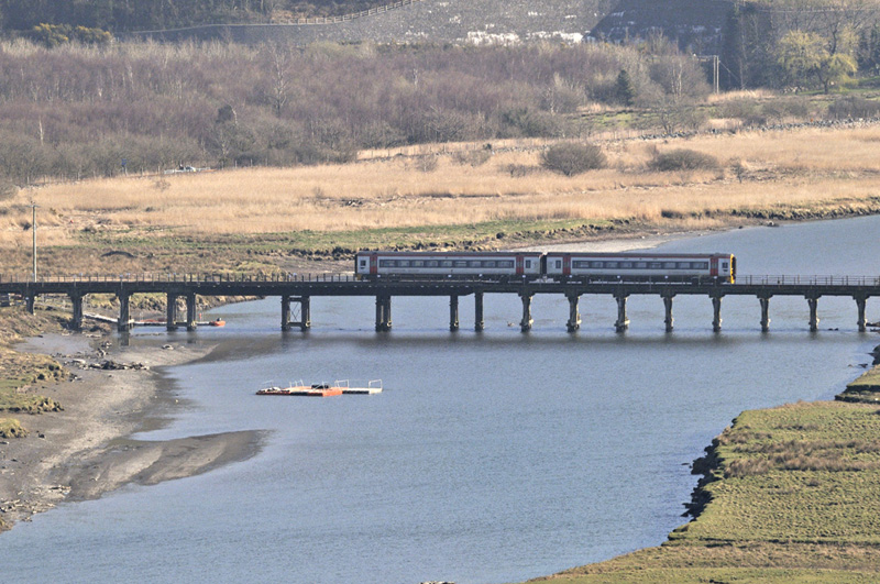
Here's a zoom in to the railway bridge leading to the station at Dyfi Junction, out of frame to the left. The line that crosses the Dyfi here then runs down to Aberdyfi and up the coast to Pwllheli - highly recommended on a good day, once they let us out again.
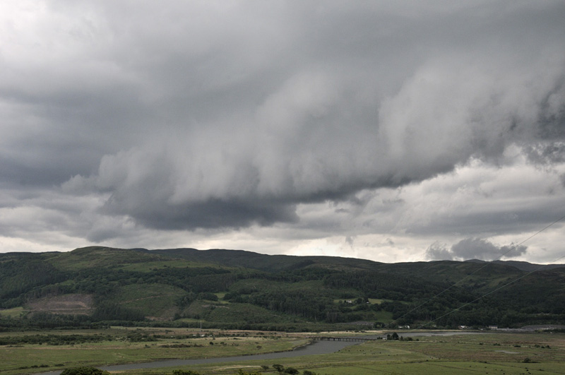
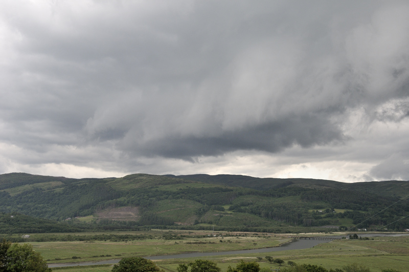
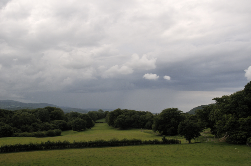
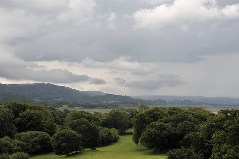
In fair weather-conditions, this is the daily view after a short walk (wide-angle, cropped). One can appreciate the potential for storm-photography:
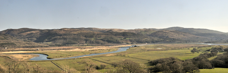
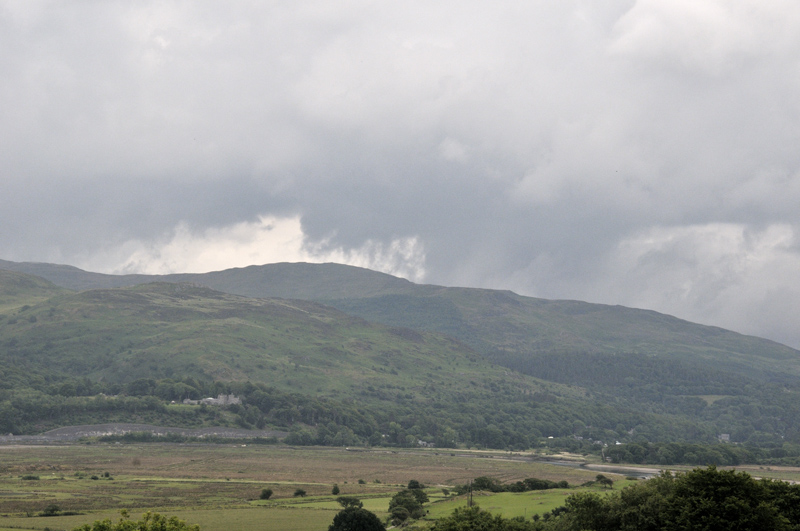
The same railway bridge under more typical conditions, with the walled cutting of the A487 Glandyfi Bends (a recent improvement of what was a notorious bottleneck) in the background.
Over to the east is the main Hide of the Cors Dyfi reserve - home to the Dyfi Osprey Project. One can observe the birds through binoculars, though a telescope would be more useful.

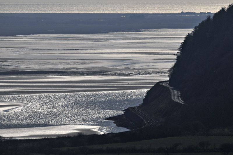
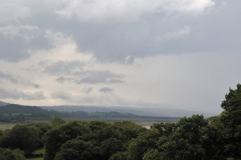
And to the west, the lower Estuary, Ynyslas and the sea beyond.
Being spring, of course there were lambs everywhere!

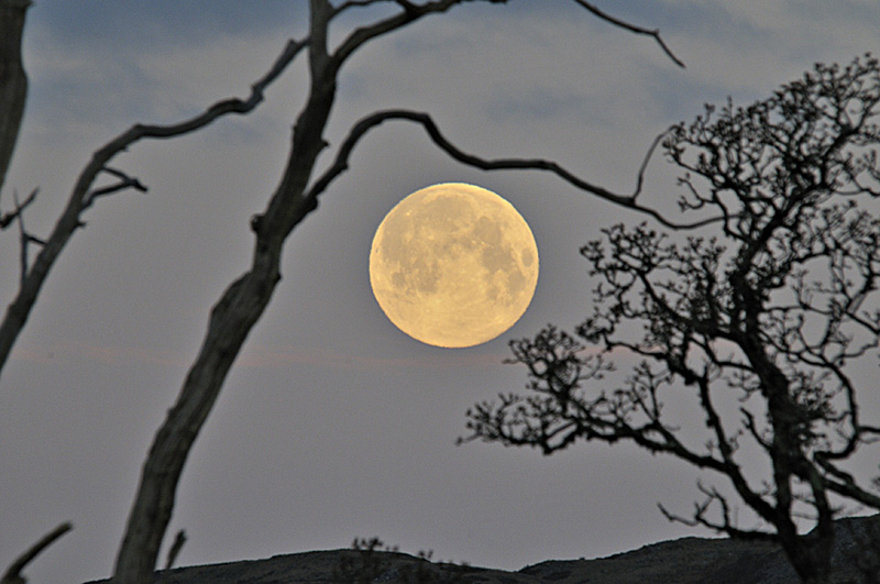
I got this lucky shot of a setting full Moon on the early morning of April 8th: moments either side of the timing and it would have been behind one or other of the trees.
April and May in particular featured largely settled dry weather, to the extent that one particular day left some of the trees here looking as if they had been scorched. Through this time I pressed on with my writing of the sequel to the Making of Ynyslas - this one's a bit more ambitious as it's about the coming together of the Solar System and the development of Earth into a place suitable for advanced life to inhabit. It's now out for technical review, following which the main phase of editing can start. I'm glad to have had such an interesting project to get my teeth into as it has kept me busy over much of the lockdown period.
I've hardly used the car either. Because of the essential travel only rules - and the guidance that should only be within around five miles from home (note these differ considerably from the regulations in England), the roads are very quiet, especially in the early mornings, so combining exercise and shopping by walking the five miles to my nearest shop has kept me in a reasonable state of fitness and on very early mornings, in that fine weather in April and May, it was most enjoyable too.
So to the convective spell that occurred on June 13th-17th. A slack area of low pressure was either over or close to the UK for all 5 days and as convection occurred inland, sea-breezes developed daily. These being westerly and the steering winds south-easterly, there was tremendous low-level shear available to be ingested by any storm updraught. A few funnel-clouds and at least one tornado have been reported from this five days. Because of the essential travel only/5 miles rules, I simply stayed home to see what each day would bring. I was not to be disappointed and in fact pleasantly surprised: in a previous life I would think nothing of driving 100 miles plus on a storm-chasing day, but this time I just let all the weather come to me instead. Cheaper, far more relaxed and no carbon emissions - what's not to like?
Day one, the Saturday, had almost perfect conditions for severe convective weather, bar one thing: a strong, mid-level capping inversion. Clouds would rocket up promisingly then their tops would flatten out beneath the cap, maybe about 8000-10000 feet up. So that was a no-show!
On day two, I walked to Machynlleth first thing for shopping. It was still early morning when I returned and noticed a lot of Kelvin-Helmholtz wave-clouds in the skies - a sure sign of turbulence and therefore mixing, which meant the cap would likely become a lot weaker. By lunchtime, the sea-breeze kicked-in and brought with it banks of fog. As the upper clouds moved over the fog-banks from the SE-NW, they too created Kelvin-Helmholtz waves, like this example, breaking in a north-westerly direction on the RHS of the photo:
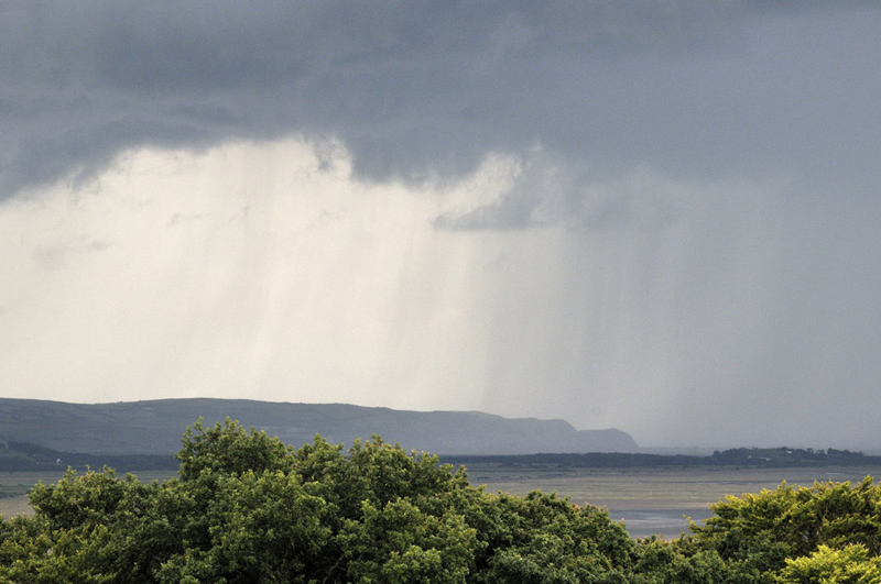
Just after 4pm, after some less-interesting downpours, this thunderstorm moved from the mountains out over the sea - the view is to the south west and features Borth Head:
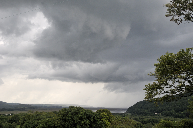
This interesting feature soon emerged and moved in a NE direction - it's an outflow-boundary going at right angles to the steering winds and once again creating very high low-level shear, with the westerly sea-breeze below and the sou-easterly steering flow above:
The part of the feature nearest me then seemed to detach itself from the rest and moved NW with the storm's updraught. I then realized that it had started to rotate rather rapidly. This was taken at 16.23:
Five minutes later. This whole lowering in center-shot was going round like the Magic Roundabout! Difficult to estimate its diameter but the Estuary it is above varies in width from 0.75-1.25 kilometers. So was this rotating wall-cloud going to produce anything else?
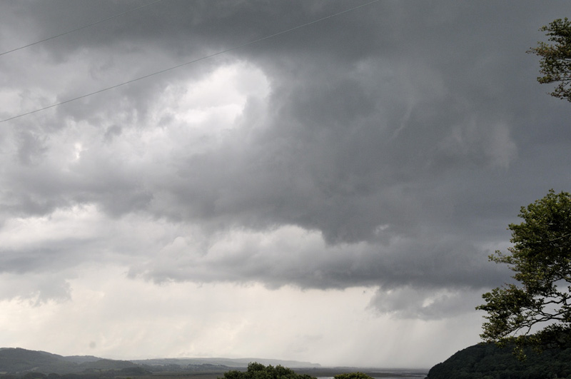
Another shot a little later....
....and a minute later again when a thin, poor-contrast funnel cloud was spawned. It's in the RH half of the image. The whole lot was lost behind the big trees after that, but what a fantastic half-hour! Such locally-derived spin-ups are not the sort of things that one can forecast, since outflow-boundaries are fickle things, but the storm was in the right place at the right time, so was I and the conditions with all that low-level shear were ideal for mesocyclone formation. It's probably a shallow meso, since I only watched it for a few minutes and it wouldn't have had time to extend much up the convective column, so the storm is probably not a supercell, since they are defined as having a deep, persistent mesocyclone. But I'm not complaining!
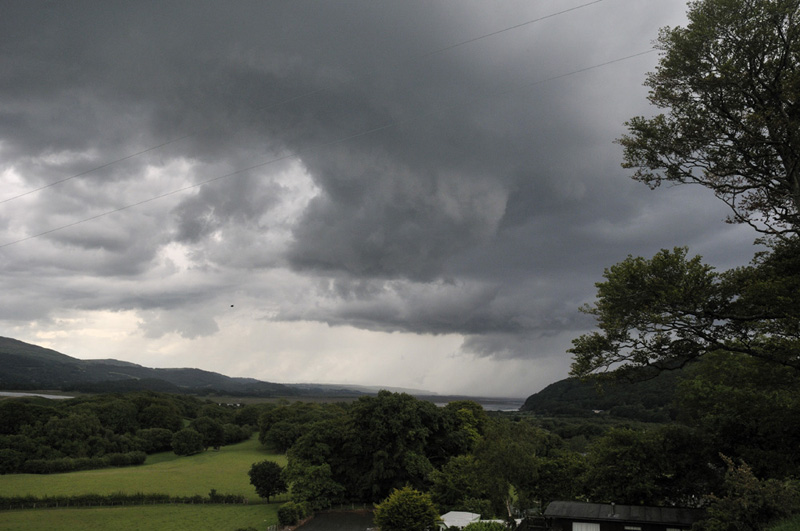
Visibility of day three - Monday 15th June - was rather poor when the first heavy showers arrived. Again the sea-breeze was there and this time storms passed to my north, the thunder rumbling away every so often.
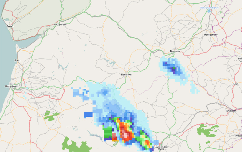
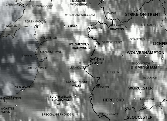
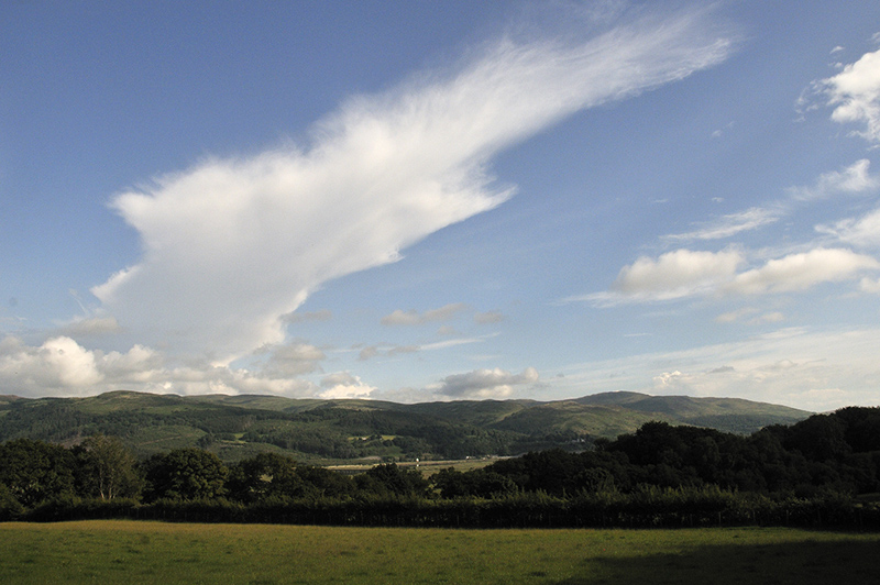
I had almost written the rest of the day off when all of a sudden the murk cleared away. Looking around, I could see a prominent anvil well to my south-east. A look at Netweather's radar showed the only storm anywhere near was between Llandrinidod Wells and Rhayader, 40km (or 25 miles in old money) to the SE:
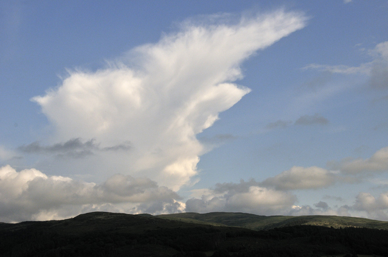
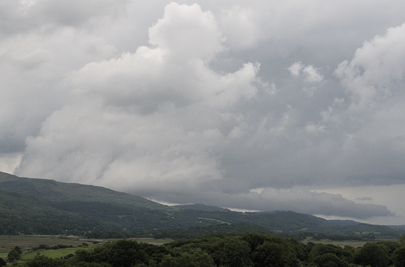
So it was time for another look out the back. And what a sight: a beautiful clear-sky anvil and with some Kelvin-Helmholtz waves on the filament of low cloud passing the front of the anvil's lower region.....
Here's a UK Met Office visible satellite image from around the time: Llandrinidod Wells is annotated below-centre and the storm is the bright white area of cloud right on top of it.
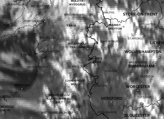
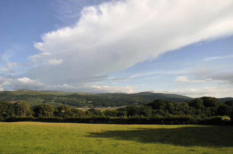
Then, even more remarkably, the anvil started to shear-out to the north-west very quickly indeed. The photo below was taken just over ten minutes after the one above and already the anvil's leading edge is almost overhead - and 40 kilometres NW of its core, within which all the rain/hail was falling and lightning discharges were taking place. Upper-level winds must have been very strong at the time, as soundings later confirmed. Storm-motion itself was near east-west.
Satellite from almost the same time as the image above. The anvil can clearly be seen, stretching out NW from the vicinity of Llandrinidod.
40 minutes later and I could no longer get the anvil in the viewfinder even at 18mm! By now it was well beyond the Estuary. As the storm crossed over the spine of the Cambrian Mountains, it appeared to cross the sea-breeze front, encountering much cooler dryer air beyond it. Sea-breeze fronts can act like local drylines, and that cooler dryer air killed the storm off, by depriving it of the necessary fuel (warmth, moisture) to keep going.
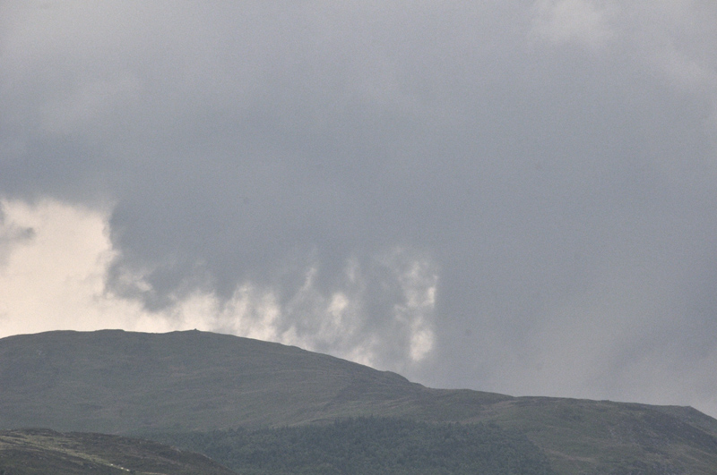
Day four, Tuesday, was less spectacular but still featured this thunderstorm, here crossing the western upslopes of the Cambrian Mountains:
It wasn't completely without interest, though: a bit of thunder and then this came into view: the updraught zone, complete with lots of scud and potential for a funnel or two:
Close-up. You could see these tendrils writhing and twisting as they rose up into the cloud-base. A funnel-cloud sighted and photographed near Bontgoch, a hill-village on the other side of the Estuary, may have been associated with this storm.
Same storm, a little later....
And later again: R of centre, the lowered area may be a shallow wall-cloud, since once again low-level shear was available in bucketloads and it was attached to the updraught-base.
More Kelvin-Helmholtz waves, these probably due to low-level fog being over-ridden by the strong sea-breeze, since the waves are breaking to the east:
Another lowering...
Day five was thwarted by very thick clag, being brought in as soon as the sea-breeze kicked-in, so it was more of an audible than a visual experience - the drumming of the heavy rain and the distant booming thunder, with the activity commencing late afternoon.
Other areas have witnessed far bigger storms, with some phenomenal lightning activity and for some unfortunate places, pretty bad flooding, but given the continuing lockdown rules in Wales, I am more than satisfied with the results of this past few days. And there's still the rest of the summer to come! More soon - hopefully sooner than the last gap in posts!
The Welsh Weather & Dyfi Valley landscapes Image-Library - Click HERE
BACK TO WEATHER-BLOG MENU