AUTUMN
2004 - PART 3:
10+ thunderstorms in one day!
21:10:04
BACK TO WEATHER-BLOG MENU
New! Fine Art Prints & digital
images for sale-
Welsh Weather & Dyfi Valley landscapes Slide-Library
- Click HERE
By 8.30am on Thursday 21st a TORRO
tornado watch had been issued for England, Wales and
parts of Eire, with the additional threat of severe
thunderstorms with large hail and gusty winds. Such days
are when I'm up at 6 poring over the charts and keen to
head out as soon as possible.
This turned out to be a mainly disappointing day
photography-wise but it did save a nice surprise for the
end. But the storms themselves - well I have never seen
so many in one day. I stopped counting at 10, but would
guess that I saw about 15!
The morning saw me down at Borth. Several storms rolled
up across the Bay, with thunder booming out of the murky
unphotogenic grey clouds. A cell just off the coast
between 1200 and 1230 gave a fair bit of lightning
activity and the static in the air made my car radio
crackle, then whine, then scream at one point. This is
the second time I have experienced this effect, which I
suspect to be due to static build-up on the aerial. A bit
alarming when you're on an exposed coastal vantage point!
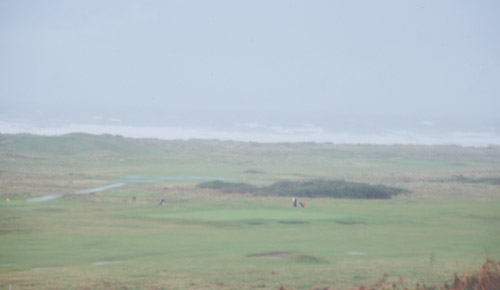
I fled the scene, noticing en-route that the golfers were
out on Borth golf course. Not the wisest place to be with
a metal club pointing up into the air!
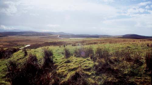 Came home to check the data and messages. A storm had been flagged up as a potential supercell due to its appearance on radar: this was just off SW Wales and would arrive over the Cambrian Mountains. I went for an intercept on the Machynlleth-Llanidloes mountain road: by the time it arrived, though, it had pretty much fizzled out. Here, beyond the sunlit moorlands, further anvils are dimly visible out to the west. By 2.30 I was on the way back to the coast for another intercept, this time opting for the Aberdyfi-Tywyn area.... |
|
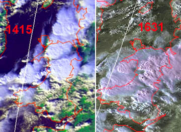 Here are satellite images for the afternoon, courtesy Bernard Burton. Times are in GMT, so that the LH image was at 15.15 BST. You can see a huge shieldlike cloud covering all of Mid-Wales - this is the joined anvils of several individual storms. Out over the bay is a series of storms running trainlike into the coast near Aberdyfi. On the way to Aberdyfi the sky just to my north darkened rapidly and in no time repeated lightning flashes were seen. Through Aberdyfi and out towards Tywyn I ran into hail covering the road and lots of standing water. I stopped at one of my usual laybys to take stock of the situation - wet and thundering to put it in a nutshell! |
|
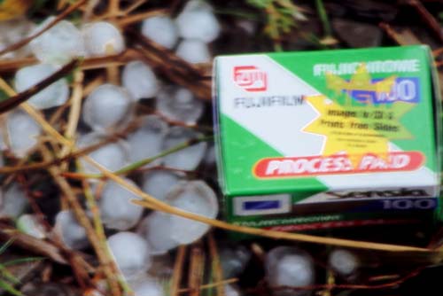 This is a poor (no, awful!) photo because it was handheld out of the car window. Didn't fancy getting out of the car with the amount of lightning about! Safety first! Anyway it does record the size of the hail that fell. These had been melting for maybe 10 minutes when I took this. The LH edge of the film-box is 40mm in length so the largest stone here (at the box's bottom L corner) is getting on for 20mm across. That is big enough to hurt! They were all well-rounded with clear outer layers and white cores. There were quite widespread large hail reports that afternoon. Forest Enterprise in Dolgellau had reports from 2 members of staff who took cover due to hailstones. One stopped beneath a large oak tree to prevent his windscreen being shattered but landed up with 4 inches of debris on his bonnet due to the hailstones ripping leaves and branches from the tree. The second report said that the hailstones where as big as a ignition key plastic fob and the hailstones were fairly angular and not "round". I spoke to the first witness myself, who told me that he ran into a thunderstorm in mid-afternoon near Ganllwyd - this being about 5 miles NNE of Dolgellau. Hailstones to an inch fell. The witness took some home and put them in his freezer. Must go and have a look sometime! |
|
 And once again the golf continued.... maybe they enjoy the danger! Admittedly, the current storm was clearing to the NE, but there was plenty more to come.... |
|
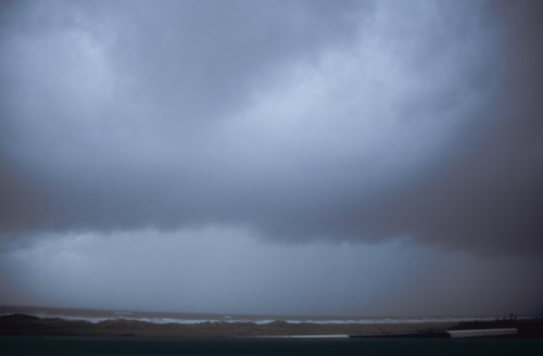 ....and soon enough the next storm was heading in! This was about as good as it got for low-level structure and the light conditions were awful. It was going to be difficult to get much in the way of decent photos out of this lot so I just sat back and enjoyed the show, occasionally moving a little N or S if a cell was coming straight at me..... |
|
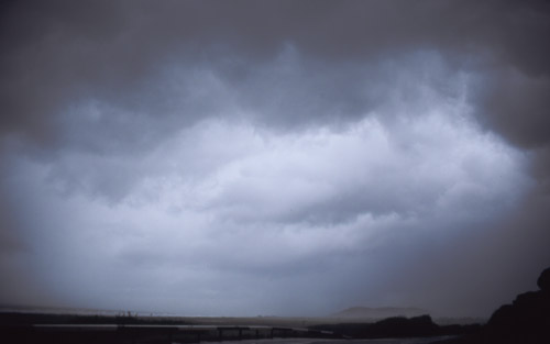 ....as the black clouds raced past... |
|
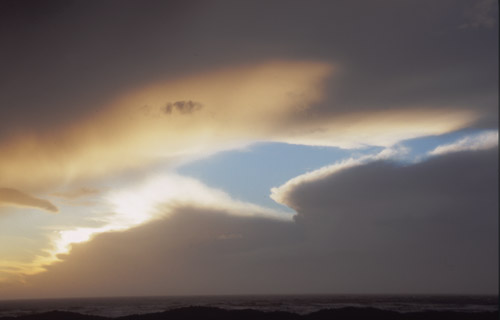
 As the afternoon wore on a breather looked to be possible. This was fast-moving stuff with a gale-force steering wind, so the clearance would arrive quickly.... |
|
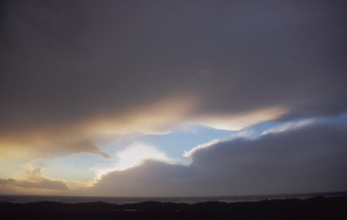 ...at last producing some decent if strange skyscapes... |
|
 ....under one storm anvil with the next lot out there over the bay... |
|
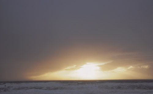
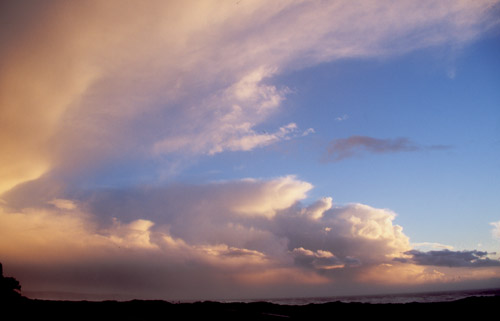 ...looking S down the coast, cell after cell lit by the setting sun.... |
|
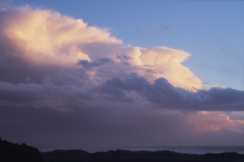 ...until darkness began to draw over the scene. Activity quickly waned hereabouts as the evening drew on - a pity as otherwise I'd have tried to get some lightning shots. But an impressive day nevertheless! |
|
BACK TO WEATHER-BLOG MENU New! Fine Art Prints & digital images for sale- Welsh Weather & Dyfi Valley landscapes Slide-Library - Click HERE |