AUTUMN
2006 - part 1: Cloudbursting!
BACK TO WEATHER-BLOG MENU
New! Fine Art Prints & digital
images for sale-
Welsh Weather & Dyfi Valley landscapes Slide-Library
- Click HERE
The anti-drought continued through
September and into October with style, and the fields
have returned to their customary emerald green. In the
past few weeks I have driven through the heaviest rain I
have ever encountered and slept through a similar
overnight deluge that flash-flooded part of the house I
live in leaving a sorry sight awaiting me first thing in
the morning. This weather stuff's not all fun and games,
y'know.
Here is the pick of the shots from recent times. Most
date from the weekend of the 29th September-1st October,
when a lot of storms were around, although they mostly
proved exceptionally uncooperative in photography terms.
That's one of the things I really like about doing this
though - you are, at the end of the day, totally at the
mercy of the laws of atmospheric physics and can only get
results when circumstances beyond your control come
together favourably. It's something humans cannot control
at all. I like that.
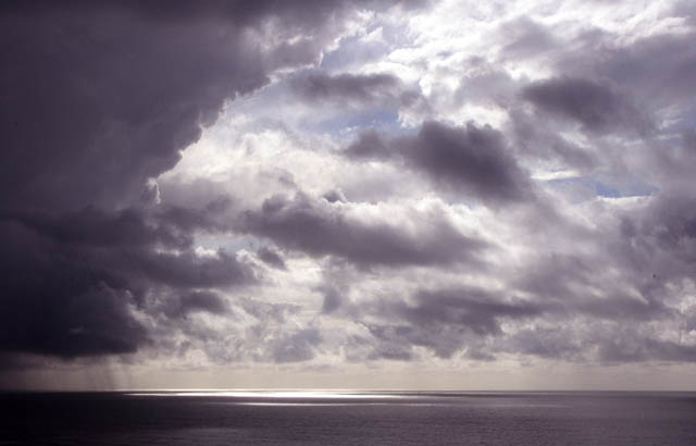
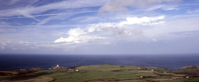
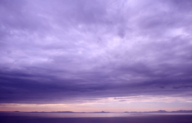 The above image, and the one below, were taken late on a September afternoon near Llwyngwiril. Cardigan Bay is covered by an extensive stratocumulus sheet - outflow from old storms way to the SW, and clearer air is visible in the distance beyond the Lleyn Peninsula. Bardsey is at the far L. I love the light on this and the way the cloudbase pulls you towards the horizon.... |
|
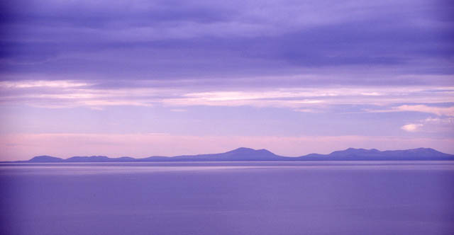 Telephoto of part of the same view.... |
|
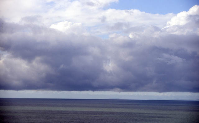 On to the weekend at the end of September. On the afternoon of the 29th, convective towers out in Cardigan Bay were sporting little funnel-clouds here and there along their bases, which were better viewed through binoculars due to a) their small size and b) their distance from me... |
|
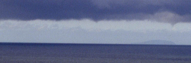 Here's a close-up, about as close as is possible without the grain of the ISO 100 film becoming too noisy. Distinct small funnel to the RHS. Had the convection been more vigorous a group of waterspouts would have been a nice possibility! |
|
 To the SW there was more vigorous activity.... |
|
 ...with strong upper-level shear very apparent. What this means is that the winds aloft - 20,000 feet up or more - are very strong compared to those further down. Therefore, the fine cirrus-cloud forming the storm's anvil is drawn away well downwind, forming a long veil of cloud many miles long. |
|
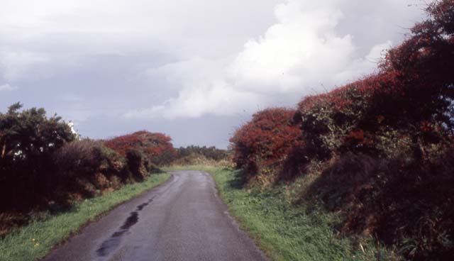 September 30th saw another of my exploratory runs to SW Wales, to check it out as "chase-country". This time I concentrated on the area between the Teifi Estuary at Cardigan and Strumble Head SW of Fishguard, a place that is approached by winding lanes like these. A multicellular line had just passed through when I arrived, with, like the day before, anvils sheared out way ahead of the precipitation, which was pretty intense. But it turned out to be the first and last storm of the day! So it was time to go exploring instead.... |
|
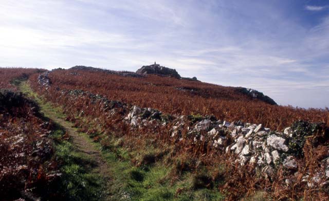 The path up to Garn-fawr, the highest bit of ground hereabouts with a scramble to reach the trig-point.... |
|
 From the top there are extensive views in all directions. Here, the retreating multicell line can be seen in the distance, whilst Strumble Head lighthouse dominates the foreground... |
|
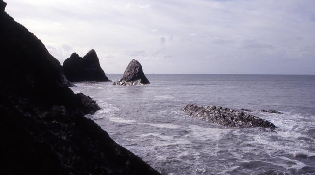
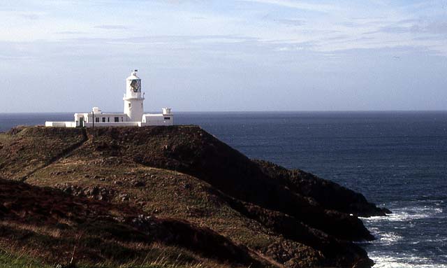 Here's the lighthouse itself, with rocks falling away to fairly rough seas. It's seriously deep in places here with fearsome tidal overfalls and submerged rock-pinnacles awaiting unwary boat-owners.... |
|
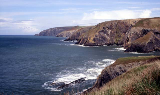 Moving on up the coast past Fishguard, this is Ceibwr Bay. Note the retreating multicell line is still visible! |
|
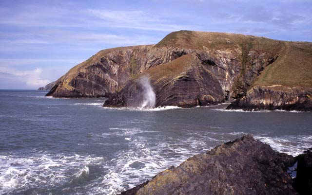 This is a photogenic spot and would be a great place to visit on a really rough day. Even today the waves were breaking quite high over the rocks in places... |
|
 This view looking SW would be quite excellent with 20ft waves slamming into the pinnacles! |
|
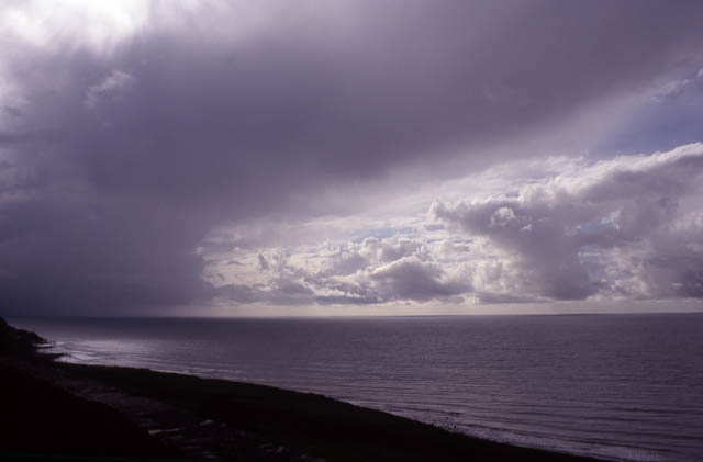
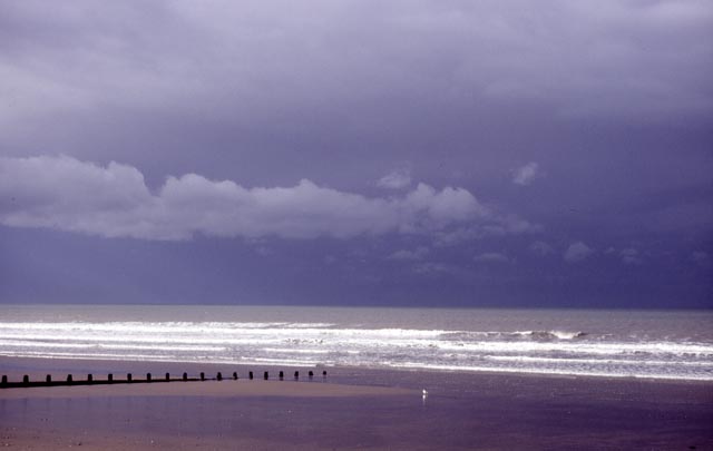 After visiting Ceibwr, the veil of cloud to the SW had started dominating things, thus killing off any more photographic opportunities. The following day, Sunday October 1st, saw threatening skies moving in from Cardigan Bay. I headed to Borth hoping for good things.... |
|
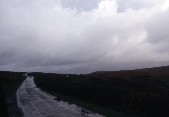
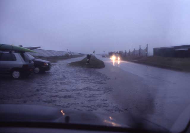 ....but was met by a cloudburst that made the road awash and brought light levels down to near-dusk for my trouble! |
|
 Undaunted, in the afternoon I headed SE to the Borders to intercept an apparent clearer area, indicated on satellite imagery, with a whole clump of storms following on. However, whilst heading down there it seemed to have largely filled itself in! The occasional bright patch gave hints of stunning mammatus-laden thunderheads in the distance so I carried on regardless... |
|
 ....only to find more of the same! This is the road that crosses from Painscastle to Cregrina, going over Llanbedr Hill, one of a group of lovely open hills to the east of Builth Wells. They deserve their own webpage and they shall have one in due course! Anyway, sat up there in the jeep, with it rocking from side to side, battered by squall after squall after squall, the road a wide river and the light fading fast, I decided to accept defeat. A Saturday with hardly any storms followed by a Sunday with far to many to get a decent look-in! So at about 6.30pm I set off home, taking the valley road down towards Aberedw and the main A470.... |
|
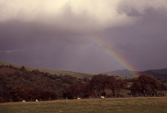
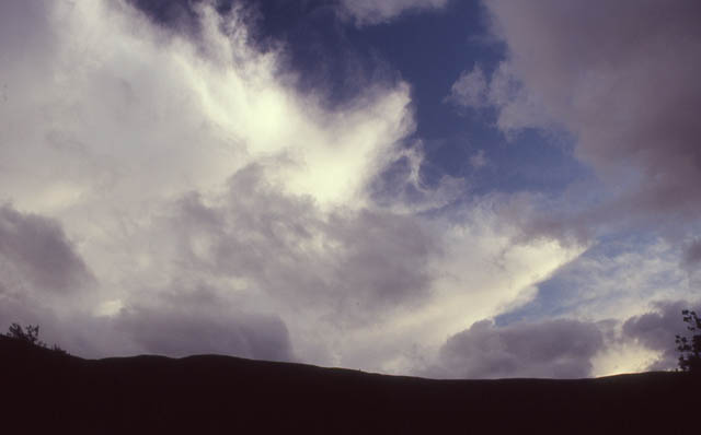 ...whereupon a huge hole promptly opened up in the endless cloud-deck revealing what I had been after all along! Despite dusk rapidly approaching, I stopped and watched this lot go by, with the silhouette of Llandeilo Hill in the foreground.... |
|
 ...with the anvil cirrus lit by the last of the sunlight.... |
|
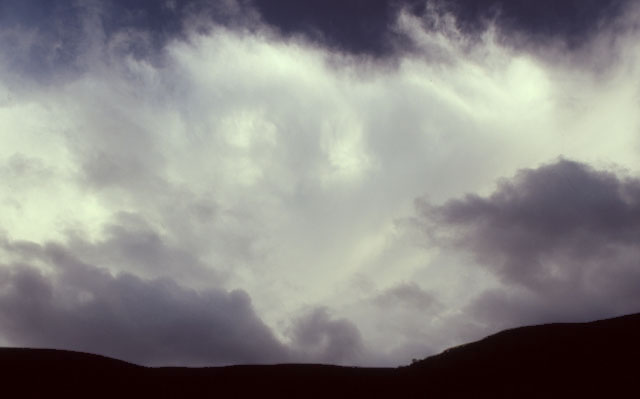
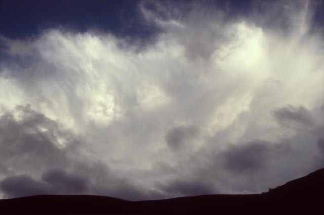 ....and just a hint of mammatus to finish off with. By now, the "cloud hole" was rapidly closing up behind me, as another storm approached from the south-west. It was time to go. Just as I reached Builth Wells, I went into the core of the next storm's heaviest rain. This was the stuff that makes giant-sized splat marks on the windscreen and bounces back 10cm or more on impact! Visibility dropped right back to less than 100m and my speed dropped to around 15mph. I finally punched through the core a few miles NW of Builth and fled northwards up the A470 to drier skies, the pub and home. Later, I returned to these hills on a sunny, warm October afternoon and wandered contentedly along the wide trackways, camera in tow. In many places, washed-out track-bed and rock-fragments freshly strewn over green grass gave witness to the ferocity of that final cloudburst of the day. These were not the most photogenic storms I have set out to record, and I wouldn't call the day a success in those terms, but they certainly meant business and it was good to be out there amongst them and to feel humble in the presence of the uncontrollable power of the natural world - a world with neither compassion nor hatred, merciless and unrelenting but not deliberate, neither kind nor cruel. Such storms have rumbled their way around the planet for hundreds of millions of years, yet Homo Sapiens - mankind - has been around for less than half a million years and civilisation for a fraction of that again. It is right, therefore, to feel humbled by the raw power of the natural world - it doesn't need us, but we most certainly need it. I remind myself of that often, and when I forget to, such storms as those I was pounded by on Sunday October 1st 2006 do a very good job of reminding me! |
|
BACK TO WEATHER-BLOG MENU New! Fine Art Prints & digital images for sale- Welsh Weather & Dyfi Valley landscapes Slide-Library - Click HERE |