AUTUMN
2006 - part 2: Devastating superbolt hits Arans?
BACK TO WEATHER-BLOG MENU
New! Fine Art Prints & digital
images for sale-
Welsh Weather & Dyfi Valley landscapes Slide-Library
- Click HERE
Into November and some beautiful
warm, bright Indian Summer days were there to be had. On
the 7th a group of us set out from Cwm Cywarch to climb
Aran Fawddwy, at 905m (2971ft) the highest peak in Wales
outside of the Snowdon group's "fourteen
three-thousanders". The day was a great one for
photography but it included the discovery high on the
mountain of a most unexpected sight. More on that further
down the page!
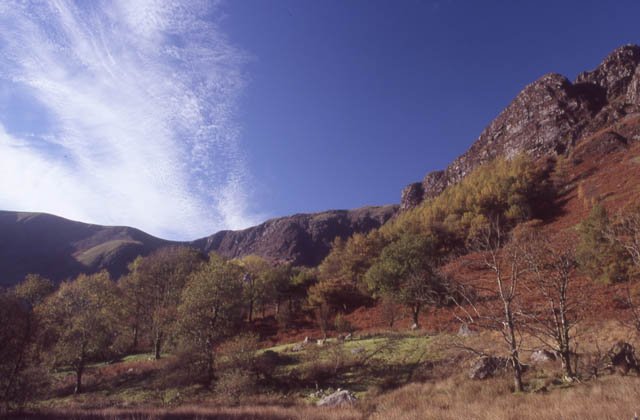 We took the LH valley up out of Cwm Cywarch, which leads steeply up under the crag of Craig Cywarch.... |
|
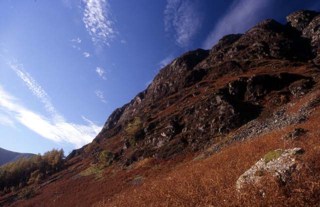 ...seen here towering above the bracken-covered hillside... |
|
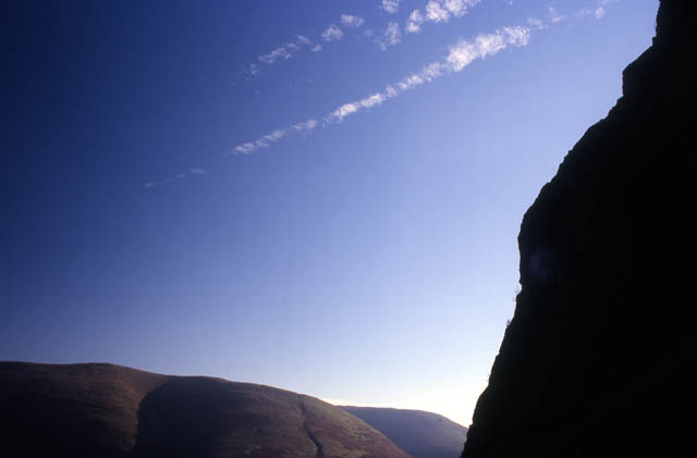 ...and here, from way up the path, in silhouette.... |
|
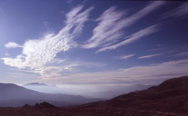
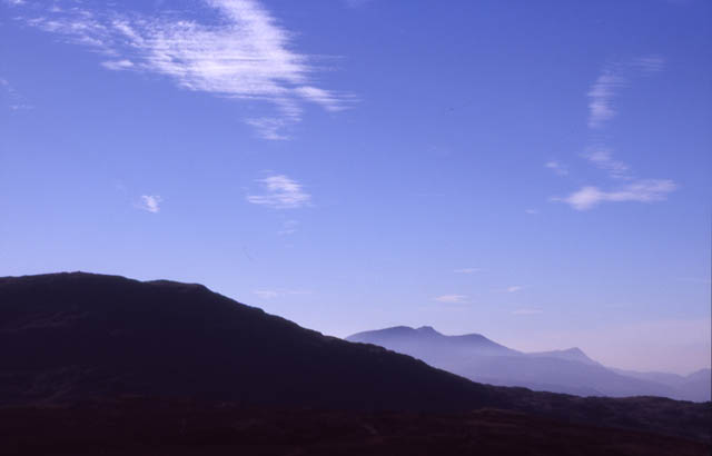 The path exits onto a broad boggy plateau area across which Aran Fawddwy is a good tramp of about a mile. This is looking the other way, westwards across to Cadair Idris... |
|
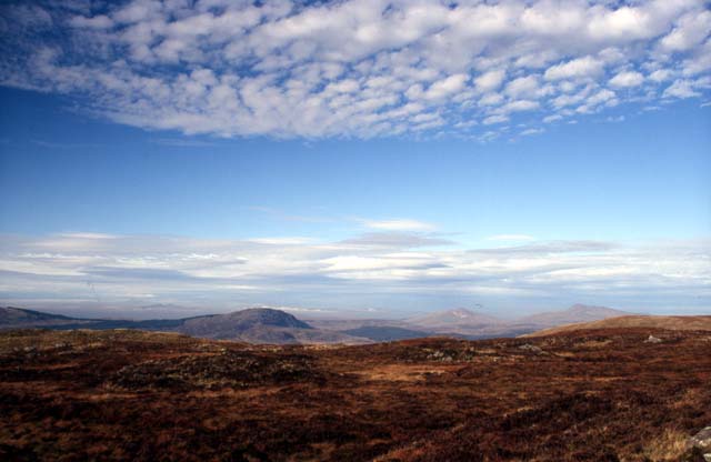 ...while this is looking north-east towards the Arenigs and Rhobell Fawr.... |
|
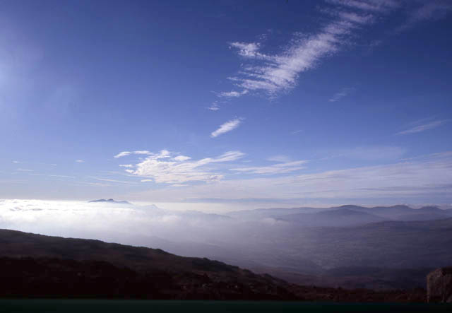 All the way up we'd become aware of a fog-bank, drifting in like a summer sea-fog off Cardigan Bay. Here, Cadair Idris has almost been engulfed and it looks like we're next! |
|
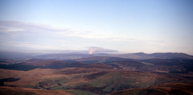 Looking NE from the summit and a substantial moorland-fire is generating its very own cloud-bank away in the distance, somewhere on the NW Berwyns at a guess... |
|
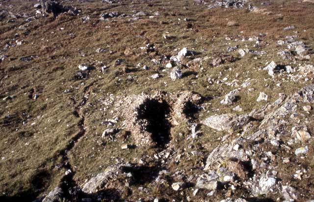
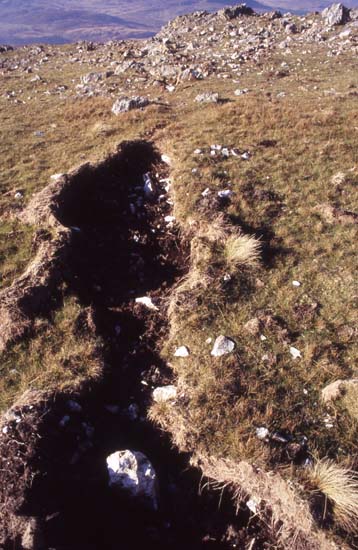 The path divides on the way down and tracks lead off to each valley draining the head of Cwm Cywarch. I had noticed some unusual ground disturbances on the way up and now while the others had a late lunch I went to check them out before the fog rolled in. Here is the first example. It's up to 0.3m wide. It's as if the ground has burst open with peat and stones flung out sideways. First thought was an extreme downpour & flash-flood damage, but on level and sometimes uphill ground? I think not! Second thought was an impact from a breaking-up meteor. However, if that was the case, the trajectory involved would have demolished the fence that was just behind me when I took this... |
|
 Parallel and along in the same direction was this hole plus the wiggling, narrow and shallow trail to its L. It appeared that the agent of destruction had started up by the fence and had radiated out across >15m of ground.... |
|
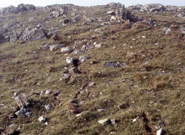 Here, another nearby parallel wiggling trail can be seen going from the upper L to bottom R... |
|
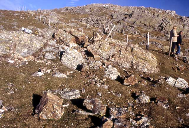 ....while this rock outcrop has been rent asunder. The large, microwave-sized boulder and brown rock fragments in the foreground have all come out of the shattered outcrop between them and the style. The other holes and "wiggly trails" are just out of view to the L. So what caused this damage? I cannot imagine any human motive to create this mess. Apart from anything else, to achieve the damage in the last photo, one would need to carry a compressor, rock-drills and explosives all the way up there - it's hard enough work carrying ones lunch that far!! Lightning is a good candidate, and specifically a positive "superbolt" C-G strike. These bolts occur when there is a discharge between the anvil at the top of the thundercloud and the ground - a much greater distance travelled than a standard, negative C-G stroke. Such bolts have to overcome far more electrical resistance due to the distance involved, and are therefore many times more powerful than ordinary bolts - themselves capable of splitting mature trees down the middle. So my theory - and that's all it is - is that a very powerful lightning bolt struck here. The ground was saturated and the heat converted the water to steam with explosive rapidity, rending the ground open and flinging rocks out sideways. The lightning dissipated to earth along a series of radiating channels. I'd be interested to read any thoughts as to the validity of this idea, but the lack of a plausible alternative is glaring! |
|
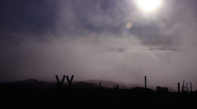 Meanwhile the fog duly rolled in. Luckily the paths are easy to follow as they run alongside fences! |
|
 Luckily enough the fog cleared again revealing beautiful late afternoon skies out westwards.... |
|
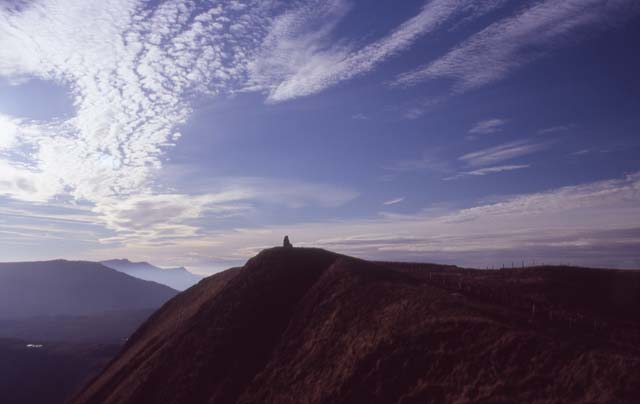 Here is the view west from just beyond Drws Bach, with the memorial cairn..... |
|
 ....and here is a late afternoon aspect of Aran Fawddwy and Aran Benllyn from Dyrysgol's grassy top... |
|
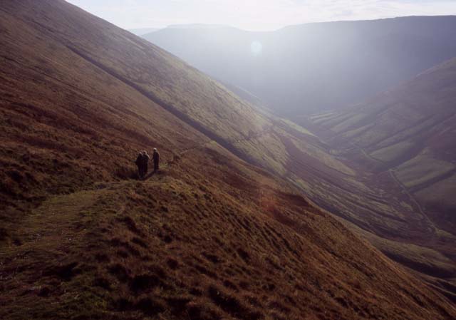 ...and finally, homeward bound on the miners' track down to Cwm Cywarch and in due course the pub! A great day for photography, mountain air and the unexplained! |
|
BACK TO WEATHER-BLOG MENU New! Fine Art Prints & digital images for sale- Welsh Weather & Dyfi Valley landscapes Slide-Library - Click HERE |