BACK TO WEATHER-BLOG MENU
The Welsh Weather & Dyfi Valley landscapes Image-Library - Click HERE
Hot on the heels of the last post of Summer comes the first from Autumn. Ironically, given the amount of effort made during convective weather periods, poring over chart after chart to predict areas where photogenic storms are likely to be met with, this was an entirely chance encounter - and I saw as many funnel-clouds within just 35 minutes as I have seen in my entire weather-photography career!
I had headed down to Borth Beach for a fishing session in the early hours: at this time of year, our beaches are deservingly popular by day, and fishing does not mix well with people in the sea, swimming, surfing, doing their thing with kite-powered kit and so on. We fish by night instead.
There's something deeply peaceful about the sea at night. Standing alone on a beach as the ebb tide drains the sands, the stars bright overhead and just the distant lights of the Bay's coastal towns reminding you that there are people here on the planet: the wink of Bardsey Lighthouse over the north-western horizon and every so often the streak of light as a meteor burns away to vapour up in the Mesosphere - even when the fishing is slow there's no shortage of distractions!
On September 4th, the fishing was slow down the ebb. When I arrived at about 0400, the roar of the surf that greeted me almost had me abandoning things straight away - there was a much bigger swell than I had expected. Big swells on these shallow sandy beaches kill the fishing - there's simply way too much energy in the water. Fish eat to gain energy (among other things) and they know that if they have to expend more energy hunting than they will gain by eating they will, all things being equal, eventually die. So in a big swell that sends tables of water surging at 2m/sec or more up the beach they will, quite sensibly, move out a little and wait for easier conditions.
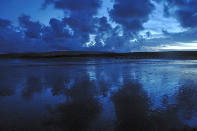
As the ebb wore away the swell dropped off sharply, but the fishing remained secondary to the interest of the breaking day, reflected on the wet, newly-uncovered sand:
At sunrise, shallow convection was evident out to sea, with small towering cumulus popping up and dispersing repeatedly, lit up by the rising sun and again beautifully reflected in the wet sand:
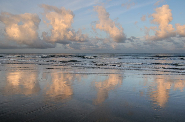
The sea in Autumn is at its warmest, and because the air over it is cooler now, that leads to instability: the sea surface warms the air above it, warm air rises and convection is the result. If the atmosphere is unstable at all levels, thunderstorms can result. On the 4th this was not the case: the instability was limited to lower levels, with a shallow ridge of high pressure aloft in the wake of the cold front that had brought much rain to Wales the evening before....
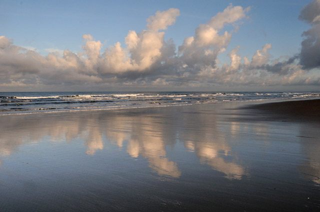
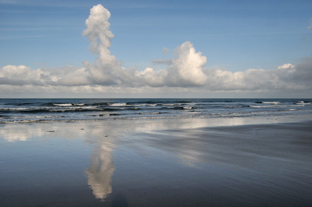
This image shows how buoyant the lower-level air above the sea was: this is a single parcel of air that has been warmed by the sea and has shot up skywards, like a hot air balloon, its moisture condensing into a tower of cumulus cloud.....
At the same time, despite the synoptic-scale airflow (i.e. that marked on the weather-charts) being sou-westerly, an easterly breeze wafted across the beach. Looking north, towards Aberdyfi, fog streamed like a river out of the Dyfi Valley, heading out to sea before dispersing. This was a katabatic flow - a gravity-driven density-current of night-cooled, moist air draining down the valleys of the Cambrian Mountains, strong enough to hold back the SW synoptic-scale airflow. It was to have a great deal of relevance.....
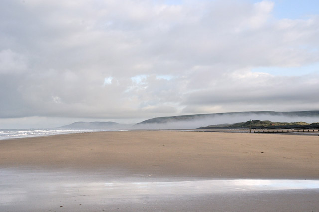
Having abandoned the fishing (one ray caught and returned - I don't kill them as there are better and commoner eating-fish to be caught most trips), I thought to pop over to Ynyslas and get some photos of the early morning light in the Estuary. I bumped into an old friend and whilst chatting away, I happened to notice something out to sea, over the dunes. Grabbing the binoculars, I identified it as a funnel-cloud. Time to get back to the open coast!
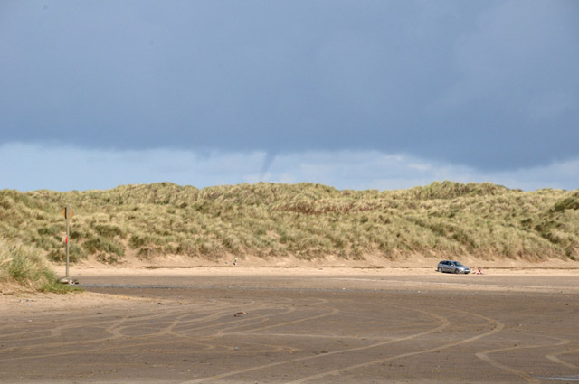
At Ynyslas village, a track leads across the golf-course to some old brick buildings at the top of the beach. Sprinting the 200-odd metres to this vantage-point, I saw the first funnel-cloud disintegrate - but a new one had formed to its south-west:
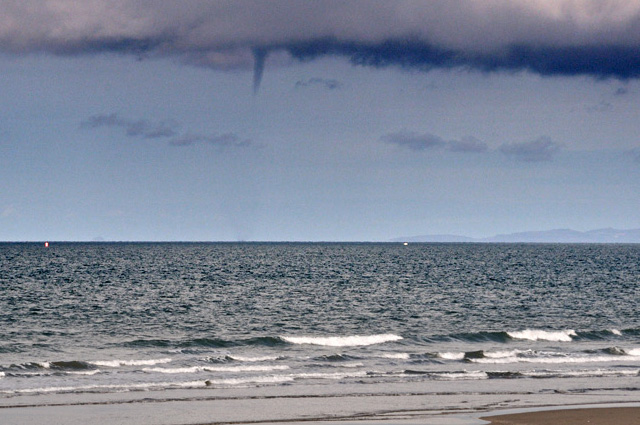
Enhancement of the image in Photoshop - by pushing the Levels almost into oblivion - reveals that this is a waterspout: the disturbance on the sea surface is obvious (I can see it in the shot above). The funnel-cloud merely marks that part of the vortex where condensation into cloud is taking place: the vortex itself extends all the way from cloudbase to sea surface:
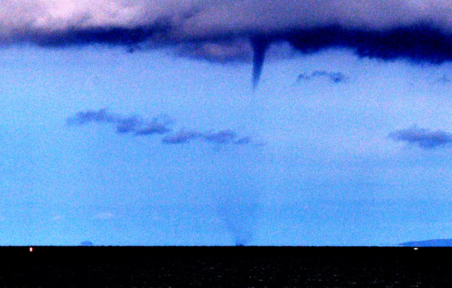
The spout tracked SW-NE (L-R) across the Bay:
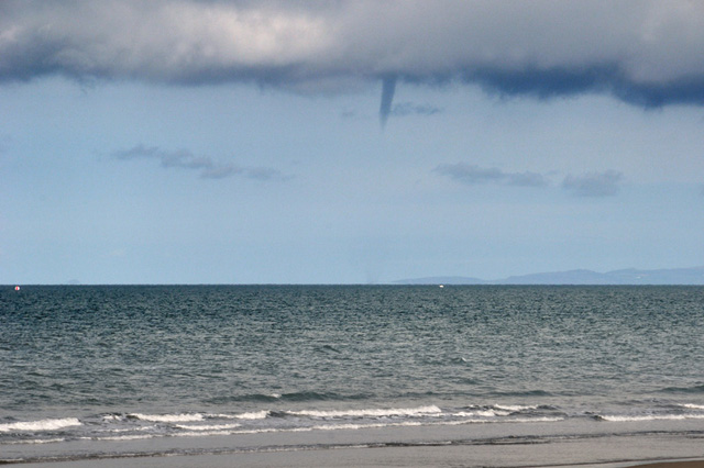
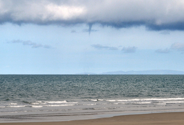
Examination of atmospheric soundings "upwind" - from Camborne and Valentia - for 00z and 12z show the Lifted Condensation Level (LCL) was at 920-940 hPa at 00z, rising to 870 hPa by 12z on the 4th. These atmospheric pressure-levels are at heights of 700-900m above sea-level. The LCL is the height at which the moisture present in a lifted parcel of air cools sufficiently to condense into cloud: in other words it is the cloudbase - a useful forecasting tool e.g. for hillgoers to figure out if they'll either get a good view or need a map and compass.
Thus, though these funnel looks small, the visible part of the vortex is 200-300m long!
Even in a small funnel-cloud like this, the winds are much, much higher than in its surroundings - it was almost calm on this occasion, but 40-60mph winds, spiralling upwards were likely present within the funnel. It is these winds that cause the pressure within the vortex to drop radically, pulling in more ambient air which then expands and condenses-out its moisture, thus generating the visible funnel-cloud well below the surrounding, LCL-defined cloudbase.
Meanwhile, to the NE, another lowering was in development - a much stouter affair:
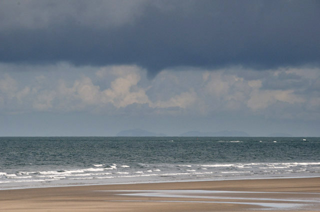
And southwest again, yet another!
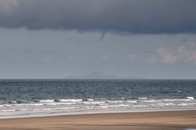
This one seemed not to make contact....
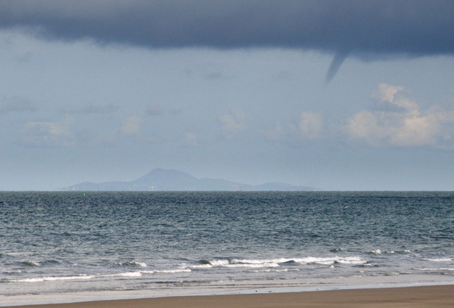
In the meantime, yet another vortex had formed to the NE....
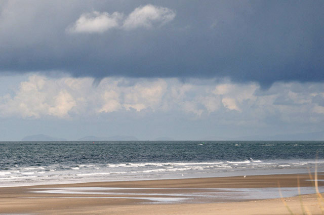
Here's a zoom-out to ultra-wideangle - there were four funnels visible at this point.
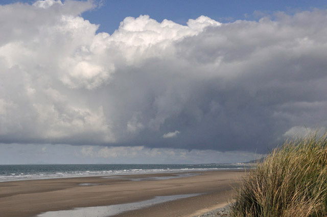
SW again and a thin ropy funnel is visible - I think this is the thinned-down waterspout from above but things were constantly developing at this point! Next to the ropy funnel in the shot below, a circulation is visible on the sea surface - through its parent funnel-cloud is almost invisible - waterspout #2!
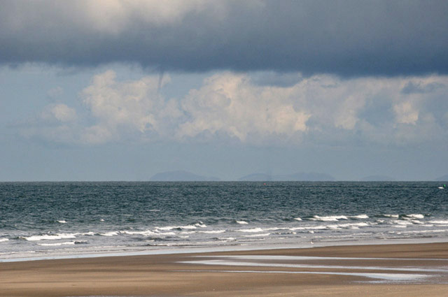
Here is a digital crop - the seawater spray from #2 is easily seen and that from #1 is less clear. #2's ropy funnel can just be made out....
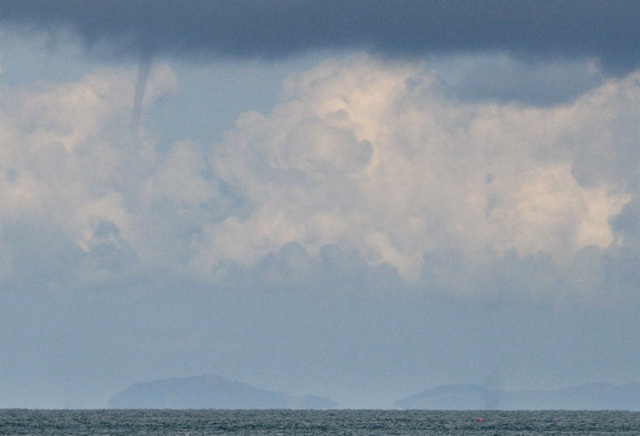
In another zoom-out, here they are, all four in a row:
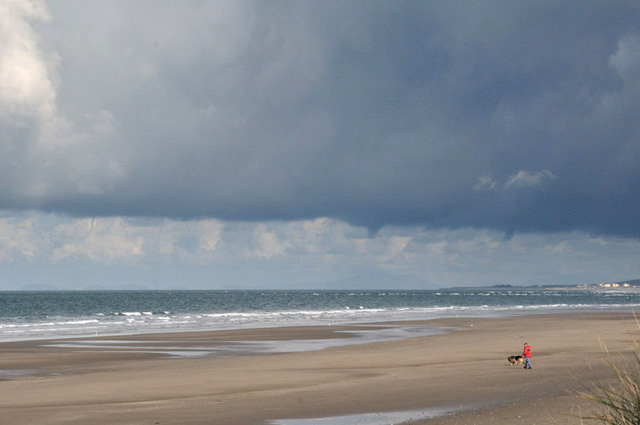
Now, spout #2 has a more visible funnel...
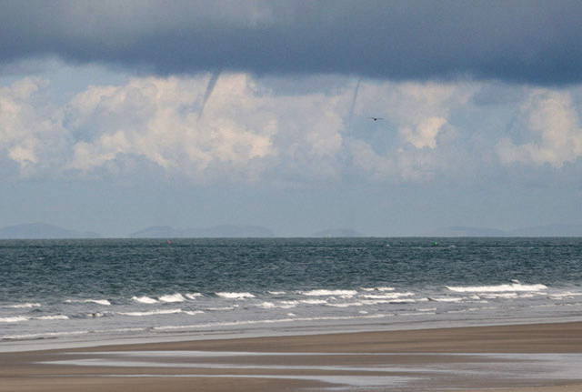
Meanwhile, to the NE, the stouter funnels were heading for the coast. Tywyn is visible on the RHS......
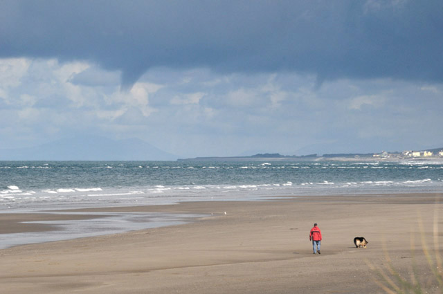
Hot on its heels, waterspout #2.....
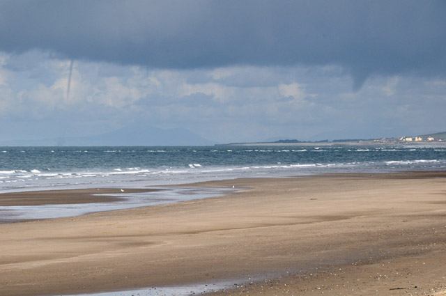
The view from Tywyn must have been great, not that I was complaining!
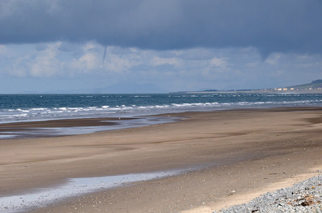
Here, waterspout #2 is nearing the coast, the stout funnel is disappearing off R but a new vortex is developing just NE of the waterspout:
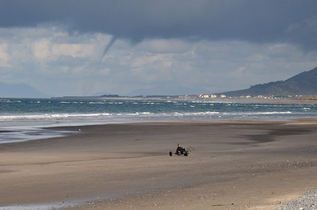
A kite-carter adds some neat foreground:
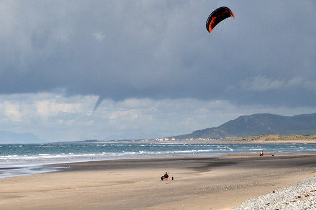
The new vortex extends down powerfully:
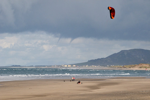
This bit of the show was the most photogenic....
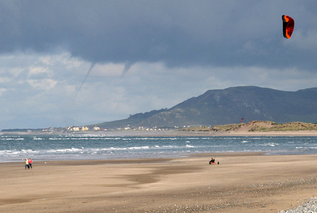
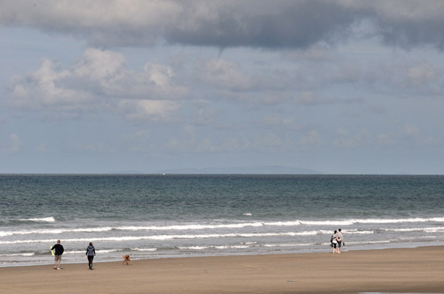
Meanwhile, out south-west, although the convection was less intense, more funnels were being generated. I took my last photo at 10.44am, 35 minutes after the first sighting.
The images have generated much interest on the UK Weatherworld forum, where I had some particularly useful discussion with Met Office meteorologist Nigel Bolton. The diagram below shows what was happening:
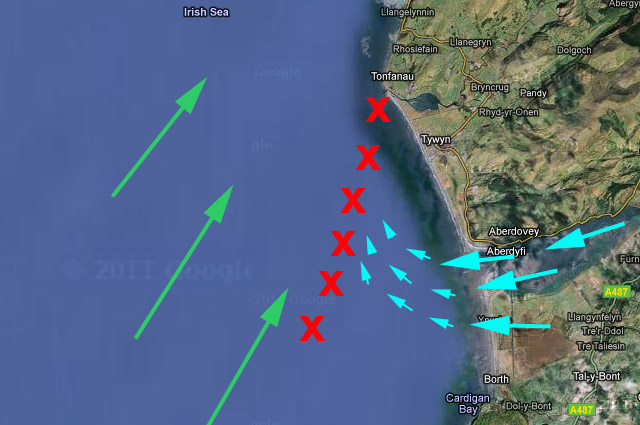
Big pale blue arrows = cold katabatic flow (the foggy air draining out of the Dyfi Valley)
Big green arrows = synoptic airflow (sou-westerly)
Little pale blue arrows = air from the katabatic flow pushing the local warm air up into the cloudbase
Red X's = line along which convection was occurring and funnels/waterspouts were developing.
So: we have scattered early morning convection occurring around the Bay. In this localised linear zone, the cold easterly katabatic flow coming out of the Estuary is acting like a small cold front: it is undercutting and lifting the air over the sea because a) it is colder and denser and b) it is converging with the synoptic airflow coming up from the SW. The resulting convergence-zone manifests as a line of stronger convection, compared to the weak stuff that is present elsewhere in the Bay. The convergence also results in strong-wind-shear (wind directions and speeds varying with height), which sets off rotation: this rotating air being pulled sharply up by the updraughts in the cloud creates multiple vortices, some of which are persistent and strong enough to form funnel-clouds and waterspouts.
Why did the activity peter out by about 1100? The answer is straightforward: the katabatic flow was exhausted as the air over the Dyfi Valley warmed back up in the morning sunshine. No katabatic flow, no convergence. End of fun.
Here's a satellite pic, courtesy of Bernard Burton (http://www.woksat.info/wwp2.html):
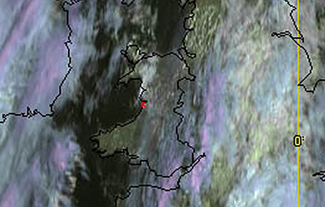
"X" marks where I was and the convergence-zone is the bright white area to the N & W.
One interesting thing about the above observations is that these are common conditions in Autumn: on any evening where winds fall light there will be cooling and valley-fog will form. With a light and weakly unstable synoptic airflow out over the sea - from the S, SW, W, NW or N - this convergence will occur and will accompany convection. It could well be the case that early morning trips to the coast in such setups will result in further funnel/waterspout sightings. But next time, if the wind's a sou-westerly, I'll be heading up to Tywyn!!
The Welsh Weather & Dyfi Valley landscapes Image-Library - Click HERE
BACK TO WEATHER-BLOG MENU