Spring
2005 PART 1:
Winter's last gasp: surreal snow showers
8th April 2005
BACK TO WEATHER-BLOG MENU
New! Fine Art Prints & digital
images for sale-
Welsh Weather & Dyfi Valley landscapes Slide-Library
- Click HERE
A final(?), Northerly outbreak
occurred towards the end of this week and Friday the 8th
signified an unstable, convective airflow and an excuse
to get out there with camera. Snow showers were widely
forecast for coastal regions and so the favoured venue of
the big layby near Llwyngwiril, overlooking Northern
Cardigan Bay, was chosen....
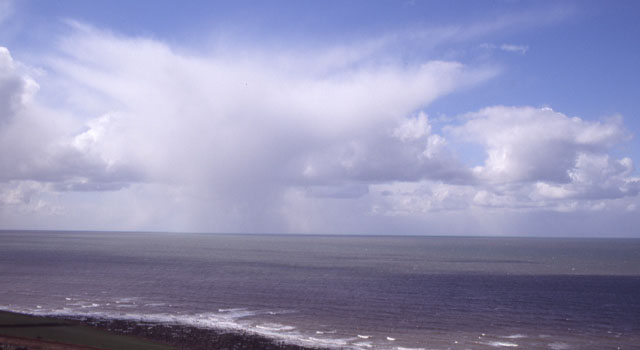 At first, small Cumulonimbus clouds out to sea gave light falls of what looked to be snow..... |
|
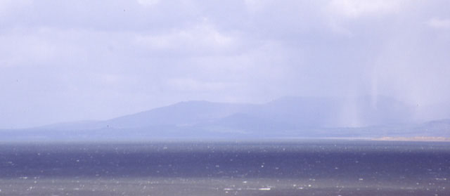 To the north, heavier developments were underway over the Llyn Peninsula. Here, heavier shafts of falling snow part obscure the hills. This shower intensified as it moved back out across the bay and straight towards me.... |
|
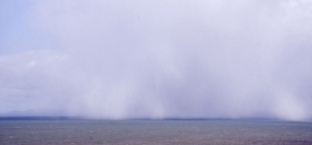 ...totally obscuring the view as it trundled across the sea... |
|
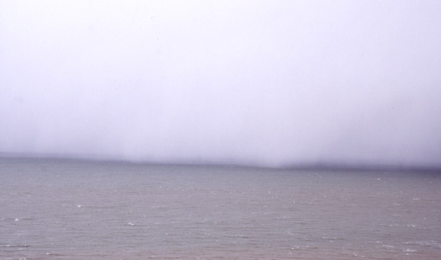 ...like a curtain, it shut out all that was beyond. Here it is less than half a mile away. An absolute blizzard followed - for 10-15 minutes! I like the weirdness of this photo! |
|
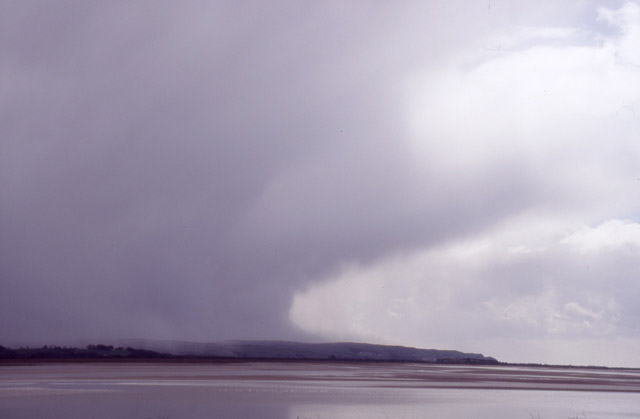 With nothing of further note heading down, I followed it homewards. Here it is across on the S side of the Dyfi Estuary. This is an interesting photo as the snow is marking out the downdraught caused by it dragging cold air down with it. On hitting the ground that air fans out away from the cloud - hence the snow being blown along the ground at the RHS of the cloudbase here. Only a quick trip out, then, but the April Showers would soon be kicking off and some serious storm-chasing would be on the cards! |
|
BACK TO WEATHER-BLOG MENU New! Fine Art Prints & digital images for sale- Welsh Weather & Dyfi Valley landscapes Slide-Library - Click HERE |