Spring
2005 PART 2:
April Showers (and a well-defined convergence-line)
18th April 2005
BACK TO WEATHER-BLOG MENU
New! Fine Art Prints & digital
images for sale-
Welsh Weather & Dyfi Valley landscapes Slide-Library
- Click HERE
During the third week of April, at
last the classic April situation of sunshine and heavy
showers was forecast. Monday the 18th looked just
possible for something to fire over the Cambrian
Mountains although the setup was a bit marginal. So off I
went, keen for a break from the desk apart from anything
else....
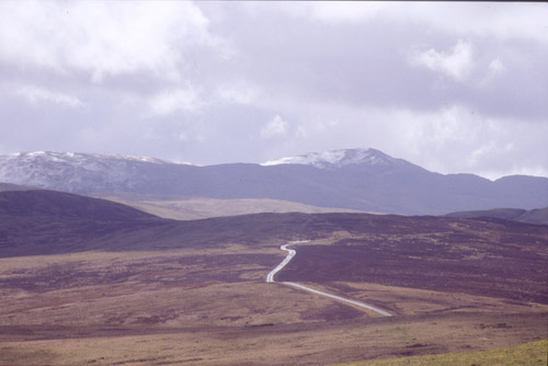 ...pausing to get a last (probably) shot of snow on Plynlimon for this Spring, anyhow. Grey clouds massing behind.... |
|
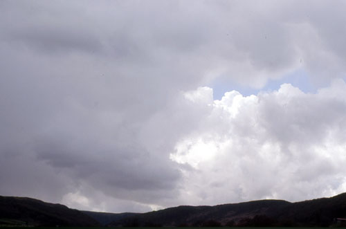 Onwards towards Llanidloes more intense convective weather could be seen so I continued south towards Rhyader. Here's a cell just to the north of Rhayader... |
|
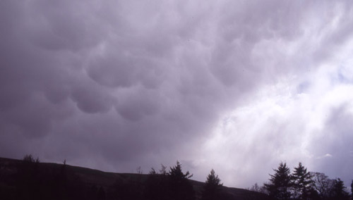 And a more menacing one to the south. Going east, the signs that these cells were displaying combined with the only modest rain that was falling from them suggested one thing - that they were outflow-dominated (i.e. all the "whoomph" was pouring out of them and nothing was going back in - so that as they moved further NE they were decaying away). After calling a friend to get some data I decided to move SW to hit them where they were developing, which seemed to be over the Cambrian Mountains.... |
|
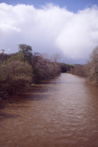 .....here at Newbridge-on-Wye more solid-looking storm-clouds are visible over the mountains, forming a backdrop to the swollen, muddy waters of the River Wye. The only way to reach this area, one of the remotest in Wales, would be to continue to Beulah and take the single-track mountain road through Abergwesyn and over the mountains to Tregaron, and hope I might get closer.... |
|
 ...which was not apparently going to be the case! The very low cloudbase was still miles away to the NW. The only possibility now was going to be to drop down into Tregaron and head N towards Devil's Bridge, as it was becoming apparent that the cells were initiating at the western edge of the Cambrian Mountains. A pity as I love the wilderness up here, although today's peace was broken by the two A-10 "tankbusters" that buzzed my jeep a couple of times! Onwards, anyway.... So down along winding roads through dense forestry, across the fields in the valley below and on through Tregaron, up to Pontrhydfendigaid, turn off through Ffair-rhos and ahead is a long tall deck of cloud. Stretching way out west and disappearing into a blackness to the east, this was it at last. I know this area quite well so was able to position myself right under its centre in no time... |
|
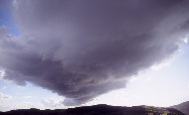 This was taken from the old lead-mines above Ysbyty Ystwyth. It shows the bank of convective cloud stretching well out SW into the distance. To its SE are scattered cumulus-clouds, but to the NW the skies are clear. The steering flow was a SWerly. What was fixing the convection along this line alone? The answer was that it must have been a week sea-breeze coming in from the Cardigan Bay coast, not much more than 12 miles to the west. That would be the clear-air zone. Meeting the marginally unstable SWerly airflow would create a convergence-zone - a place where two airflows meet. Where these occur, air is forced upwards, sometimes to the point where convection is possible. This was what was occurring here, resulting in this well-defined line of convective cloud in an otherwise pretty much uneventful sky. I waited a while as the convection overhead continued and intensified. It got darker and odd hailstones started to fall..... |
|
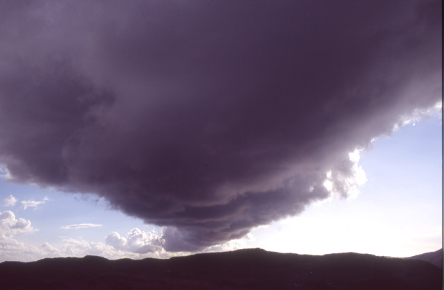 ...which was when this was taken! This shows rather better how a convergence-line acts as an airmass boundary: the clear sea air to the R and the cloudier, weakly convective air to the left. Wanting a better look at what was going on I pressed on, and hail started to fall more regularly. Getting out from beneath the line, I headed north and found a good vantage point not far from Devil's Bridge.... |
|
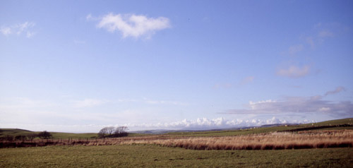 ....but by now evening was well in progress and what convection there was had weakened. This is looking north across Cardigan Bay, towards the Llyn Peninsula - the spine of which is marked by a line of sizeable cumulus cloud, marking in turn another sea-breeze convergence-zone. Today had been mostly unremarkable for photography but provided some interesting information on storm initiation. The cells developing along the convergence-zone running over Ysbyty Ystwyth were then drifting NE in the steering SW airflow. As they did so they ran up over the Cambrian Mountains where they were further intensified giving heavy downpours, probably helped due to air being lifted into them as it was forced up over the hills. To the east of the hills, all such assistance ceased to exist and here, as I had seen earlier, the cells collapsed showing typical outflow features such as mammatus and virga. An educational day! The 19th on the other hand would be tiring but quite exciting! |
|
BACK TO WEATHER-BLOG MENU New! Fine Art Prints & digital images for sale- Welsh Weather & Dyfi Valley landscapes Slide-Library - Click HERE |