SUMMER
2004 - PART 2
A SUDDEN (AND BEAUTIFUL) AFTERNOON THUNDERSTORM - July
6th
BACK TO WEATHER-BLOG MENU
New! Fine Art Prints & digital
images for sale-
Welsh Weather & Dyfi Valley landscapes Slide-Library
- Click HERE
July
6th 2004 was the day I aborted a fishing-trip, turned the
car round, grabbed my camera and headed for the hills. It
was late afternoon and it suddenly became clear that
convection had kicked off in earnest. The reward for this
change of plan was the most exquisite storm updraught I
have ever seen myself - enjoy - I certainly did!
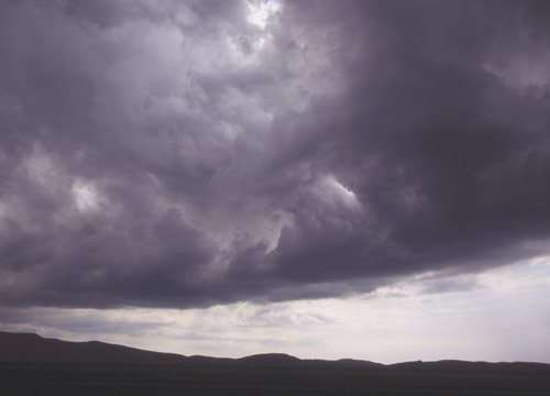
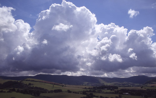 Over the hills towering cumulus started to shoot up in rows. My initial decision was to head towards a wall of blackness I could see to the east, but on realising that the "thing" building up right overhead was far more interesting I cut back through Abercegir and Melinbyrhedyn to get onto the good old Dylife mountain road and its many vantage points. As I did this it was getting darker and darker overhead and moderate-sized hailstones began to fall, at first intermittently.... |
|
 ....on reaching the mountain road I could at last see what was going on properly. A boiling mass of upward-moving clouds! |
|
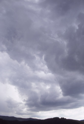
 The textures in this great bank of active convection were amazing. After a while I continued uphill, wanting to get a decent view of the whole storm as it matured.... |
|
 ....stopping halfway under leaden skies to get this one... |
|
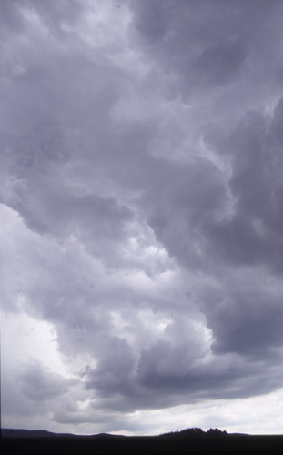
 ...and here, zoomed out to a wider angle. Odd chinks of sunlight create weird illumination effects. The main storm was to the R of the image... |
|
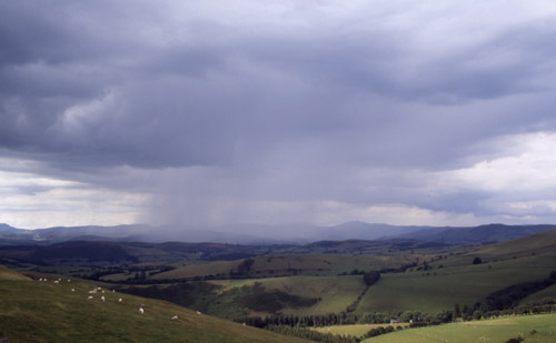 Up on the higher ground and looking back at it, hail and heavy rain are starting to fall a little more intensively.... |
|
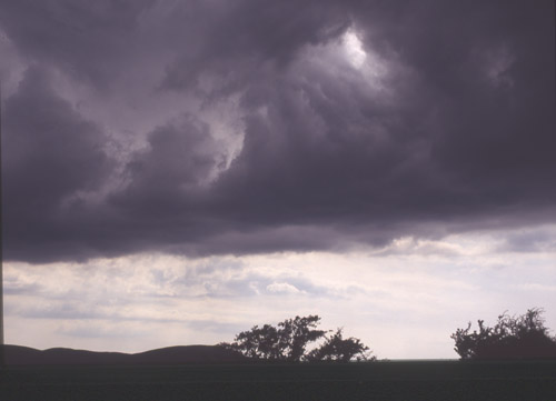
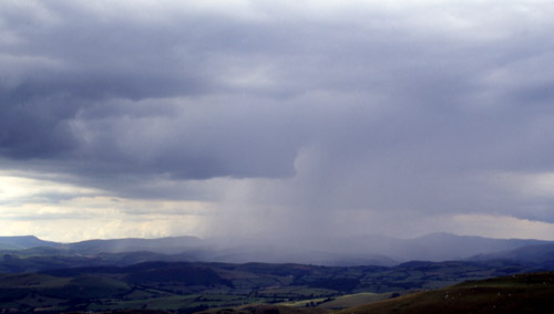 ....and maturity cannot be far off, although a strong updraught is evident from the rain-free base quite close to the precipitation... |
|
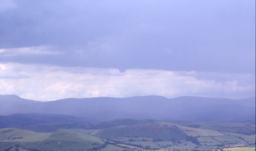 ...while a bit later, out to the left of the developing precipitation core (which had moved a little to the NE), the long flat cloudbase is punctuated by a hard-edged lowering. This looked as though it might morph into a funnel-cloud but didn't, although it retained this shape for a minute or so. |
|
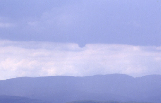 ...here in close-up. It was a little too far away to be sure what it was*; it's far too smooth to be scud-cloud, for sure. I would guess it was a rotating updraught-base - these were strong updraughts all along. Within a short time the precipitation rapidly intensified (spoiling the view!) and that was that. A cracking little storm after weeks of zilch! * this has since been examined by Tony Gilbert of TORRO, who has stated that it is a tuba funnel-cloud. These relatively uncommon features are bowl-shaped convex lowerings, which are often accompanied by more typical thin textbook funnels. |
|
BACK TO WEATHER-BLOG MENU New! Fine Art Prints & digital images for sale- Welsh Weather & Dyfi Valley landscapes Slide-Library - Click HERE |