SUMMER
2007(?!) - part 1: big June thunderstorms!
BACK TO WEATHER-BLOG MENU
New! Fine Art Prints & digital
images for sale-
Welsh Weather & Dyfi Valley landscapes Slide-Library
- Click HERE
Summer officially begins at the
onset of June and ends with August's passing. Normally.
This year, April seems to have been our Summer! Although
temperatures here in Mid-Wales have not been particularly
cool most of the time, the big feature has been a dire
lack of sunshine - and lots and lots of rain. The
picture's been the same in most places, with perhaps the
most astonishing statistic being from Aberdeen airport.
They had more hours of sunshine last December than this
June!
Statistics mean little, however, to those who are still
unuable to return to their homes after the severe
flooding that struck many areas, particularly Yorkshire,
last week. The problem occurred when a low pressure
system developed over the southern UK with its
wrap-around occlusion becoming practically stationary
over a curved line from E Wales through Shropshire to the
S Yorkshire area. Steady heavy rain fell for simply too
long for the drainage to cope.
Other shorter-term but torrential deluges hit many areas
due to the frequent thunderstorms that affected the UK
during June, and I was able to get out in pursuit on a
number of days, starting with Friday 15th:
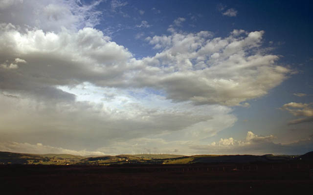
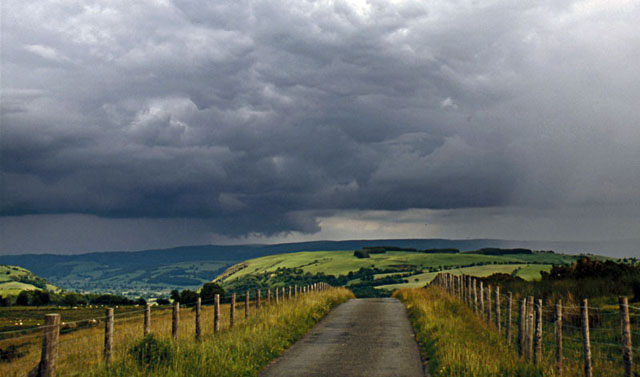
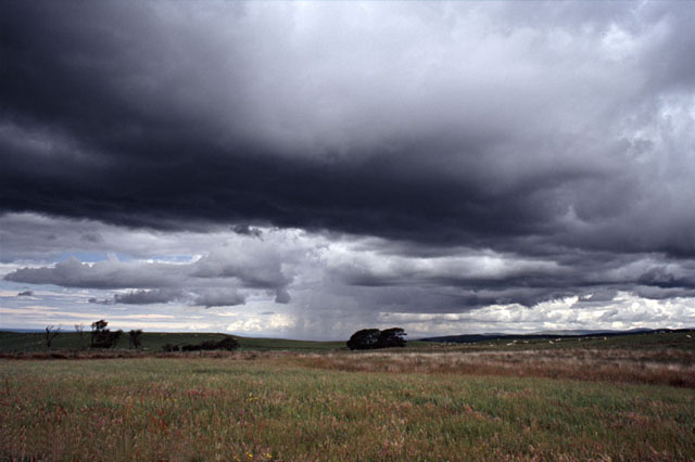 On the 15th I caught up with the convection as it was developing, in the Trisant area between Devil's Bridge and Aberystwyth. I deliberately targeted the coast in case sea-breezes set in, to meet the southerly steering flow. The resultant convergence might produce a funnel-cloud - in theory... |
|
 Despite a few promising lowerings, the cloud simply grew into a big downpour....! |
|
 After some time, I abandoned the storm and headed north towards HQ, pausing to catch this scud rising into the cloudbase, before the torrential rain blocked out all visibility.... |
|
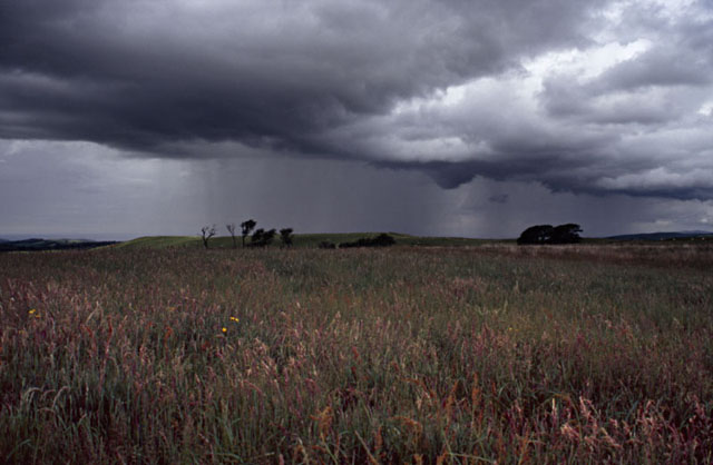
 A quick check on the radar revealed a line of intense mature storms heading northwards towards the nearby hills. I intercepted it quickly, catching it as it was gusting out. In this photo the gust-front is just approaching.... |
|
 Tendrils of scud approach the ground as the gust-front moves over.... |
|
 ...revealing a cavernous "whale's mouth" structure.... |
|
 This is my favourite! |
|
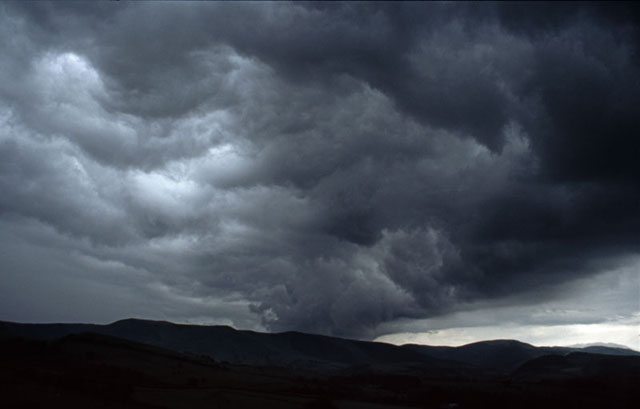
 ...while this was looking 180 degrees in the opposite direction I followed the slot between the gust front's leading edge and the precip behind me for a few miles NNW, but the front then met with what had been a rather innocuous shower over the Dyfi Valley. This then exploded and became electrically active giving a deluge and a good number of vivid lightning-strikes, each, curiously, involving a CC with a CG at one end, the CC being first although a very short time separated them. Once this started I drove to the edge of its core and sat back to enjoy the lightshow! This was classic, text-book stuff. The old outflow boundary (i.e. the gust-front) moves forward of the storm that spawned it, and like a little cold front it pushed tons of moist air along and up into a developing shower updraught with a heavy thunderstorm developing very quickly as a consequence. |
|
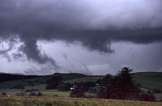
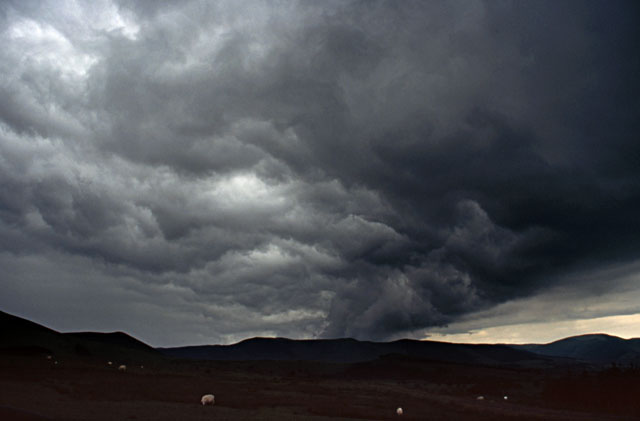
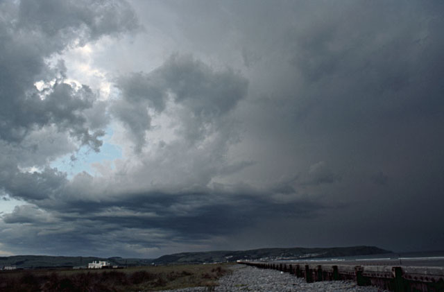
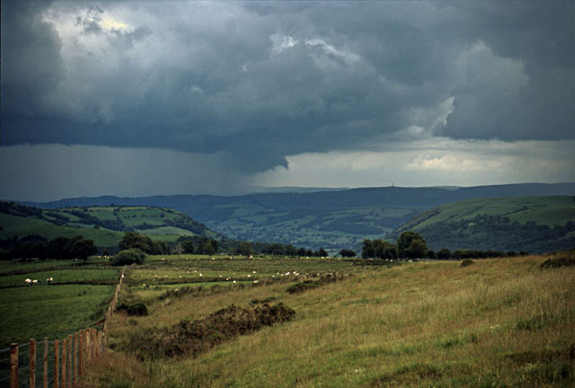
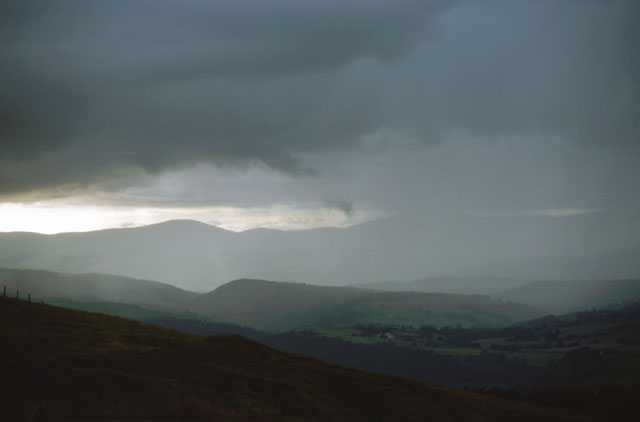
 A great start there, and only four days later I was out again. This time I pushed SE into terrible visibility associated with a powerful Mesoscale Convective System (MCS) that occupied a lot of the Midlands/Welsh Borderland, where it caused some serious flooding. Wanting to see something, and equally not wanting to get caught in a flash-flood, I struck out west to arrive at the coast in early evening, with a useful clear slot between me and the MCS to my east - the anvils are visible in this image... |
|
 ...and another line of thunderstorms on the cold front to the west. The front steadily approached and out popped a high-based gust-front.... |
|
 ....which raced out overhead, expanding rapidly.... |
|
 ...and quickly closing the clear-slot! The front moved over Machynlleth at dusk, with another awesome whale's mouth structure, although it was too dark to photograph. |
|
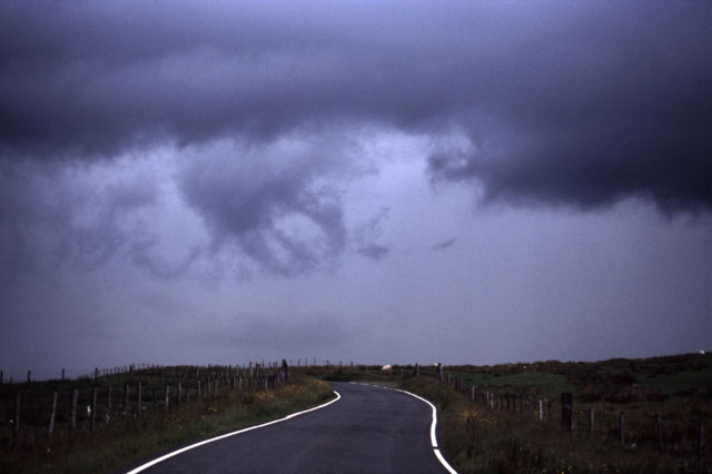
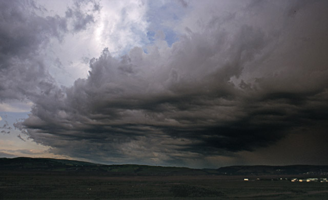
 Moving on to June 22nd and once again convection is kicking off, this being a line of developing storms near Newtown. I sat and watched that lowered area just R of the precipitation - in prime funnel-cloud conditions they can rapidly develop from features like this.... |
|
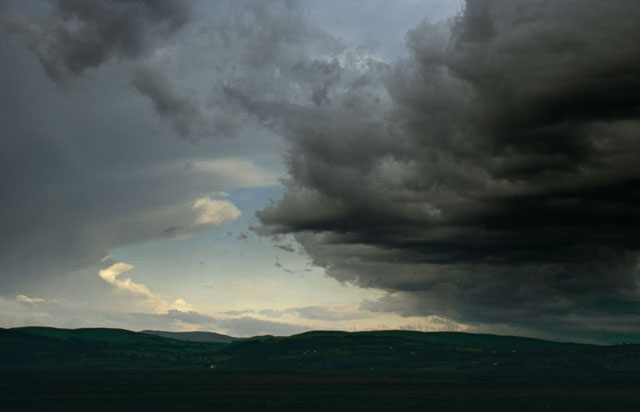
 Almost! It wasn't though, as a quick check with binoculars showed... |
|
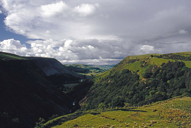
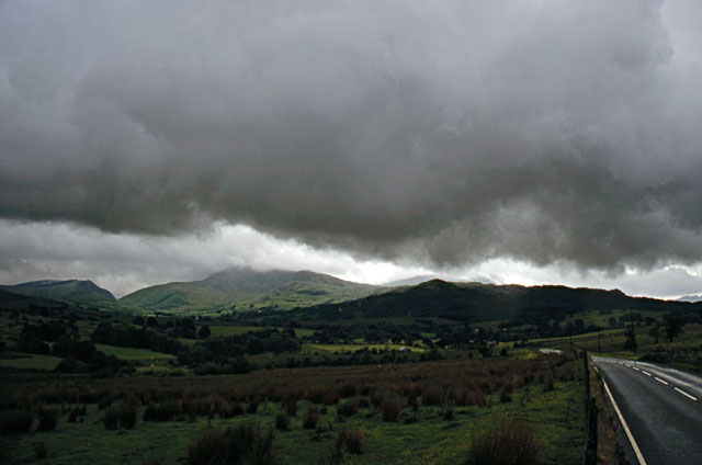 The mission continued with an evening drive to intercept a strong storm between Cadair Idris (seen here looking W) and the Dyfi Valley. I took the road up through Corris and then headed along the A470 to the Bwlch. This is a hallowed ground for military aviation photographers who catch the jets flying very low through the pass above Tal-y-llyn from a vantage point widely known as Cad West (the notch on the L of the photo above) and also the Bwlch itself.... |
|
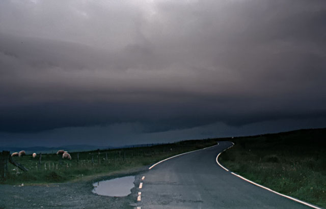
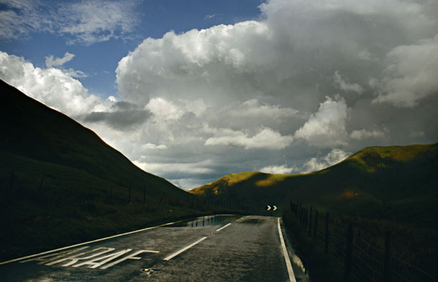
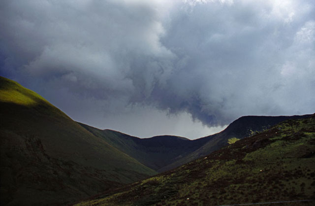 ...although with weather like this there would be nothing flying today! Yet another gust-front through a gap in the mountains at the Bwlch... |
|
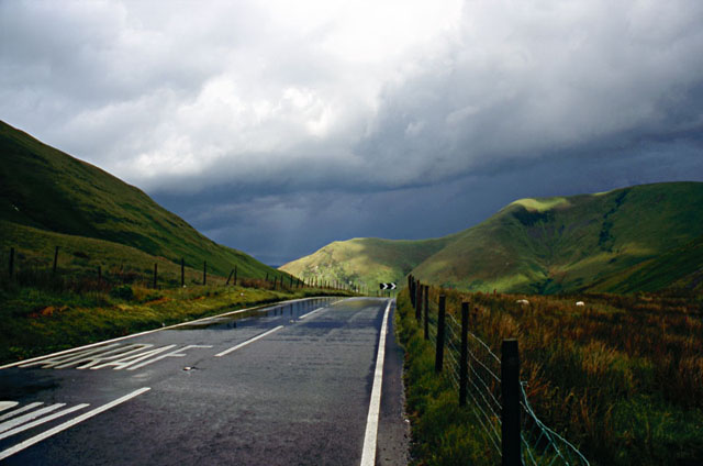 ...looking down the Bwlch. "Araf" is Welsh for "Slow" - as there is a hairpin bend just round the corner this is fairly good advice. Today a river was running down the road to make things a little more tricky! |
|
 As the clouds moved away some better structure was visible. I followed these storms SE, passing a bit of flooding in the Dyfi Valley, but as evening wore on they tended to decay.... |
|
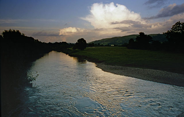 ...with this farewell shot showing the last of them reflected in the Severn at Caersws as dusk gathered. |
|
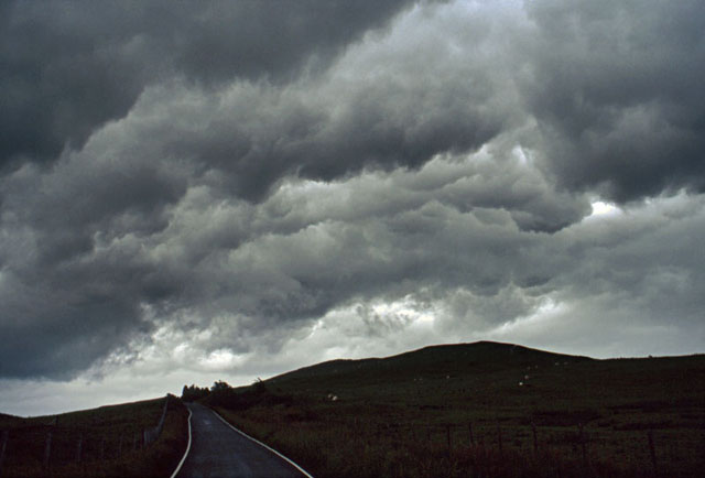
 The 24th brought another risk of storms but not as severe as those of previous days. I did catch this one near Presteigne, on a reconnaisance trip armed with a sheaf of 1:50,000 maps, checking out new vantage points. Just to be original it too sports a gust-front! |
|
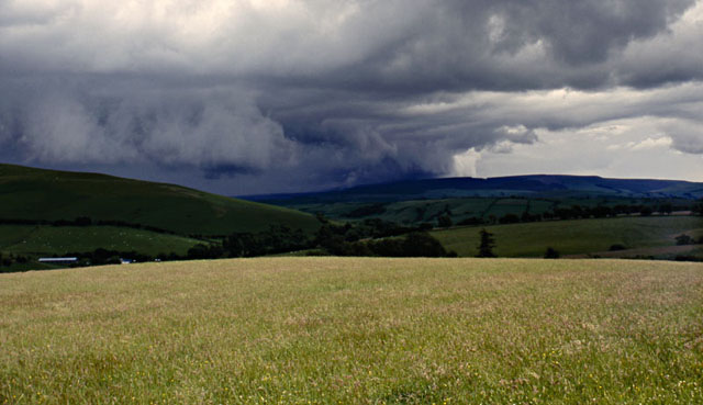
 As afternoon passed into evening, further mostly wimpish storms fired closer to home. Here's one near Newtown but with its anvil overspreading the Cambrian Mountains, seen from the Dylife road... |
|
 ...while I'll sign off with the last cell of that day, giving the Machynlleth area a soaking! Although I was pleased with the haul so far, I must admit to having been somewhat disappointed not to have seen any of those elusive funnels: they might have eluded me here in Wales, but reports came in thick and fast to TORRO with attached images of funnels from many parts of England and Scotland during this period. So the "Great Funnel-Hunt" of 2007 continues! |
|
BACK TO WEATHER-BLOG MENU New! Fine Art Prints & digital images for sale- Welsh Weather & Dyfi Valley landscapes Slide-Library - Click HERE |