BACK
TO WEATHER-BLOG MENU
New!
Fine Art Prints & digital images for sale-
Welsh Weather
& Dyfi Valley landscapes Slide-Library - Click HERE
Through
most of August and into the first week of September, unsettled
and profoundly unsummerlike conditions have prevailed with a
near-constant mobile Westerly airflow
affecting the western UK. It has brought us, on a regular basis,
frontal rainbands followed by squally showers, and at times some
fairly impressive thunderstorms, torrential falls of rain, hail and
even a landslide that closed a major trunk-road. Plenty for me to get
my teeth into in other words. That's the useful thing about
storm-chasing - it can be done in bad weather! So we'll get the good
weather over and done with straight away - this was taken above
Aberdyfi in mid-August on a day when storms affected many areas but for
once left us alone: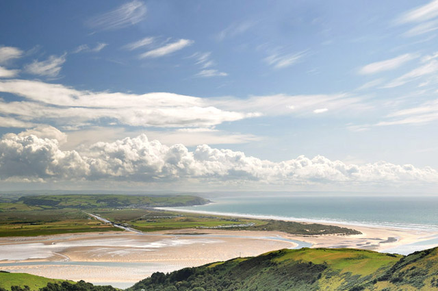 This entry features two successful storm-intercepts (out of a total of four "chase-days"), the first of which involved an early start on August 22nd. A strong-looking thunderstorm was evident on the rainfall radar, crossing Cardigan Bay: a quick step-back through the 5-minute plots gave a time for its landfall and a place - Borth beach. Upon arrival, it was still way out to sea, so I was well in time, and a heavy shower over the hills above Aberdyfi provided a nice surprise by throwing out a lateral gust-front southwards (the prevailing wind being westerly): 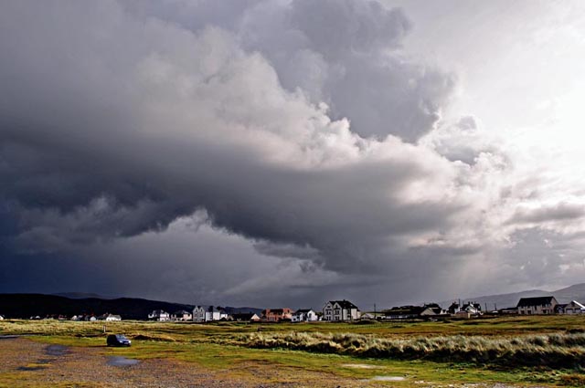 The target storm duly advanced on my position, and I was a bit disappointed to see that it was a mess, structure-wise - this was the one I had hoped might sport a spectacular shelf-cloud but all I had was a darker and darker sky. Lightning flickered closer and closer so I came down from the top of the beach to find somewhere less exposed to sit it out and then see if the sight of the anvil retreating up the Dyfi Valley might offer any opportunities.... 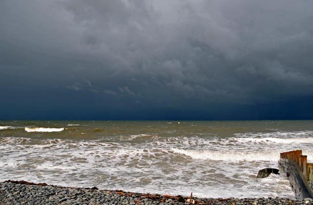 The sight of the storm retreating certainly beat the sight of it advancing, but quickly the morning sun appeared over the top of the anvil, to blow out the highlights of subsequent images.... 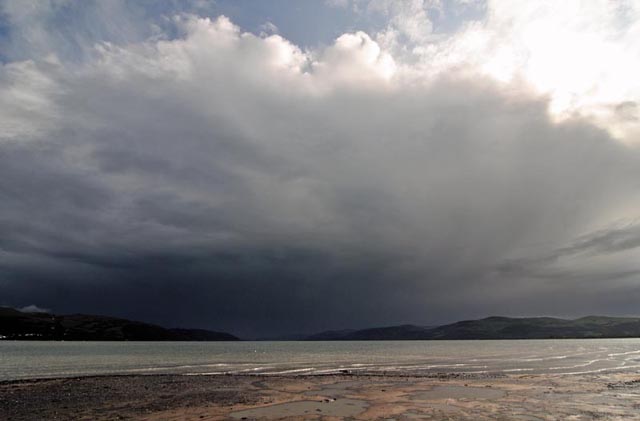 To work around this bit of natural inconvenience, I concentrated on the foreground: 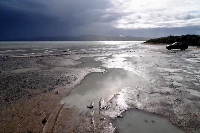 It was a huge tide, covering almost all of the flat, sandy parking-area: 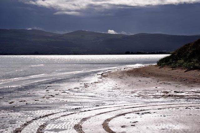 It's rare for a storm to catch me by surprise but the next one did! August 28th had been a day of mostly mundane showers and overcast conditions, but this cell exploded into life. The radar screengrab below shows how heavy it was, with one pixel plotting a mighty 90-120mm/hour rainfall rate - that's tropical! 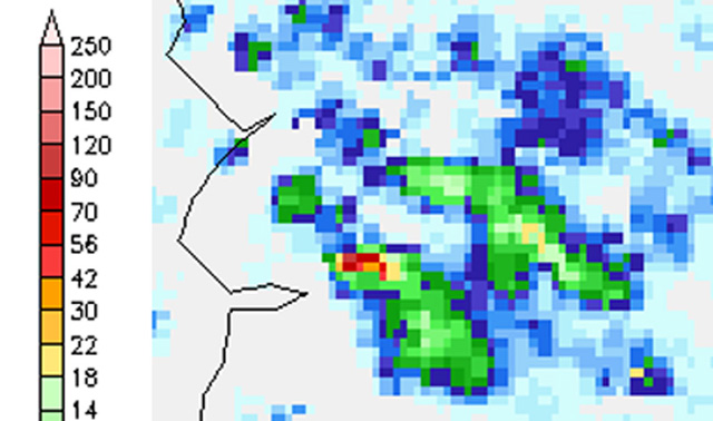 The cell in question had moved in from the NW, so as the radar shows it had been raining heavily for a while before the torrential stuff started to arrive with huge raindrops hitting the road with almost explosive force: 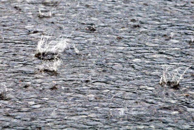 In no time, a blinding downpour was in progress: 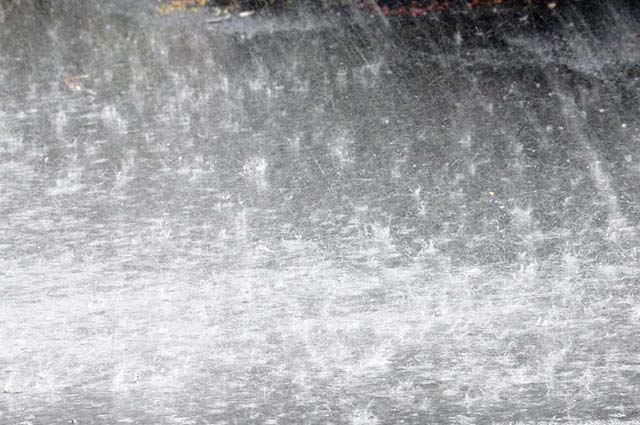 Ducking in and out of the front door of the house I was in, I was able to grab a series of images, drying off the skylight filter in between shots, when a distant roaring sound began and got louder. Suddenly, a violent squall of even heavier rain and hail swept up the street, tearing apart the minor river of water flowing down it, bouncing inches into the air: 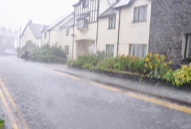 Gutters were not coping and the water was literally streaming from the rooftops until it passed as suddenly as it had begun - a wild five minutes indeed! 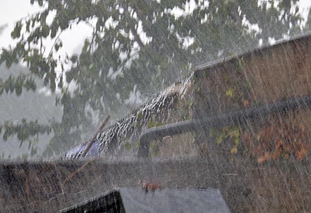 The hailstones were still lying in drifts where the floodwaters had left them an hour later. These were up to large pea-size, many showing a classic "birds' eye" structure indicative of several stages of growth as the storm updraughts had lifted them up through the cloud repeatedly, allowing several stages of hailstone growth:  September 1st was a notably thundery day here, and justified a day out with the camera. I stayed local (time and again this has proved a good tactic) and watched the rainfall radar to identify targets. The first one was a line of storms moving up from the SW. ETA - ~1130 BST north of Tywyn. Getting there in good time, it duly arrived and the obviously heavy precipitation looked to be spawning a strong gust-front: 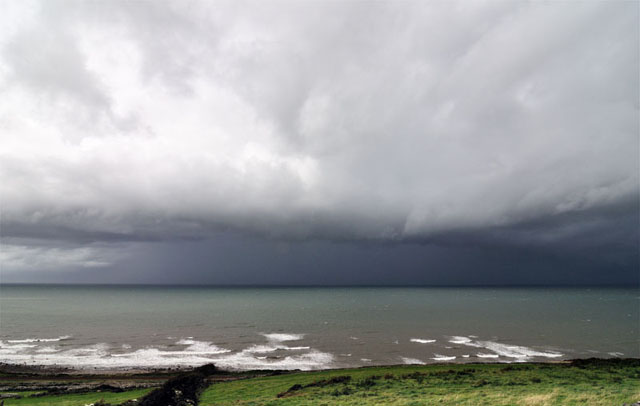 However, this was as good as it got: 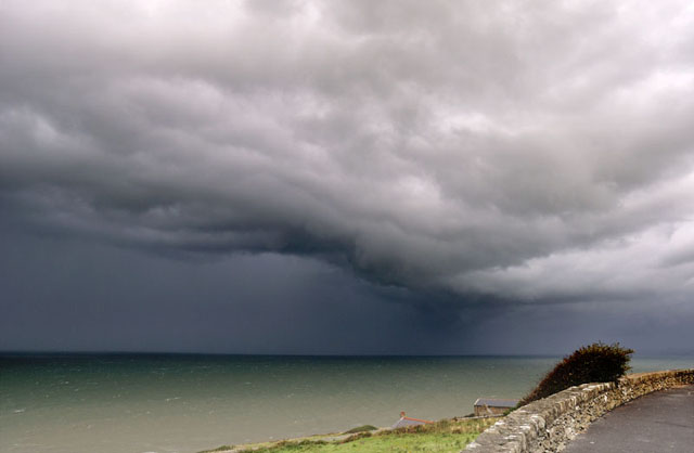 The next storm was heading straight in to my south so a move was called for. I headed back south-east to meet its tail-end, spitting out the occasional cloud-to-ground lightning bolt, with the thunder booming from side to side of the Dysinni valley while the sun lit up my vantage-point: 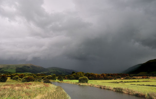 A while later, the same storm towering high over Cadair Idris, with the sun penetrating up-valley as far as Bird Rock. Vigorous updraught towers on the storm's rear flank indicate it to be a backbuilding multicell: 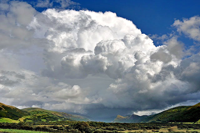 I then headed to my favourite spot above Aberdyfi to watch a mature storm drifting up over Plynlimon and developing cells between me and it, before activity seemed to die off a bit: 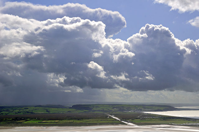 It was time for a forecast/radar update, so I nipped home to do that and have a brew. The radar and satellite images showed one final band of storms along a surface trough so I headed down to Borth for the finale, arriving at a windswept beach, the incoming tide washing great clumps of eel-grass, wrack and kelp ashore. One couple were braving the elements and the car-park was almost deserted - amazing given that the previous day had been August Bank Holiday Monday! 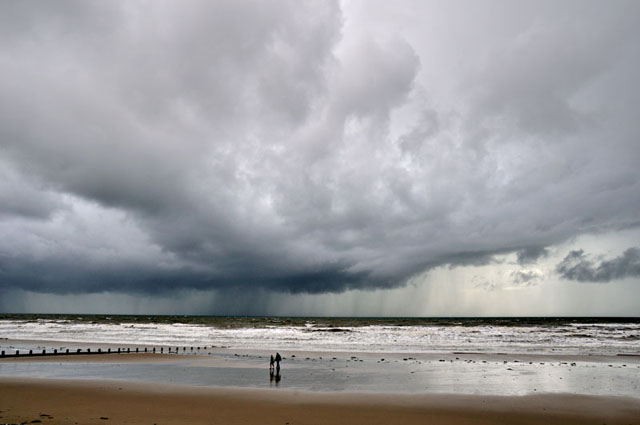 As the rough weather swept in I resorted to the same tactics as on the previous trip and headed to an almost deserted Ynyslas to ride the storm out and see what its other side looked like. It was a humdinger, with hail lashing across the sand: the photo below was taken not long after it started: 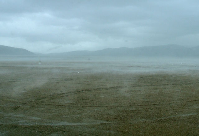 No spectacular anvil this time, but it produced this rainbow as a final flourish! 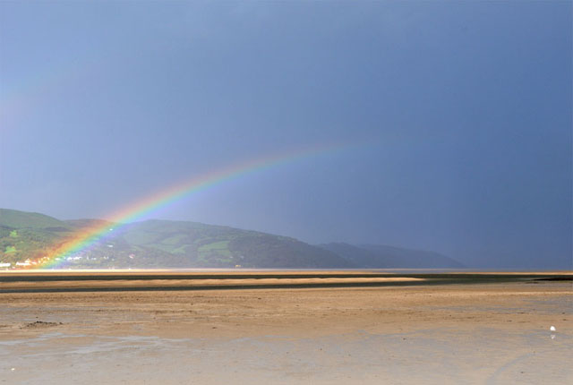 Some big rainfall totals must have occurred in places and the following day I received an email from Richard Street who had been travelling along the A470 between Dinas Mawddwy and Dolgellau. He said: "I found your site completely by accident, looking if there was any news on the latest landslide at Dinas Mawddwy last night around 6.30. I arrived there not long after on my way home....." and attached a series of images, of which I have posted two, below, with my thanks for his permission to use them: 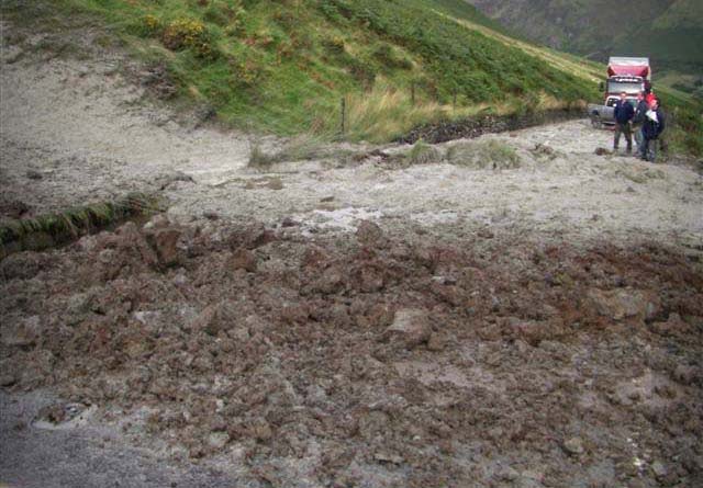 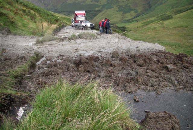 This area is prone to landslips during heavy rain for geological reasons: the last major slip occurred in January 2005 a few hundred metres further up the valley. A couple of days later I drove up to the Bwlch from the Dolgellau side and parked (the road had been blocked-off here), and walked down to the site of the slip. The council people had cleared the debris from the road but the slip's path and the damage caused to the crash-barriers were still evident: 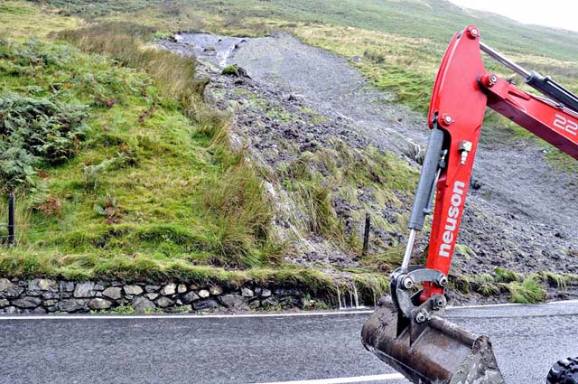 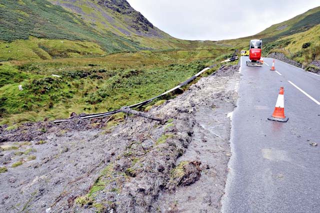 This type of landslip is known as a bog-burst, which typically occurs in areas where gleyed tills (the grey clay in the images) are present, sat atop the bedrock. The tills are geologically young, remnant deposits associated with the deglaciation 12,000 years ago when the most recent ice-age ended. In many areas they have been eroded away by water action. In this landslip-prone area, quite large tracts remain, and being impermeable they create poorly-drained areas which in turn allow bogs to develop, with matted vegetation of reeds, sedges, mosses etc. Over centuries, this in turn allows peat to accumulate between the vegetation and the till. Under conditions of oversaturation due to prolonged heavy rainfall, the peat can become supercharged with water which can then force its way gravitationally downslope, along the interface between the till and the matted bog-vegetation above. As the water builds up, it can hydraulically jack-up the matted bog-vegetation so that a large bulge appears in the hillside. This eventually fails when the hydraulic pressure exceeds the tensile strength of the matted vegetation - and whoosh! Because the initial burst strips away the bulging vegetation, exposing the till beneath, the ensuing high-speed debris-flow will readily erode down into the till so that the resultant debris consists of a liquefied mixture of clay and peat, dense and fast enough to transport large clumps of reeds, rocks and so on, and to demolish things like crash-barriers in this case. Had a car been it its path it would have stood no chance - it would have been flung downslope along with everything else. The final image shows a rather sorry fence-post: 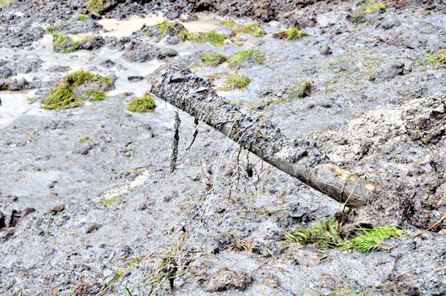 The road will remain closed for a few days, according to reports, whilst safety assessments are carried out and repairs made, In the BBC Wales report, local councillor John Pughe Roberts is quoted: "It is nature - what can you do about it?" Indeed! It's just as much a part of natural things as is sunshine - and ourselves. It's just that sometimes, Nature does something to remind any of us who might have forgotten the point that it calls the shots at all times! |
|
BACK TO WEATHER-BLOG MENU New! Fine Art Prints & digital images for sale- Welsh Weather & Dyfi Valley landscapes Slide-Library - Click HERE |