Tornado activity in Wales:
an early success for the third-time stormchaser
August, 2000
BACK
TO WEATHER-BLOG MENU
New! Fine Art Prints &
digital images for sale-
Welsh Weather & Dyfi Valley landscapes
Slide-Library - Click HERE
Tornadic activity occurs most years in Wales and
the summer/autumn of 2000 saw quite a few, with
some impressive photographs being taken near
Llandudno in North Wales. But mainly they are not
seen, occurring miles from nowhere in the
Mid-Wales hills.
Tornadoes can occur associated with all three
categories of thundery weather outlined above.
Here is an example from last year: it was only my
third serious attempt at chasing after storms
armed with a camera (as opposed to just going for
a walk/drive with a camera), so I guess my luck
was in! (update May 2005: it was: despite many
days out there I have since only seen 5 more!)
August 20th 2000: a hot-tish (for here) Sunday
afternoon, and unstable southwesterly airflow
covering Wales. I checked the latest radar image
on the BBC weather site and headed off towards
two sharply defined red echoes 15 miles to the
SE, somewhere between Rhyader and Llanidloes.
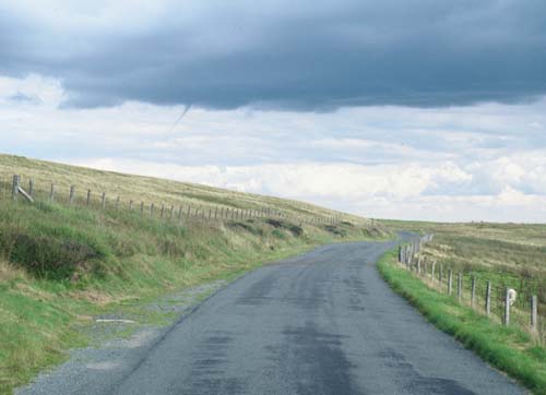
Climbed up the mountain road towards Dylife
noting altocumulus towers going up rapidly to the
S and SE, clear out to W. Got to the Wynford
Vaughan-Thomas Memorial Pulpit (by the best view
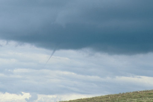
in the world), rounded the bend and saw this
(below): a right old heartstopper of a moment!
|
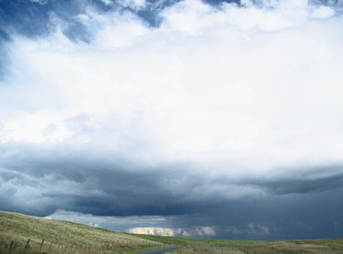
I
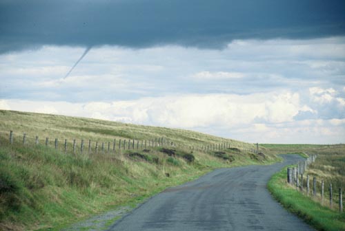
continued towards Dylife, and stopped about a
mile from there. I was able to watch the funnel
advance and retreat for a good 15 minutes. It was
on the northern, leading edge of a developing
cumulonimbus. The storm was drifting NNE at no
more than 10 knots, and the precipitation core
was some way off to the south. People driving
past saw me with the camera and were asking if it
was a tornado.
|
Here it is quite a solid-looking feature....
|
Elongating at times but not reaching the
ground....
|
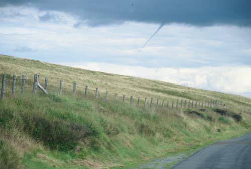
Here's a telephoto....
|
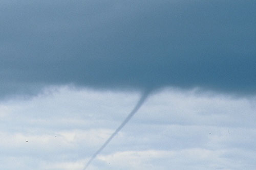
Then it started to retreat back up into the
parent cloud...
|
This is a wide-angle shot taken moments before it
disappeared for good. Its remains can be seen as
a small lowering in the cloudbase, straight above
the road. The disappearance coincided with the
storm reaching maturity and the anvil streaming
out above. This was a funnel-cloud related to
strong updraught development during the
developing stage of the storm: a classic example
in fact. You are a lot less likely to see funnels
or tornadoes descending from mature storms as in
most cases the updraught has weakened and the
storm is dropping its payload of rain or hail.
This is what is known as a storm
"breaking". (update May 2005: in fact
the point just before the "breaking"
offers the best chance of seeing something!)
The precipitation to the south was obviously very
heavy: a black curtain obscured the landscape.
|
Turning back towards Machynlleth, this was the
view NNE from the Wynford Vaughan-Thomas pulpit.
The distant high peak is Aran Fawddwy (2970
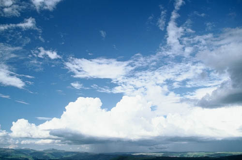
feet). The afternoon convection was now waning:
although lighter showers still fell from
altocumulus clouds these were not to develop any
further. I headed back to Machynlleth for a
celebratory pint....not bad at all for a third
chase!
DAMAGE REPORT!
Why not check out my archive
page on a devastating tornado that struck on a
winter day a few years ago just up the coast from
where I live?
The Tywyn
(Gwynedd) tornado, January 21 1995
BACK
TO WEATHER-BLOG MENU
New! Fine Art Prints &
digital images for sale-
Welsh Weather & Dyfi Valley landscapes
Slide-Library - Click HERE |