AUTUMN
2003 - PART 1 - Storms? - What storms?
BACK TO WEATHER-BLOG MENU
New! Fine Art Prints & digital
images for sale-
Welsh Weather & Dyfi Valley landscapes Slide-Library
- Click HERE
The almost total lack of convective weather in Mid-Wales
since August 10, 2003 is perhaps as remarkable as was the
plunge in temperatures in the second half of October!
When I say that this page is Autumn 2003 Part 1, I mean I
am hoping for a Part 2 full of convective fun, but with
only November to come I start to wonder if it will
happen.*
The only autumn weather event of major note thus far
somewhat missed Mid-Wales. On 22nd September a vigorous
cold-front swept across the UK from the NW and blasted
the remains of the Summer sideways! Over Mid-Wales it had
already cooled down, but as the front swept into England
and warmer air, things got a bit more interesting with
several tornadoes being recorded, including some damaging
ones such as that at Knutsford in Cheshire.
The weather patterns this year have been unusual.
Normally we get low after low running east across the
Atlantic and affecting the UK, interspersed with
short-lived ridges of high pressure. Rain then showers
then sun, rain then showers then sun. That's called a
Zonal pattern and is typical of our weather in NW Europe.
This year large areas of high pressure have built over
the N Atlantic and Scandanavia, preventing the lows from
taking their usual track. This is what is termed a
Blocked pattern. It is what assisted the summer of 2003
to be a record-breaking hot and dry one.
This autumn, a continuing largely blocked Atlantic has
fed what low pressure systems there have been down from
the North, resulting in most shower activity hitting the
N and E coasts of the UK. As the lows have sank into the
Continent, bitterly cold (for the time of year)
easterlies have kicked in - a scenario more reminiscent
of February than October!
All eyes are now turned to winter, because should this
remarkably persistent pattern keep going through into the
main winter months a notably cold and snowy season could
occur - comparable with some of the legendary hard
winters of the 20th Century. With snow already on the
tops of the highest Welsh mountains we await developments
with interest, although it is too far ahead to be certain
at the moment. But I sit here writing this on yet another
morning when the first thing I've done is to light the
fire because it's so cold. I cannot remember an October
like that!
Weatherpix on this first autumn page are thus sadly
lacking in storms, but I found some nice
sunsets/cloudscapes to compensate. They were taken, along
with a host of others, at Borth and Tywyn on the Cardigan
Bay coast. Enjoy!
* it did - see Nov 2nd page!!
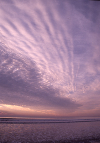 The first 4 pix in the sequence were taken in early September at Borth. Classic decks of mid-level altocumulus streamed across the sky, backed with wispy high-level cirrus clouds. This one was taken with the lens set to 28mm in order to get as much of it as possible.... |
|
 A little later and the altocumulus deck is covering much of the sky, with some altostratus in the distance where the sun is setting......... |
|
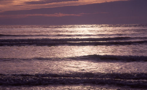 Last light on a silver surf.... |
|
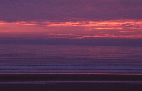 The sun has slipped below the horizon but still casts a pink glow over the altostratus...... |
|
 At Tywyn on October 15 2003. Howling easterlies - katabatic winds streaming down off the Cambrian Mountains and thus being much stronger than the synoptic situation might suggest. When this photo was taken it was gusting to a force 8 and though the sea swell was light what spray there was became airborne very quickly. This photo has a cold feel to it and I can confirm that it was bloody freezing! |
|
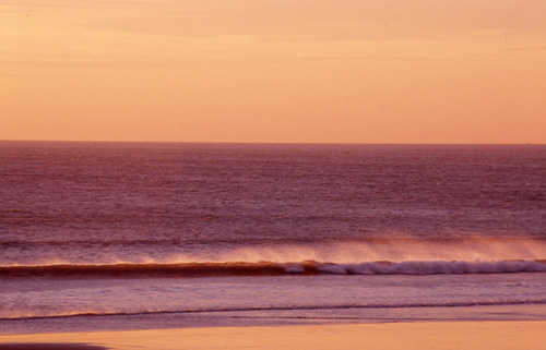
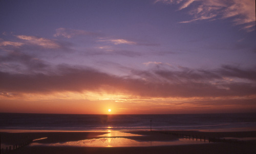 The same evening: a rather washy sky morphed into a classic sunset! Although I rarely get excited about sunset photos I was pleased with this one. |
|
| Now let's cross our fingers and hope for something a bit more exciting in November! Who knows, if the current pattern persists we might even get a blizzard or two later on..... | |
|
|