AUTUMN
2004 - PART 1:
THUNDERSTORM WITH EXCEPTIONAL MAMMATUS CANOPY - 13th
September 2004
BACK TO WEATHER-BLOG MENU
New! Fine Art Prints & digital
images for sale-
Welsh Weather & Dyfi Valley landscapes Slide-Library
- Click HERE
Instability values were reasonable
on this day and with a strong SW airflow over the warm
sea, chances of getting some results looked reasonable,
despite the rather poor low-level shear which would tend
to preclude any "spout" activity. Fellow
weather enthusiasts (and professional meteorologists)
Brendan Jones and Laura Gilchrist were in the area so we
decided to meet up late morning at the layby looking out
over the sea on the coast-road near Llwyngwiril. A
surface trough was forecast to move into the area at this
time, so it was decided we'd intercept it and see what it
produced. I think it is fair to say that it ended up
producing a lot more than we had bargained for!
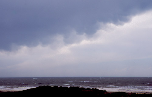
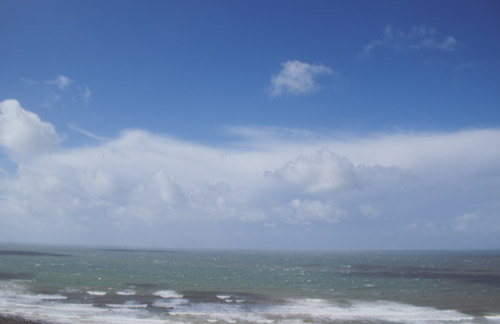 On arrival at the layby a large Cb was visible out over the rough sea, coming our way. Static crackles on LW radio suggested some electrical activity (a look later on at lightning strike plots confirmed that it was slightly active at this point). So it was a case of waiting it out to see what might happen..... |
|
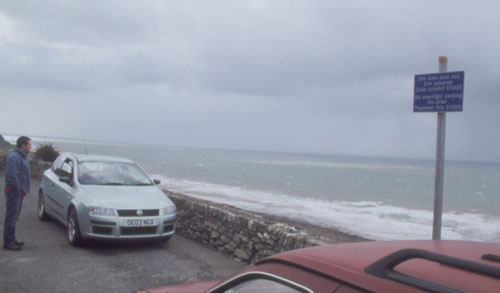 ....a rare photo of a chaser-convergence in Wales! If this was the USA the layby would be full of geezers with tripods, video cameras etc etc etc! Bren willing the storm forward (his video camera perched on the wall) while Laura scans the horizon from the car. My old shed in the foreground! If you want to see what the camcorder captured, right-click this link to Bren's website and select "save target as" to download a 35-second timelapse from an hour's filming. Stunning as the clouds race in over the sea, complete with backing track! It's about 1.5Mb. http://www.eots.co.uk/Timelapse/seasquall.wmv |
|
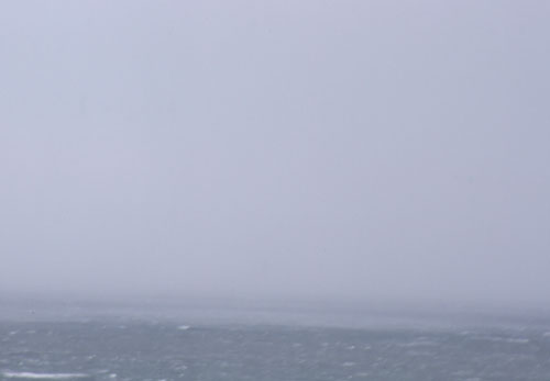 It duly arrived as a curtain of heavy rain whipped up the sea. Through binoculars small spin-ups could be seen on the sea's surface as the gust-front moved in...... |
|
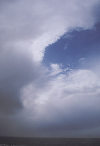 ....and then almost as quickly it cleared! It became obvious that we had managed to position ourselves smack between two main storms - this was looking southwards. A quick confab and we decided to move south. Tywyn prom was my first idea but on approaching Tywyn something caught my eye so I carried on until reaching a large layby close to Aberdyfi where I knew we'd be in position if this was what I thought it was.... |
|
 ....would this morph into anything more impressive as the anvil came over and the awful light conditions improved???? |
|
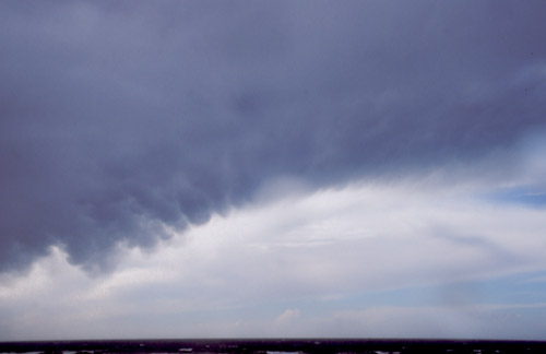 Looks like it might! |
|
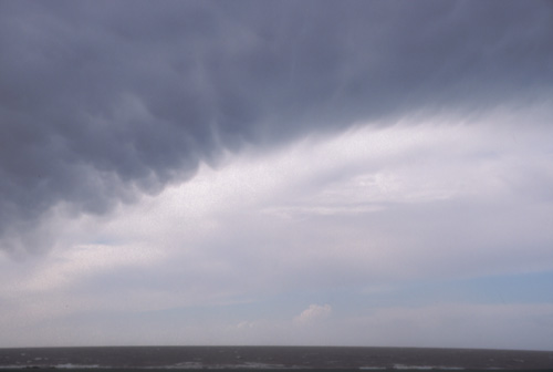 Getting better! |
|
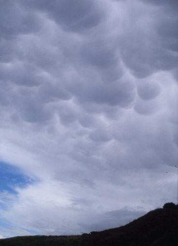
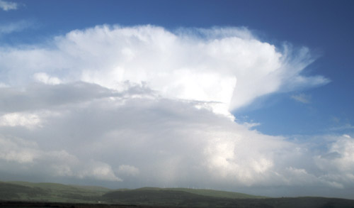
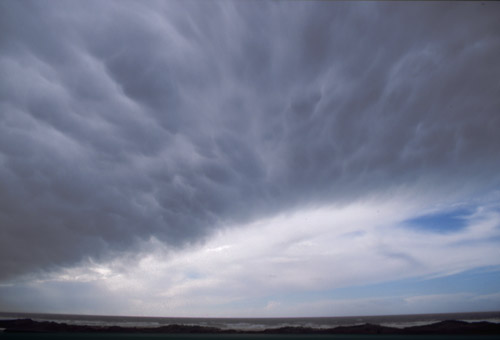 WOW!!! |
|
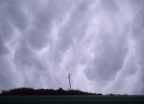 Seconds later looking in the opposite direction. While I was taking this, Bren pointed out that the whole sky was full of the stuff so we charged down to the other end of the layby for a less interrupted view.... |
|
 ...and this is looking northwards. Still those damn overhead wires in the way so we carried on until we were clear of them..... |
|
 WOW!! (#2) |
|
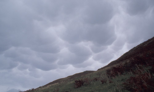
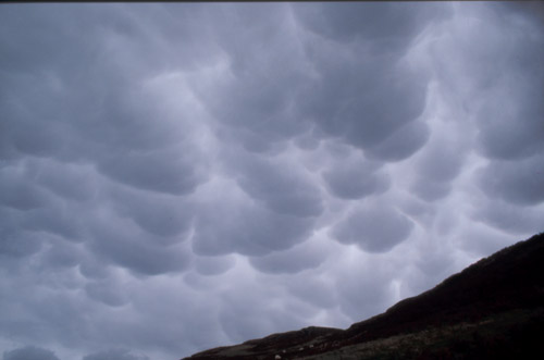 Mammatus (or mamma) - pockets of cold air sinking below a storm's anvil. Tends to indicate that a storm has reached the mature part of its lifecycle and is dissipating. |
|
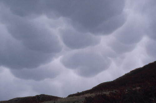 Almost looks alien! Everyone happily clicking away among the "wow" noises! |
|
 ...and finally after a few minutes that felt like hours it started to clear, light levels increased and that was that. Looking out seawards a few small cells were visible on the horizon but nothing too promising so we went for a brew in Aberdyfi and waited to see if much else would arrive. It didn't so I went home to check email and radar etc while Laura and Bren made their way back north, calling me later to say that some more, albeit limited, activity was breaking out near the coast at about 1700. A quick look around and I decided on Borth as a target for a follow-up, driving through some short sharp downpours on the way.... |
|
 ....but apart from a few lone Cbs over the mountains like this one, activity was waning. It had certainly got a lot rougher with the wind now gusting to gale-force.... |
|
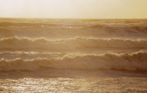 ....as witnessed by the state of the sea! Taking the three pix from which this one was scanned gave my lens an unhealthy coating of salt from the wind-blown spray - lucky I was using a skylight filter! |
|
 ....and so that was that. Another good day out on the road and good to share it with two fellow storm-enthusiasts! Ten days have now passed since this trip and not one jot of photogenic convective weather has been noted! |
|
BACK TO WEATHER-BLOG MENU New! Fine Art Prints & digital images for sale- Welsh Weather & Dyfi Valley landscapes Slide-Library - Click HERE |