Major Atlantic storm reveals the Fossil Forest at Borth
BACK
TO WEATHER-BLOG MENU
New!
Fine Art Prints & digital images for sale-
Welsh Weather
& Dyfi Valley landscapes Slide-Library - Click HERE
| The
mild but very unsettled weather had the entire UK firmly in its grip
throughout November, with a particularly stormy spell from mid-month
onwards. Record-breaking rainfall affected western areas with Cumbria's
flood disaster dominating the news - although Mid-Wales did not
entirely miss out as the images below will show. It was not until the
very end of the month that more seasonal temperatures arrived, bringing
with them the first hill-snow of the coming winter. But - justifiably -
we'll concentrate on the storms first! A very brief settling-down in conditions allowed a fishing-trip on November 10th. I chose the Stone Jetty at Aberystwyth Harbour for my day out in pleasant sunshine. Here's the view from the end at dusk, with the potting-boats coming in for the night. This is the last calm image on this page! 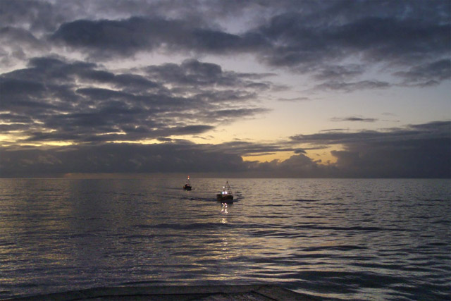 By the middle of the month, strong jet-streaks raced one after the other out of Newfoundland and across the Atlantic, engaging developing areas of low pressure and winding them up into powerful, often sub-960 millibar Atlantic storms. One storm after another passed over the UK, alternately bringing periods of heavy rain and squally showers with hail and thunder. The 17th brought showery conditions intense enough to warrant a morning intercept down to the coast at Borth.... 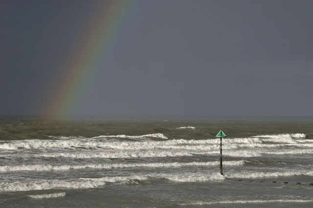 ...with this squall coming straight at me.... 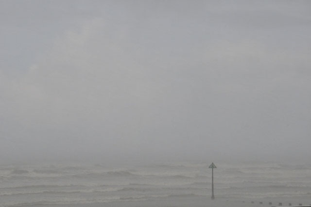 ...gusts of wind rocking the jeep and shrill static-scream on the radio as the hail-core lashed by, blocking out visibility.... 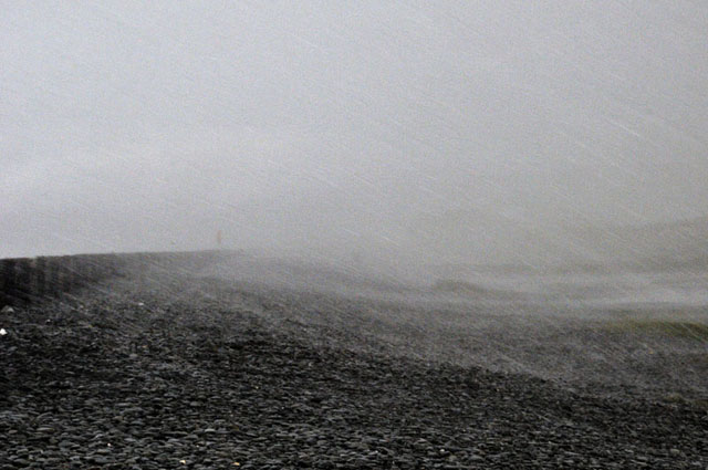 ...and clearing to this beautiful convective cloudscape! 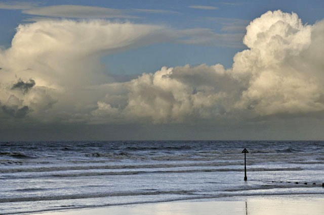 The 18th brought severe gale-force sou-westerly winds and a huge ground-swell from one of the biggest lows of the month. High tide at Aberystwyth was just after 0800 so I headed down there to capture some wave-action.... 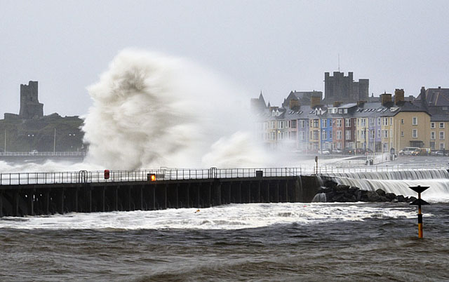 ....messing about with the camera's ISO settings got a slowish exposure for these images, giving some interesting motion-blur effects.... 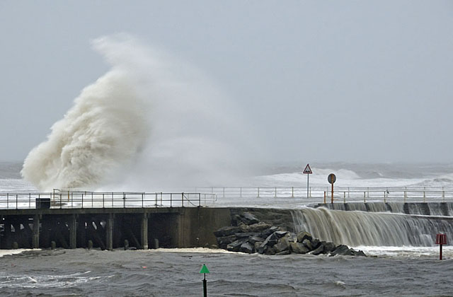 A view of the Stone Jetty, where I had been fishing when the first photo on this page was taken! 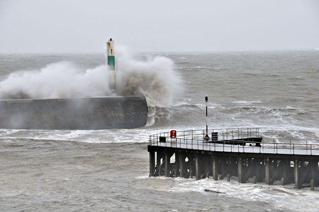 Not a safe fishing venue in conditions such as these! 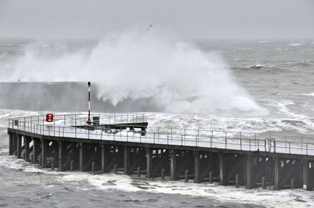 This was taken on the main Prom.... 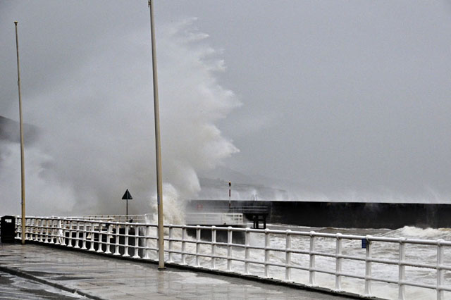 ...whilst on the way home I stopped at Borth to check out the surf! 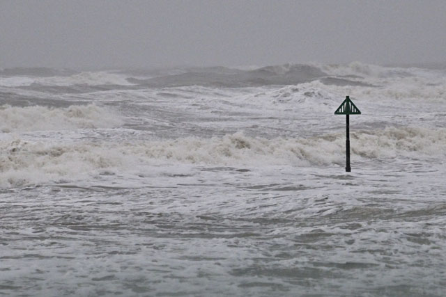 But for many, the big feature of November 18th 2009 was the flooding, on a disastrous scale up in Cumbria. The cause of the problem was a specific synoptic set-up that we call a Warm Conveyor - I have covered severe ones over Wales before e.g. February 2004. In brief, warm conveyors occur when the UK is within the warm sector of a depression with winds coming up from the SW - importantly, from way, way down so that the air has a tropical or subtropical origin. The excessive moisture in such an airflow falls out as rain when the air is lifted up over the western mountains of the UK. The rains these setups give are steady, heavy and prolonged - in the 2004 example, Capel Curig saw 261 mm in 48 hours. Worryingly, there are two properties of a warming system that can influence these conveyors: these are a) that a warmer sea temperature gives more moisture to the air via evaporation and b) warmer air can carry a greater quantity of moisture: put together, this means that a warming climate can produce more intense rainfall rates from conveyors. The phenomenal and record-breaking 300 mm+ day totals in the hill country above Borrowdale are a possible sign of the influence of climate change - it is important to note that global warming does not CAUSE weather events - it INFLUENCES them. Climate predictions indeed suggest that such events are likely to become more intense in the coming decades: although the frequency of warm conveyors is unlikely to be affected, their intensity is likely to be influenced. So forget the hype over the so-called "climategate" - this is a real and increasing problem. Down here, we were luckier in that we were closer to the edge of the conveyor, so that the duration of the rainfall was less, but by the time I had arrived back from Aberystwyth, the valley was flooded from side to side: 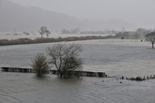 Water levels had risen to "half gate height" in just a couple of hours and by the afternoon, it was impossible to get out of Machynlleth to the north or south..... a slightly cheeky caption for the image below could be "Climategate"! 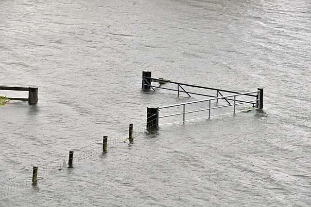 Near Dylife, this landslip of waterlogged peat and clay swept down and over the road, blocking it completely.... 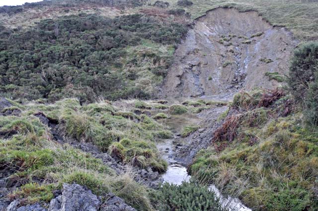 ...whilst once the floods receded, the damage to fences along the A487 to Dyfi Bridge was plainly evident. Several cars were lost along this section of road, attempting to drive through deep water and either stalling or sustaining internal engine damage due to water getting into air intakes - with diesels this can mean the need to replace the whole engine, so deep floods are best avoided! 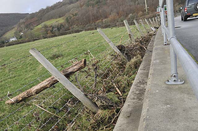 I was awoken early on the morning of the 25th by a deafening crash of thunder, and that afternoon there was more intense convection around as I drove over to the Midlands: this was after sunset at Caersws, with a thunderstorm anvil sporting shallow mammatus.... 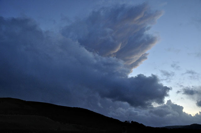 Things finally calmed down by the 28th and the shower-clouds parted to reveal the first snow of the 2009-10 season. I stopped at Glandyfi to capture the view of the white-over Tarrenhendre ridge over the Estuary: 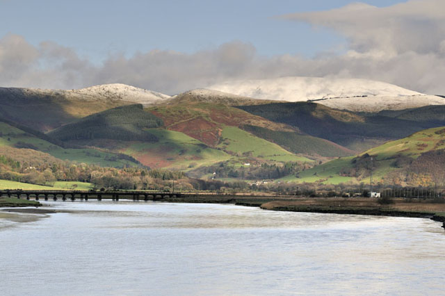 Intense coastal storms often rearrange the local beaches and at Borth, the "Fossil Forest" can become well-exposed. On a cold early December afternoon, with a low Spring tide coinciding with the last hours of daylight, I took myself down there for a look. I was not to be disappointed: 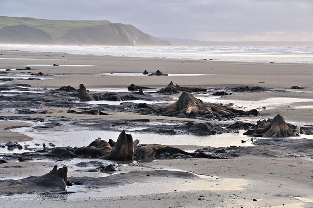 The forest isn't fossilised as such and is geologically young at only 6500 years before present. At the time when the forest flourished, sea levels were a bit lower than those of today and the storm-beach is estimated to have been a kilometre further out seawards. The trees are mainly pines and their stumps and fallen trunks lie in a bed of peat, overlying a soft grey estuarine clay with bivalve shells, that represents a period prior to the forest forming when sea levels were a little higher. Maybe this clay was deposited in an intertidal lagoon behind the shingle bar, a bit like that one behind Chesil Beach. The tree-stumps were superbly revealed, the wood scoured clean by the action of wave-borne sand particles in the high-energy storm environment: 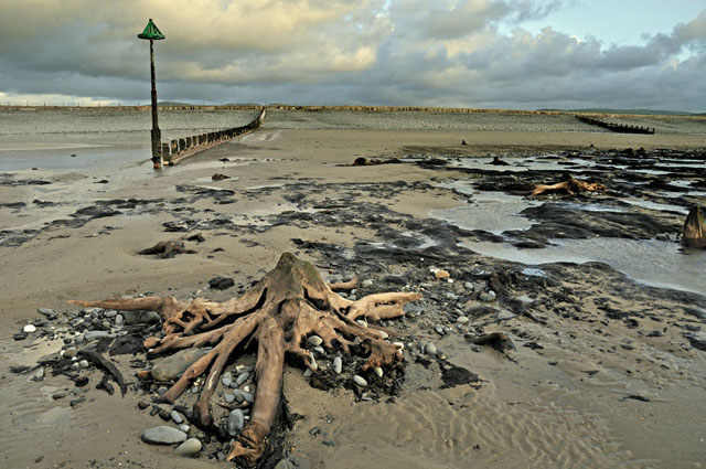 Here is a detail of the wood. Although beautiful, it is not particularly hard and, taken from its environs, dries and rots quickly. Best left where it is, in other words! 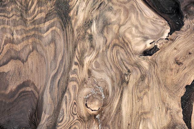 Sunset shot.... 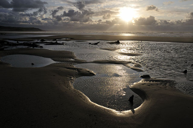 Another thing the storms have done is to throw up some big sand-bars down by the low water mark, with lagoons on their shoreward side.... 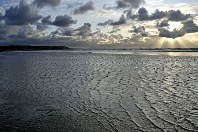 The setting sun was providing some splendid crepuscular rays: 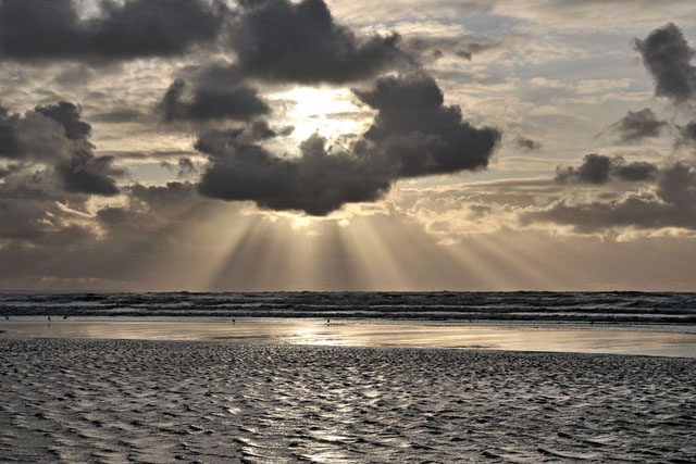 ...and there's one thing that is guaranteed at Borth on a falling tide - the incredible reflective properties of the wet sand..... 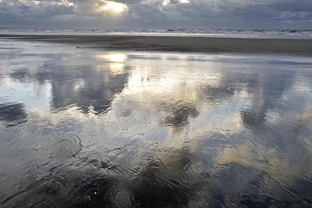 So, what can we expect this coming winter? We have a developing El Nino in the Pacific, which should mean milder and more stormy than usual (the colder winter of 2008-9 was influenced by the persistent La Nina that dominated 2008), but if the other winters of this decade are anything to go by, we should see alternating periods of mild weather with shorter cold spells. Apart from last winter, most snowy periods in recent years have occurred in Northerly outbreaks and have often occurred quite late in the season - in February or even March which is technically Spring! But long-range weather forecasting is at present akin to alchemy and it's not something I'm going to get into - so in short - we'll see! |
|
BACK TO WEATHER-BLOG MENU New! Fine Art Prints & digital images for sale- Welsh Weather & Dyfi Valley landscapes Slide-Library - Click HERE |