BACK TO WEATHER-BLOG MENU
New! Fine Art Prints & digital images for sale-
Welsh Weather & Dyfi Valley landscapes Slide-Library - Click HERE
 One big feature of the UK's weather in the Autumn months
is that we can be affected not only by bog-standard Atlantic Lows but
also by ex-Tropical storms that have become entrained into the
Westerlies that often blow right over us at this time of year. The
headline opposite (!!!) attempts to describe such an event: the passage
of ex-Hurricane Katia, on September 11th-13th 2011.
One big feature of the UK's weather in the Autumn months
is that we can be affected not only by bog-standard Atlantic Lows but
also by ex-Tropical storms that have become entrained into the
Westerlies that often blow right over us at this time of year. The
headline opposite (!!!) attempts to describe such an event: the passage
of ex-Hurricane Katia, on September 11th-13th 2011.Katia was a significant Hurricane - one of two big 'uns so far this year, the other being Irene, the one that ploughed into the Eastern USA a couple of weeks or so ago and which brought record flooding to the state of Vermont.
Often, the main thing that ex-Tropical systems brings to us is excessive rainfall - ex-Tropical Storm Laura, for example, brought significant flooding to the Dyfi Valley on the night of October 4-5 2008, featured elsewhere in this blog. In this case, the worst rain was confined to Scotland but a wide swathe of gale-to storm-force winds affected parts of the UK - with the odd gust around 80mph. Perhaps that's what the Express meant. Who knows?
So how does all of this come about? The diagram below - quick-and-dirty - shows what happens over the ten day or longer cycle that can begin with an Easterly Wave - an area of showers and thunderstorms - drifting out of Tropical Africa, and end - as with Katia - with a large Atlantic storm drenching and buffetting the UK.
Hurricanes cannot form without lots of heat being available, which is why they only form over our Tropical seas. Under favourable conditions out over the warm Atlantic Ocean, big, well-organised thunderstorm clusters can form out of such Easterly Waves, and should the right conditions persist, a circulation starts to develop, where air is sucked inwards in a spiral fashion, bringing with it the twin ingredients of more heat and moisture, and is lifted up at the storm's centre. Thus a tropical depression is formed: that is, a circulating system. Once the winds exceed 39mph, it is termed a tropical storm. Once that goes over 74 mph we have a hurricane - classified into five categories based on steady windspeed. Category 1 means winds of 74-95 mph; Category 2 = 96-110 mph; a Cat Three packs winds of 111-130 mph, a Four 131-155mph and the worst of all, a Category 5, is above 156mph. Note that these values are for sustained winds and NOT gusts - in the strongest storms, these can go up to well over 200 mph!
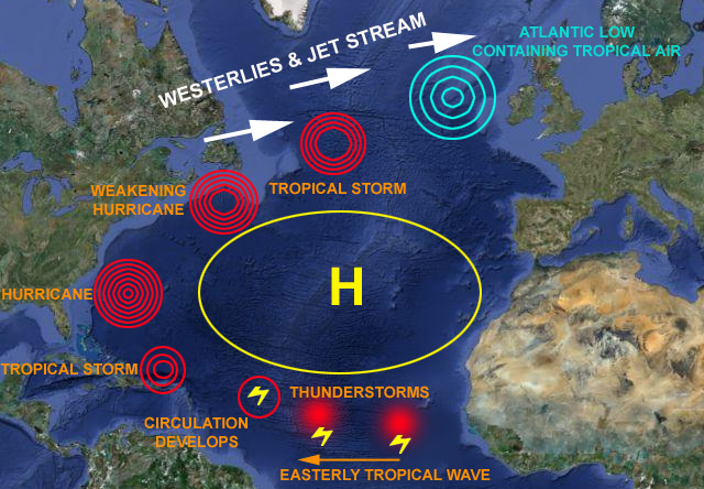
The path of a hurricane is determined by what lies ahead to help or hinder it. Areas of high pressure - anticyclones - are generally something that they go around. In the case of Katia, it steered its way around the central Atlantic High, doing what is known as a "recurve", then headed north-east off the Eastern Seaboard of the United States. Not all storms of this type stay out to sea like this - some pile straight into the eastern USA, whilst others take a more southerly track into the very warm waters of the Mexican Gulf - where they pick up even more energy, smashing into Mexico or taking the northward turn that sends them them to landfall along the coast of the Southern States - Katrina being a classic and deadly example.
Storms such as Katia tend to decay slowly as they leave the warmer Tropical waters, because their essential heat supply gradually diminishes. They weaken back down to a Tropical Storm, and eventually run into the Westerlies of the North Atlantic that mark the Polar Front - an area where storms develop by an entirely different mechanism, the collision of warm Tropical and cool Polar airmasses. Here, they transition from a Tropical system into an extra-Tropical system and finally into an Atlantic Low containing an awful lot of moisture due to the Tropical air mixed-in. That's important: a complicated-looking but in practical terms simple meteorological formula states that for every degree C warmer air is, it can hold 7% more moisture (i.e. potential rain). Thus, the more tropical air gets entrained into an Atlantic system, the greater the potential rainfall impact.
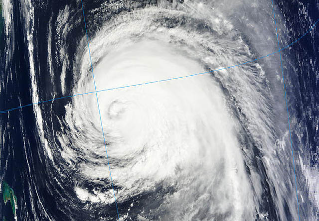
Here's Katia on September 7th, as it trundled its way past Bermuda:
A couple of days later, the forecast charts were showing it moving eastwards just south of Newfoundland, still with a warm core (the thick circular yellow line in the middle):
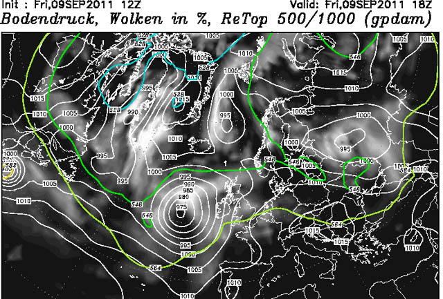
Engaged by the Polar Jet, it then shoots eastwards across the Atlantic, getting larger and stronger once more, to be in mid-Ocean by the early morning of September 11th:
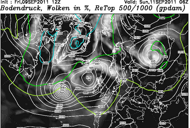
Just 12 hours later, as a major Atlantic depression, having been incorporated into an existing weaker Low in the area, ex-Katia is bearing down on NW Ireland:
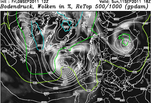
It was clear that any change in central pressure or course would drastically affect the strength of the wind and the area worst affected: for example, the charts from 1200 on the 9th had ex-Katia as a 955 mb low passing N Scotland:
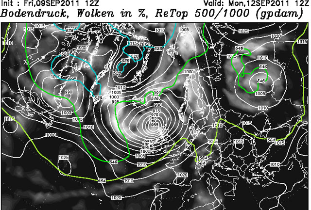
As it panned out, the centre of the low (at around 960 mb) was just slightly to the south of this position as it passed by on September 12th, so that the strongest winds were shifted a bit further south - Northern Ireland, Southern and Central Scotland, Northern England and, for a while North Wales, saw the worst.
A rising Spring tide, topping out at 4.7m (with a likely storm-surge adding say 0.3m to that) made a coastal trip tempting. OK - the biggest tides at 5.7 (+0.3)m would have been spectacular indeed, but this was an interesting storm that had caught the eye of the media, so I thought I'd go take a look. High water on Monday 12th at Aberystwyth was at 0825 BST: to allow for travel and time figuring the best vantage-point (that varies according to how the wind/swell are interacting) I made ready to set off at daybreak and set the alarm accordingly to allow for coffee, checking the kit was all in order and so on.
Camera - check. Loo-roll (for wiping salt spray from my UV filter that protects the lens) - check. Chainsaw - well if you have one you might as well take it in case you come across a tree across the road - check.
As things turned out the wind was mostly Severe Gale 9 or less, not an uncommon strength here in the stormy season. I did hit a powerful squall at Glandyfi on the way down that left lots of small debris in its wake, but the winds were not a concern - it was the waves I was after.
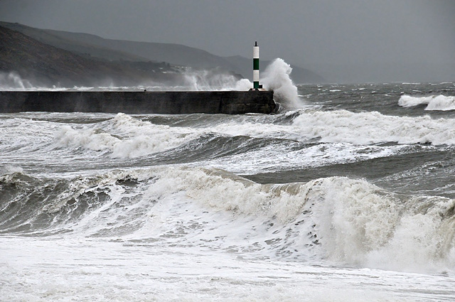
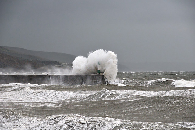
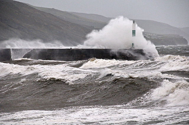
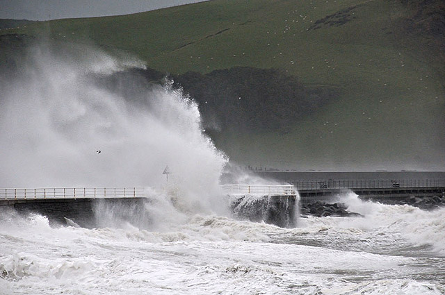
On arrival, and having made a couple of moves, finally I set up on South Marine Terrace, which overlooks the town's South Beach. Here, the huge and well-forecast swell was churning its way onto the beach, one wall of dark, foam-streaked water after another:
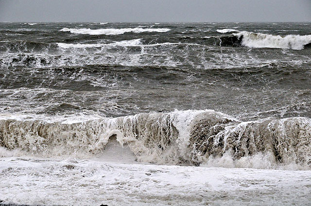
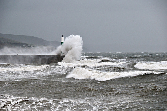
The reason why I chose this spot was that the swell was arriving from the SW, so that here I could catch the waves as they either hurled themselves against the Stone Jetty or crossed the entrance to the Harbour to break against its walls. Here's 8 of my favourites. Despite the poor light and the drizzly rain that fell intermittently, mingling with the spray, this lot made the trip worthwhile:
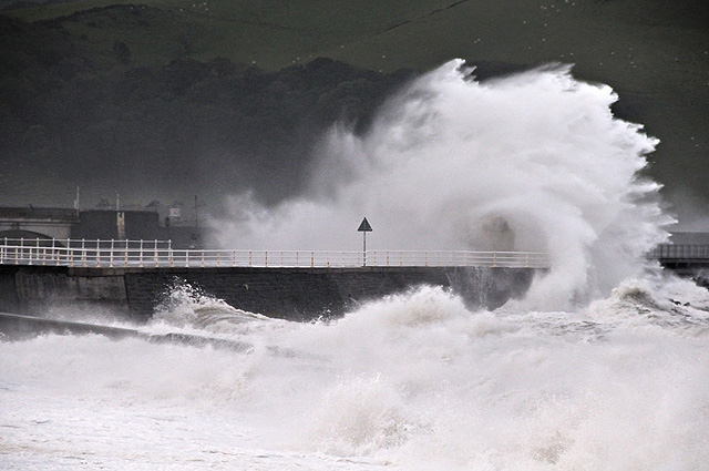
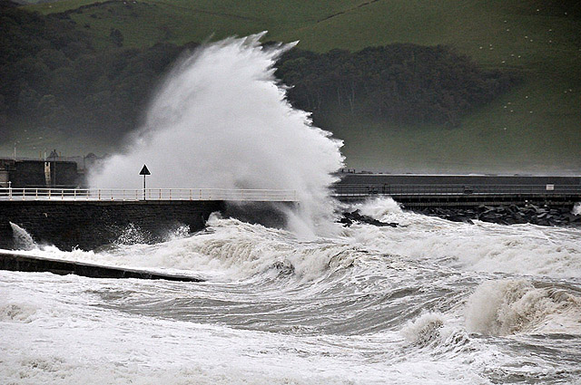
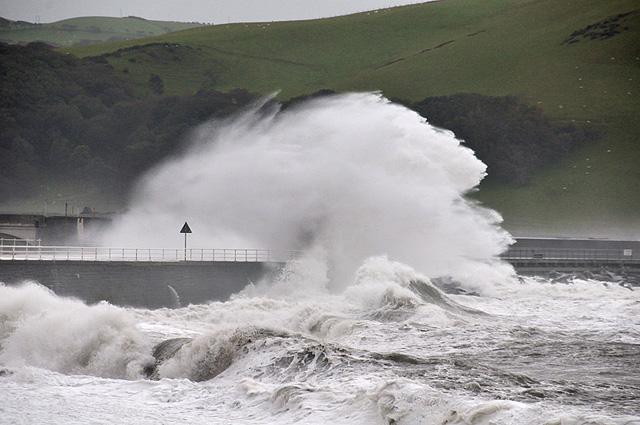
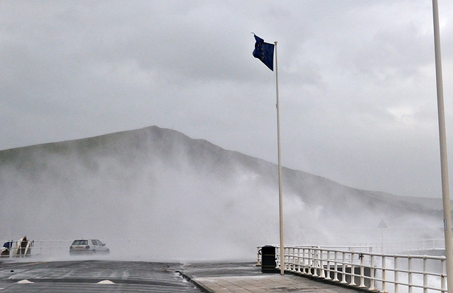
As high tide passed, I moved down to the Harbour, but the light wasn't right and there was too much spray flying in my direction:
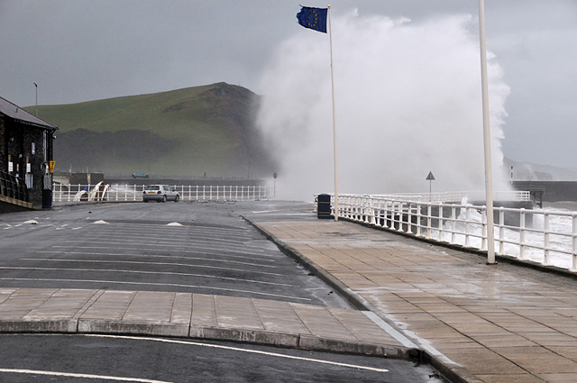
And in someone else's too!
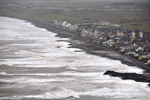
Heading homewards, I stopped above Borth to take some aerial-perspective shots both from the Clarach road and the cliff-top - they showed off the great combers rolling in, due to the swell, to advantage:
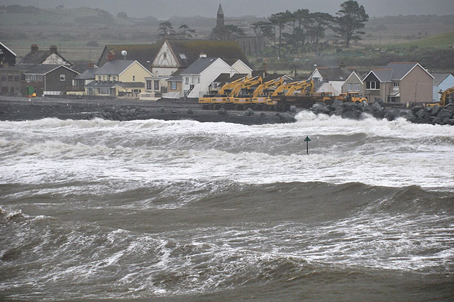
Not much activity on the sea-defences project today - unsurprisingly given the conditions/state of the tide....
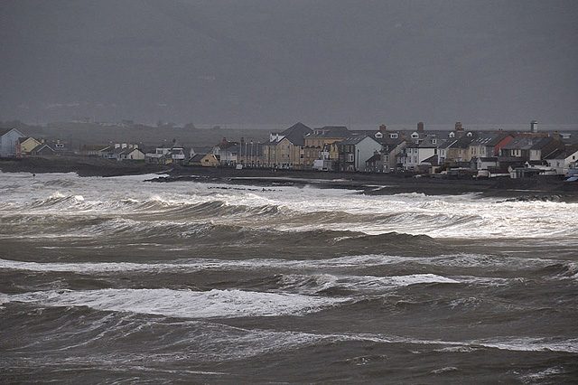
Finally, a small break in the clouds brought a neat patch of sunlight racing in over the wave-tops amongst the gloom. I waited for it to coincide with where most of the breakers were forming:
And that was ex-Katia!
Next possible recurver is Maria, but right now the forecast models suggest it runs into an Atlantic low up towards Greenland and rains itself out in the SW part of the Denmark Strait. Time will tell!
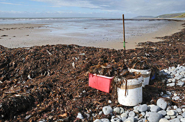
Epilogue: on Thursday 15th I happened to be down at Borth with time for a walk. This was ex-Katia's calling-card:
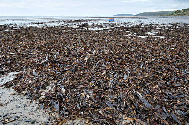
That's going to take some shifting! I tried my best on Friday but scarcely made a dent in it!
Meanwhile in Scotland, Katherine Hodson sent me this photo, taken in Glen Nevis, testifying to the tremendous rainfall that occurred:
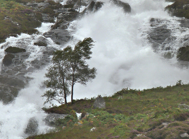
Thanks for that, Katherine!
BACK TO WEATHER-BLOG MENU
New! Fine Art Prints & digital images for sale-
Welsh Weather & Dyfi Valley landscapes Slide-Library - Click HERE