WINTER
2007-8 part 3: January squalls and lightning superbolt
strikes Machynlleth!
BACK TO WEATHER-BLOG MENU
New! Fine Art Prints & digital
images for sale-
Welsh Weather & Dyfi Valley landscapes Slide-Library
- Click HERE
The first few weeks of 2008 have
seen predominantly rough, wet and often mild conditions -
the night of the 19th-20th January was the mildest on
record for January with several locations in the SE of
England seeing minima of 13oC.
The pattern so far this month has been "Zonal"
- meaning everything is coming at us from the Atlantic as
low after low develops beneath the influence of roaring
upper-level jetstreaks. Some interesting weather was in
amongst this lot: thunderstorms - including one that gave
a lot of positively-charged "superbolts", one
of which hit Machynlleth; some powerful squall-lines,
severe gales and hail. Not much snow or frost in other
words. I'll deal with the more interesting events
chronologically, starting with January 8th.....
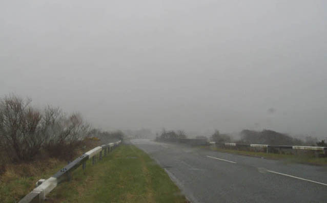 This is a typical squall associated with a heavy shower. We've all been caught in these from time to time. But what can happen if such things get a bit more organised? The evening of January 8th was a classic example.... |
|
 An active cold front crossed the UK on that evening. Such fronts can push under the warm moist air ahead of them and lift it to a height where it becomes highly unstable. Because fronts are linear features, the resultant convection occurs in a long thin line within which severe wind-gusts, tornadoes, hail, thunder and torrential rain can all occur. For fairly logical reasons, such a feature is termed a squall-line. This was the view from my house in Machynlleth at about 7pm on the 8th. There was a sudden and huge increase in wind and lashing rain and hail. This lasted a few minutes and then all returned to quiet and steady rain - a classic squall-line in other words! |
|
 Now, here's the Netweather Radar plot from a little earlier. Heaviest rain is red, lightest is blue. The squall-line can easily be seen as a thin band of torrential rain. Machynlleth is the red circle - it had yet to be hit. The arrowed area is of interest. Look at the way this section of the line has got ahead of the rest, forming a bow-shape. Such bowing segments, or bow-echoes, are focal points for severe weather along squall-lines. In a more evolved form, a whole series of these bows may develop, giving an impression that a whole lot of waves are running up the squall-line, often with breaks to the line in between them - a feature referred to by meteorologists as LEWPs - Line Echo Wave Patterns in full. Complex vorticity patterns develop in amongst such features, with a consequent enhanced risk of tornado development, but it is often difficult to analyse damage patterns because surging bow-shaped segments also bring with them the threat of downbursts or microbursts (depending on scale). These are surging downdraughts of cold air that hit the ground and fan out across it, and they can have 100mph+ winds within them - sufficient to do major damage, such as this: |
|
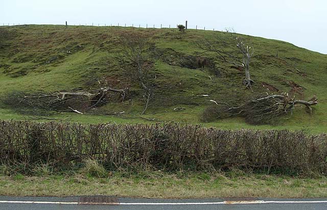 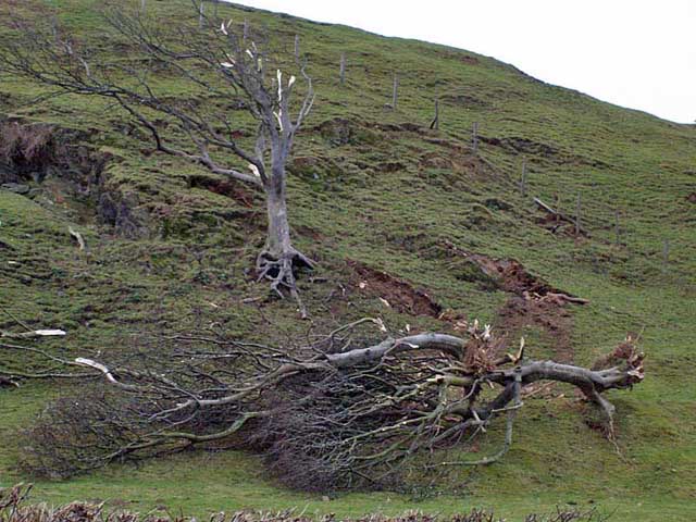 ...between Aberdyfi and Tywyn and associated with that bowing segment on the radar above. These are old, wind-gnarled trees in an exposed position in the teeth of the prevailing SW wind, yet they have been torn clean out of the ground, to slide/roll to their current position. I was sad to see this, as I have always loved old wind-bent trees - they seem to have such character. Anyway: debris has been flung forwards and not sideways as one would expect with a tornado situation. Plus, this is isolated damage. It is almost certainly evidence that there was a damaging microburst here in association with the bowing segment, with winds of over 100mph destroying these hardy old trees Thunder was also reported during the squall-line's passage with a friend living near Forge observing sparks showering down from a utility pole after a particularly close strike! |
|
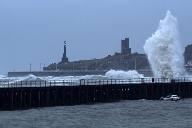
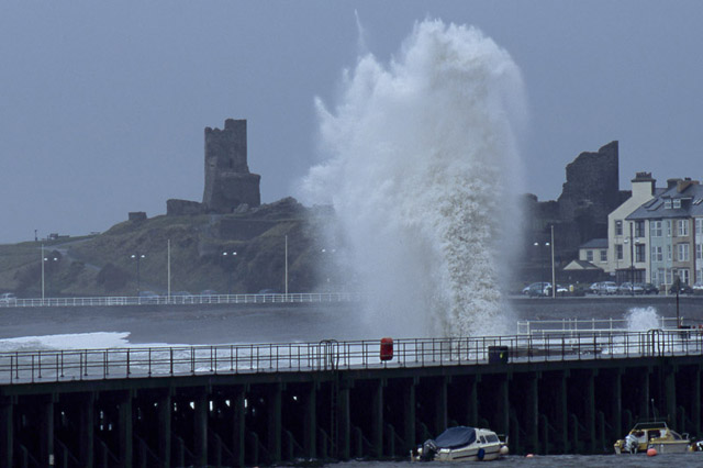
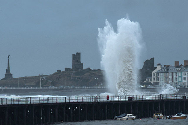
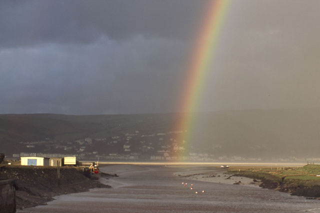 Something of a breather followed, during which I caught this bright rainbow over the Afon Leri outfall into the Dyfi Estuary, with Aberdyfi in the background.... Sunday 13th saw severe gales forecast for Cardigan Bay, with a mid-morning high Spring tide and a large ground-swell forecast, so I headed off to Aberystwyth, parked by the Stone Jetty and focussed my telephoto lens on the Harbour area, where waves were hitting the end of the Prom. Here are my three favourites - they reminded me of fireworks, somehow.... |
|
   |
|
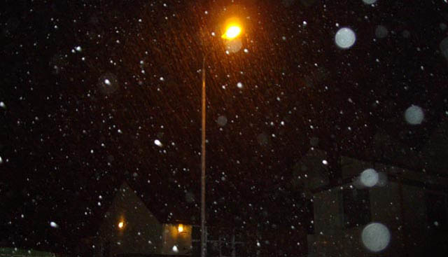
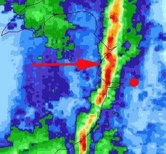
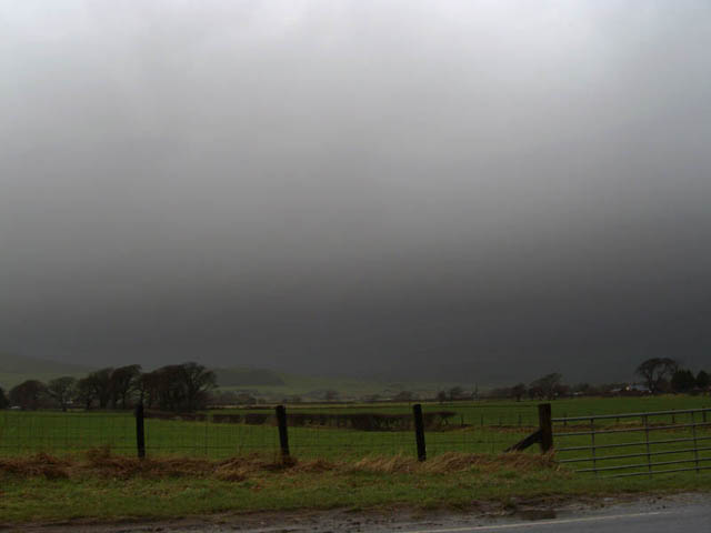 January 17th saw the next potentially interesting set of events, with conditions supportive of severe thunderstorm development. Behind a frontal system that had brought overnight rain, there was a cool polar maritime airmass, unstable to the warm sea temperatures. Strong wind-shear - winds moving at different directions and higher speeds higher up in the atmosphere - ensured that any storms that formed had the potential to become fairly nasty - unfortunately in appearance too, as the photo above, from just N of Tywyn looking towards Rhoslefain, shows! Not pretty! I stayed on the southern edge of this storm for a time, listening to the loud booming thunder, before heading north after it cleared, along the coast towards Llwyngwril, passing a favourite vantage-point layby high above the sea - where the roadside was white with hailstones... 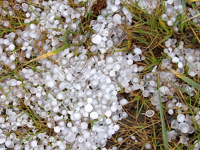 These had been melting for about 20 minutes and were up to a centimetre across: allowing for melting I'd guess they were originally marble-sized. The "birdseye" texture is common in larger hail and indicates multiple growth stages, as a stone falls and then gets lifted again by the updraught. Larger stones can make this up and down circuit many times, before they finally overcome the updraught strength and fall to earth. I continued to Fairbourne, then turned and drove back over Friog, passing through the core of the next storm. This was an alarming experience as sheets of hail battered the jeep and visibility dropped to no more than 10m. One of the most violent storm-cores I have driven in! Parking up in Llwyngwril at about 11.40, I assessed the situation. Out to sea, yet another storm was bearing down on me. It was equally unphotogenic. My decision to run ahead of it, as the roads were rapidly getting flooded in places, was confirmed when a bolt of lightning hit the nearby sea, with a long roll of deafening booms of thunder like a series of bombs going off! This very loud thunder was a strong sign that the strike was positively charged. Positive lightning makes up less than 5% of all lightning strikes, but these "superbolts" are typically six to ten times more powerful than negative bolts. In most cases, positive lightning strikes come right down from the thundercloud's positively-charged anvil-shaped top. For a number of complex reasons, winter thunderstorms produce positive lightning much more than summer storms. In essence, key factors are: a) that winter thunderstorms are "low-topped" - that is, their anvils are typically a fair bit closer to the ground than summer storms, because the top of the Troposphere (where anvils spread out) is lower down - so that lightning may be able to travel more easily from the anvil to ground; b) that since a developing winter stormcloud contains a lot more ice, due to lower prevailing temperatures, and ascending ice particles carry a lot of positive charge to the anvil, the upper region of the stormcloud can carry the bulk of the electrical charge. Never underestimate winter thunderstorms in Northern latitudes, in other words!! I fled ahead of this storm via Dolgellau and Dinas Mawddwy. On my return I had my suspicions confirmed - a colleague told me that all the strikes as these storms crossed the area were positive - interestingly once these storms had reached the Midlands, they were dominated by the more typical negative strikes! Thanks to Paul Knighley of TORRO for that info! Here's the midday radar (precipitation rates, mm/hr, on the R): 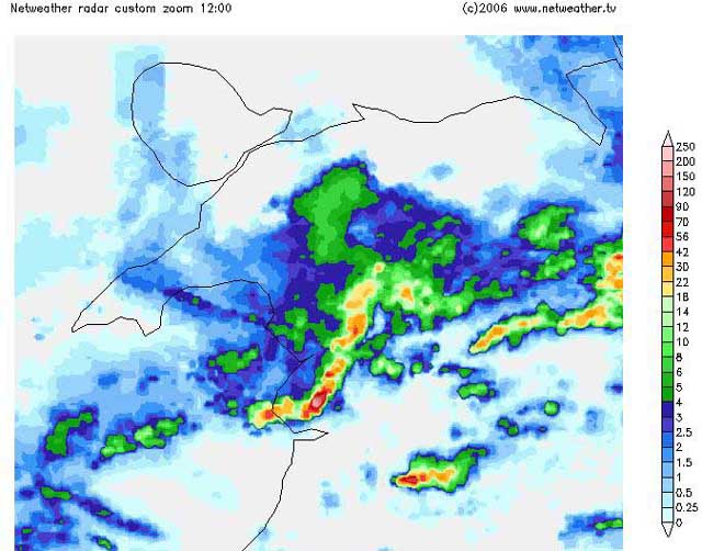 When I arrived in Machynlleth at about 1pm, power was off over 2/3 of the town, and was not to be restored for over another hour. I made enquiries - easily enough, as the deafening thunder was the talking-point of the town - and it transpired that a strike had hit somewhere near the railway station. A neighbour reported seeing a spark jump across her room at the time. Positive lightning is particularly dangerous. Since it originates in the upper levels of a storm, the amount of air it must jump across to reach the ground is much greater. As a consequence, its electric field is far stronger than a negative strike. Its duration is longer, and its peak current and voltage can sometimes be as much as 300,000 amperes and one billion volts. One consequence of this is that it can do a lot more damage: another is the deafening thunder, as heard over Machynlleth and Llwyngwril at the times of Thursday's strikes. This truly was a case of a "superbolt"! So no sign of Winter just yet, although this coming Thursday (24th) carries a risk of some wintry showers, especially for N Wales. It'd be nice to see something more seasonal. People are getting fed up of this perpetual gloom and flooding! |
|
BACK TO WEATHER-BLOG MENU New! Fine Art Prints & digital images for sale- Welsh Weather & Dyfi Valley landscapes Slide-Library - Click HERE |