WINTER CONVECTION - 7th March 2003
BACK TO WEATHER-BLOG MENU
New! Fine Art Prints & digital
images for sale-
Welsh Weather & Dyfi Valley landscapes Slide-Library
- Click HERE
After a very quiet February, some action at last! Excellent mammatus display and two pseudo-funnels in what was the shortest chase of my life, with results only half a mile from home! An ANA-cold front (in which warm air ahead of the front is lifted above the cold air behind the front - a type of line-convection) was just about clearing away E after several hours of heavy rain in the Dyfi valley. Squally winds and intense precipitation were a prelude to the clearance so I set off with a view to intercepting radar-indicated fast-moving Cbs beyond the front, as they rolled in from the Irish Sea. I'd just got out of Machynlleth when the frontal clearance arrived at about 2.30pm...
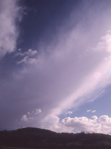
Upward-sloping Cb top, appaprently embedded in the back of the front, looking S, the whole mass moving R to L with the sun starting to illuminate its underside...
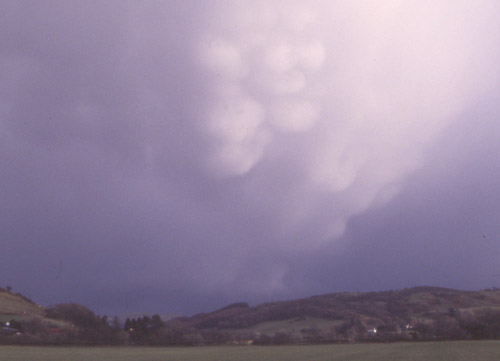
Mammatus on this back-slope coming into view so I drove on a little, pulled in and waited at the Millennium Cycle-Path bridge over the Dyfi. The bridge is famously known locally as the Saddam Hussein Bridge. Why? Because a lengthy council meeting was held where they were trying to find a commemorative name for it. After lots of two-and-fro debate, a councillor who shall remain nameless and who felt that there were more important things to discuss said something along the lines of: "Look, I don't care if you call it the Saddam Hussein Bridge, can we just decide something and move on?". It stuck, unofficially!
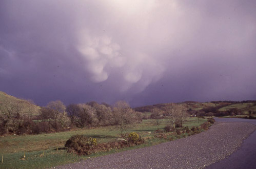
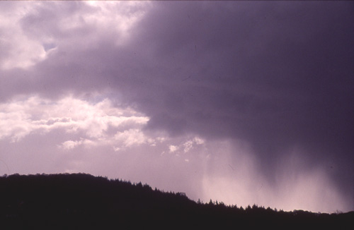
Good glob of mammatus-clouds overhangs the Dyfi valley, with the heavy rain of the front behind, from the bridge...
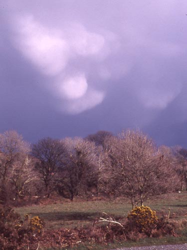
Close-up, with flowering gorse: the whole lot was receding away at >30 knots, and would soon be lost to the horizon...
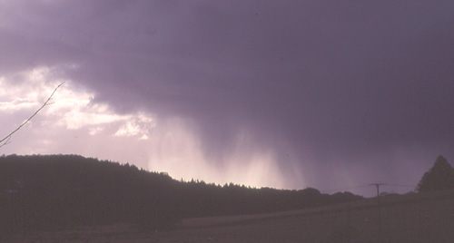
I watched it for a while longer until it slipped out of view, then set off west to intercept an incoming downpour from another cumulonimbus cloud. Here are the "rain-shafts" falling from it...
Sometimes, a particularly intense shaft of rain and/or hail can look a bit like a funnel-cloud or tornado, like the one in this pic, R of centre. An easy mistake to make that practised observation puts right....
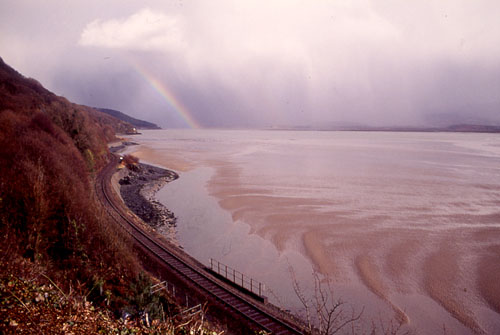
I drove on through a few minutes of heavy rain with a bit of hail mixed in. Here, close to Aberdyfi, and looking east up the Dyfi Estuary, the retreating squall and its precipitation are visible. The railway track is the incredibly scenic Cambrian Coast line - recommended!
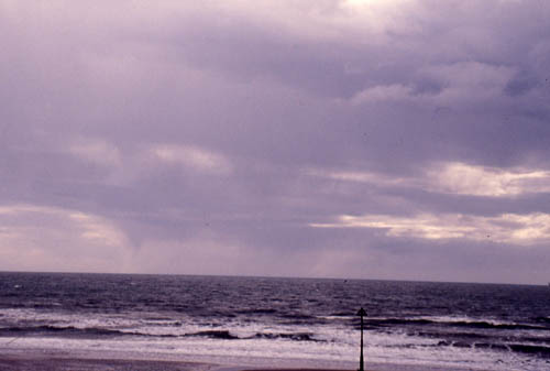
At Tywyn some more showers are visible out to sea but by now convection seemed to be weakening rapidly. Again there is a pseudo-funnel (L of centre) which is actually more rain-shafts, as a quick check with the binoculars showed. This was to be the last convective weather of note seen in the area until almost mid-April.
BACK TO WEATHER-BLOG MENU
New! Fine Art Prints & digital images for sale-
Welsh Weather & Dyfi Valley landscapes Slide-Library - Click HERE