MAY
2004 PART 2: 10:05:04
Vigorous convergence-zone convection, East Wales!
BACK TO WEATHER-BLOG MENU
New! Fine Art Prints & digital
images for sale-
Welsh Weather & Dyfi Valley landscapes Slide-Library
- Click HERE
Convergence-zones
commonly develop in the eastern half of Wales, especially
with a northerly or southerly airflow and slack
low-pressure in late Spring and Summer. What causes them
is a cooling westerly sea-breeze that works its way
inland and forces up the warm air it meets - resulting in
vigorous convection sometimes. The low-level westerly
meeting a higher-level northerly or southerly creates
what is known as wind-shear - when winds at different
altitudes are blowing from different directions. Shear is
important for storm-photography because it encourages the
updraughts that feed storm-clouds to rotate, which in
turn can generate funnel clouds or even tornadoes!
On May 10th 2004, a slack northerly flow, forecast
instability, warm temperatures inland and a sea-breeze
from the word go took my interest and I headed off early
towards the Welsh border.
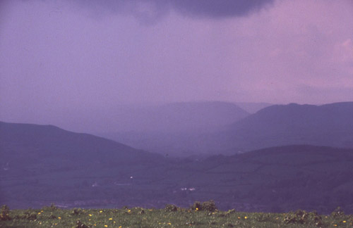
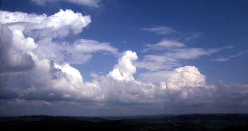 By mid-morning, lines of towering cumulus clouds were "bubbling up" near Newtown, as in this (slightly underexposed) photo. I wanted to make sure I was with the most vigorous convection, so I continued into Shropshire.... |
|
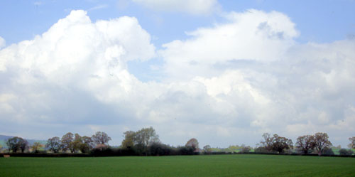
 At the Border, looking east into Shropshire revealed mostly broken cumulus banks.... |
|
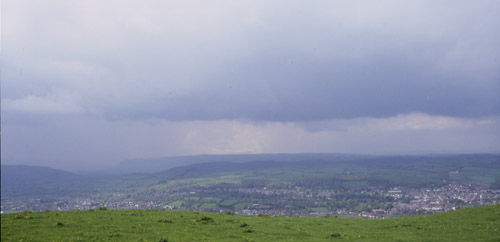
 ...while looking back west towards Newtown already revealed a cumulonimbus storm-cloud. So that was that. Newtown was the area to be with today. This was at about 12.30pm, and shortly after taking this "reference-pic" a rumble of thunder was heard. Once in the right area I patrolled up and down under the storms as they developed. This involved keeping with a cell until it matured and chucked out torrential rain, hailstones and lightning, which I'd then get out of and select the next developing storm to watch. By now it was obvious that the whole of East Wales was one big line of convergence-related thunderstorms. This was getting exciting, but was about to get even more exciting.... |
|
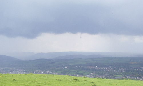
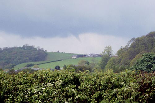 Coming back east having dodged another torrential downpour I first observed this funnel-cloud at 13.50pm just west of Glanmule. There was no hope of stopping so I drove on westwards, through Kerry, and pulled off the road just west of Kerry to get this image... |
|
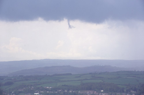
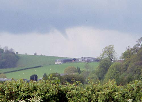 ...zoomed in here. I then continued west, knowing as I did that I was only a mile or two from a brilliant vantage-point, where it was safe to stop and I'd see this in close-up. The road climbs a hill out of the Vale of Kerry towards my destination, and as I went up the hill the funnel was dead ahead, more or less the same as in these images. Suddenly it extended downwards, then its lower third went into the most incredible convoluted shape, just like the lower part of a corkscrew! As I pulled over into the stopping-place it roped-out into a thin thread that faded from sight as I got out of the car! It was brilliant to see this but I wish I'd been able to photograph the corkscrew bit! Dash-mounted video camera would have been very useful on this occasion... |
|
 I then drove SW along a back-road and stopped at another good vantage-point, directly overlooking Newtown. With no precipitation-cores heading my way for a while I was able to relax and watch this developing storm. A mature storm is in the background, too.... |
|
 I'd got to the end of one film and was changing over when a disturbance formed in the cloud-base. Trying not to panic, I finished loading the new film and immediately took a wide-angle (28mm) shot... |
|
 ....before zooming in on it. Although a bit tatty this was definately not one of the "scud-funnels" I've seen so often. This was at 15.00pm..... |
|
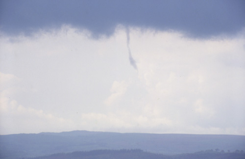 ...and in seconds it had extended itself downwards, twisting about visibly, just to prove to me it wasn't scud! Then, as in the case of the first funnel, it thinned rapidly and faded from sight. If only I'd had this quality of view of the first funnel! Shortly afterwards all hell broke loose as this storm matured.... |
|
 ...and although I was just about in sunshine here, it seemed sensible to drive off the hill-top in case of lightning, although I had to grab this pic first! This storm then merged with others to the north and east: I drove halfway to Knighton to try and get out of the rain, but by then it was clear that the most vigorous convection had ended - getting later in the day so less solar heat, plus a lot of cooled outflow from the earlier storms. So it was homeward bound, and very satisfied! A pattern was emerging today - if you were going to see any funnel-clouds it would be as the developing storms were getting close to maturity - when the most vigorous updraughts would be present. Something to remember for the future.... |
|
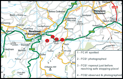 Here is a map showing the locations of the funnel-clouds. All were to the N and NW of the numbered vantage-points. May 11th still looked good too... see part 3! |
|
BACK TO WEATHER-BLOG MENU New! Fine Art Prints & digital images for sale- Welsh Weather & Dyfi Valley landscapes Slide-Library - Click HERE |