SPANISH PLUMES OF 2003 INCLUDING
AUGUST 5th FUNNEL-CLOUD
BACK TO WEATHER-BLOG MENU
New! Fine Art Prints & digital
images for sale-
Welsh Weather & Dyfi Valley landscapes Slide-Library
- Click HERE
Spanish Plumes occur as a matter of course during most summers in the UK. The term refers basically to a plume of hot and humid air being drawn up northwards from Spain to provide us with a summer heatwave. But, since the hot air often meets cooler Atlantic air as it works its way northwards, massive instability often develops, resulting in typical summer thunderstorms.
Summer 2003 saw many such plume events, although Mid-Wales missed out - generally. That's the way with summer thunderstorms: one place may experience a torrential downpour with flooding, hail, wind and lightning damage while another, 50 miles away, may experience hazy sunshine all day.
Plumes create
challenges to the photographer due mainly to the haze and
murk. Storm structures are often obscured to an extent -
compared with the clear conditions that accompany the
maritime, westerly airflows that dominate the winter
months. This page is dedicated to summer 2003 and its
frustrations and successes......
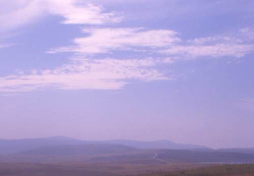
From the top of the Dylife Mountain Road, July 15. Plynlimon shimmers in the heat-haze, which has the effect of "flattening" the landscape. Typical Spanish Plume weather (dry version!).....
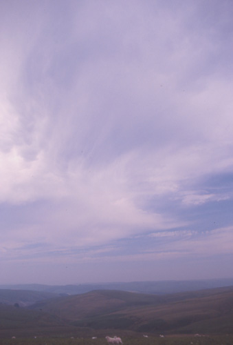
The same afternoon. Towards Dylife the sky was somewhat more dull. A very high-based convective shower hung over the valley. Virga could be seen descending from its base but, as virga typically does, it evaporated before reaching the ground....

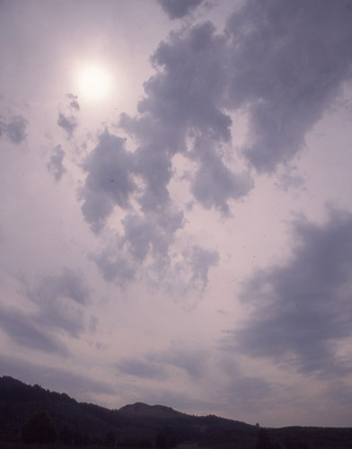
June 16: Borth. Crepuscular rays starburst out from behind developing Altocumulus towers. These were supposedly to herald an overnight thunderstorm event. Not in Mid-Wales though!..
June 22: On the way home over the Dylife road from an abortive chase to the Welsh Border. Forecast conditions had been ideal with stacks of CAPE and good negative Lifted Index values. But - guess what: an enormous overnight Mescoscale Convective System in the English Channel spewed out so much outflow cloud that the favoured area remained overcast all day and convection was as a consequence extremely localised......
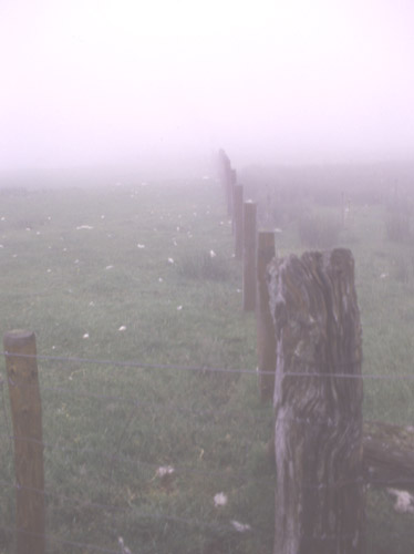
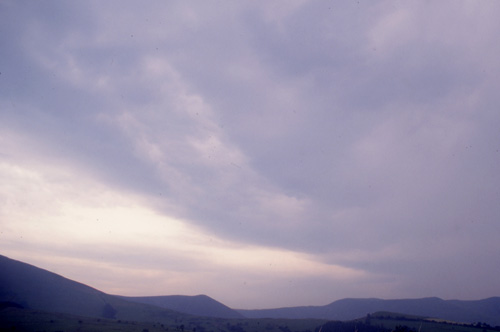
Fog is not uncommon in Spanish Plume conditions...... especially when the dreaded outflow is about!
Fog does create the occasional opportunity to photograph otherwise murky landscapes!! Looking across the Dyfi valley towards evening.
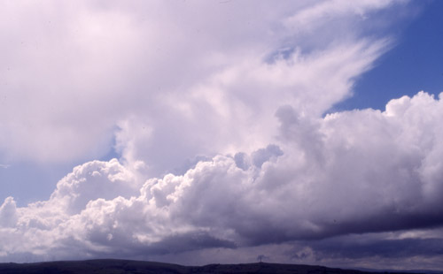
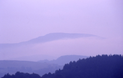
In a brief interlude in July, the odd maritime flow or two occurred - note the clarity and blueness of the sky, relatively empty of particles, pollution etc. This was taken during a day up on the hills above the Kerry road, SE of Newtown. Good views and stopping places make this a choice for a chasing venue when it's happening inland. Here, a mature Cb towers over a row of altocumulus..........
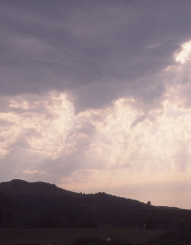
August 5 2003 at last provided a Spanish Plume in which some worthwhile thunderstorms were generated over the Mid-Wales area. A day out ensued: first off up into the mountains, where this storm dropped a few long C-G strikes over Plynlimon at lunchtime. You can actually make out some structure here for a change!!
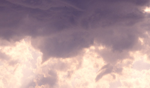
On driving back down to Machynlleth, the storm's anvil had spread out. Here, low scud-cloud gusts along beneath it while the sun just about shines through. Taken from Machynlleth golf-course.
Afterwards a run coastwards saw a cloud canopy with a lot of low gubbins - outflow from the lunchtime storm....
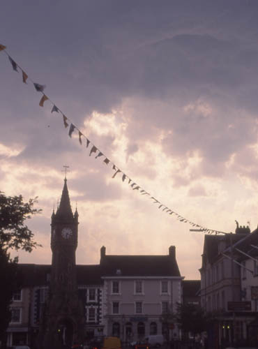
By early evening I was back in Machynlleth - and the cloud canopy at last broke up, letting the warm sunshine back through and in little time, streets of altocumulus castellanus (ACCAS) towers energetically began to "bubble up," as the forecasters like to say. Within one such ACCAS street, a second thunderstorm rapidly developed just to the NE of the town. This was its updraught in the formational stage, here above Machynlleth's clock tower. So quickly back in the car and out of town for a better view!
This was 10 minutes later, taken looking SW from the Forge road, as it crosses Machynlleth golf course. A lowering in the updraught base has developed into something rather suspicious...
Here is a close-up.....

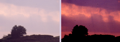
....and here are edits from the two shots side by side: they were taken maybe 20 seconds apart. This has been accepted by Torro as a funnel-cloud: here you can see the beginnings of downward propagation and a tightening-up of the structure. Logically, it was in exactly the right place - on the lowered cloudbase in the updraught area of a rapidly-developing thunderstorm. The larger images show other small vortices close to this main one at the centre of the lowering.
At the same time, long C-Gs and heavy rain started dropping from the cloud-top to the NE and thunder rolled around the valley. As the storm matured and the vortices disappeared it was interesting to note that most of the neighbouring altocumulus deck broke up - as if the storm that had formed had drawn off all the ingredients for cloud-formation all for itself!
The storm dispersed and fog started to form, spoiling the visibility again. Prior to calling it a day I noticed another bank of developing altocumulus through the murk to the SW. Another funnel-shaped feature was visible, though this time far away and through the murk, it was not obvious to the untrained eye. However, by using digital brightness/contrast adjustments (about half the brightness/twice the contrast) it becomes a bit more clear (R) compared to the original slide (L). All in all an excellent end to the day!
The most intense thunderstorms of the summer started at 6.45am on Sunday August 10 and continued for most of the morning, with on-off torrential rain and many close C-G lightning strikes. And - guess what? All of this action occurred in thick fog. It made the lightning look eerie but as for photography, well, forget it!
BACK TO
WEATHER-BLOG MENU
New! Fine Art Prints & digital
images for sale-
Welsh Weather & Dyfi Valley landscapes Slide-Library
- Click HERE