SPRING
2006 - part 3: the wet May continues....
BACK TO WEATHER-BLOG MENU
New! Fine Art Prints & digital
images for sale-
Welsh Weather & Dyfi Valley landscapes Slide-Library
- Click HERE
| The
wet May continued apace after the first ten days
and it's hard to remember a lot about it now with
temperatures soaring into the 70s (June 7th). I
am nicely sunburnt after several good fishing
trips: the mackerel are in off the rock-marks of
North Wales, and the practise I have of working
weekends when the weather's awful has allowed
time off to enjoy the onset of Summer! Let me take you back - having to use the electric heater to take the edge off the chill; seeing my breath in the air walking down Machynlleth high-street; wintry showers repeatedly being mentioned in forecasts; the Dyfi full of floodwater. May's normally a grand month but this one's been awful in the main. On Saturday 13th May, Liverpool won the FA Cup on penalties and I listened to the mounting tension whilst intercepting some thunderstorm activity in the Welshpool district..... |
|
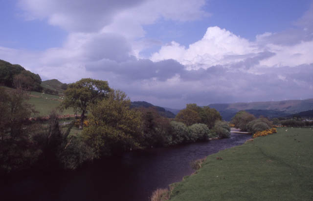 ...seen here from the Dyfi Valley near Cemmaes road, the line of towering cumulus that are each moving eastwards as they turn into Cbs and release their torrential rain.... |
|
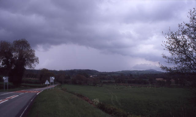 I moved eastwards on the A458 towards Welshpool. At Foel, the storm's core was visible - not much to look at so far..... |
|
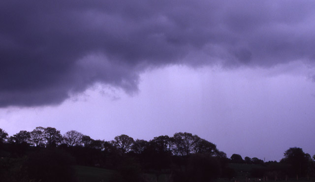 Near Llangadfan I was obviously very close to the core. Here, rain-shafts can be seen falling behind a very low (almost treetop-skimming) ragged cloud - a gust-front. It was moving very slowly so I continued eastwards through Llanerfyl, passing through it into the storm's heart... |
|
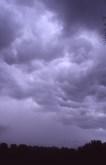
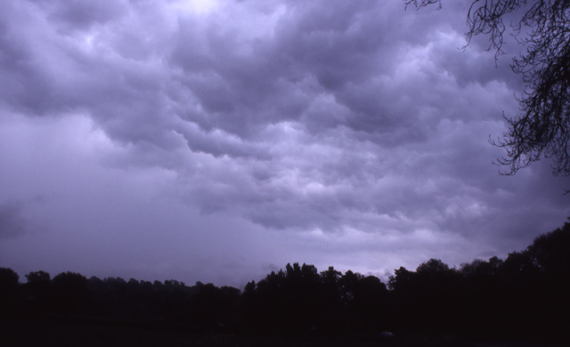 ...to be greeted with this. The gust-front is out-of picture to the R and this is looking up into the clear air on its inside, roofed with an arch of scalloped clouds, with the torrential rain to its left again. This part of a storm is known to us weather-people as the "Whale's Mouth" - presumably because it's a gaping hole in the base of the cloud! Here's a diagram showing what's what..... 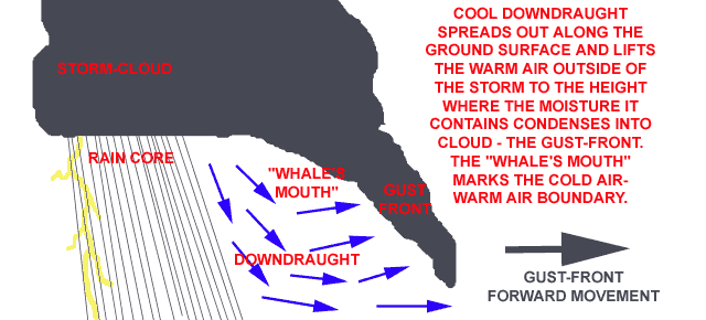 |
|
 Another shot in portait format.... |
|
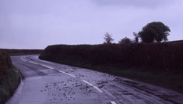 The storm moved on and was now decaying. A wander round the lanes showed that it had been intense, with rocks washed off fields littering the road in places, while in other spots springlike fountains of water were gurgling up from the ground.... |
|
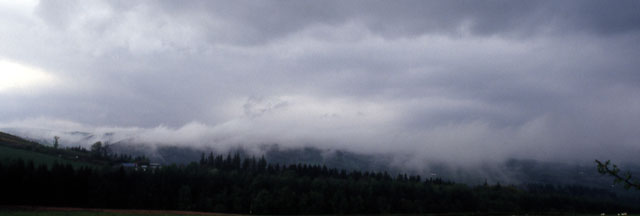 As water evaporated off the ground and up into the downdraught-cooled air, it condensed again to form thick banks of fog which gradually conspired to obscure the landscape. So that was that. |
|
 After a further tedious interlude involving rain, rain and more rain there was the chance to get out again on Sunday 21st when I headed SE towards Builth Wells, meeting the developing convective clouds near Newbridge-on-Wye. Trouble is, the convection had nothing to check its progress (which would provide fewer but potentially more photogenic/impressive storms). Instead it all fired pretty much simultaneously. This is disappointment in the same sense that you would experience if you went to what was supposed to be a half-hour fireworks display, only for the lot to be let off at once! |
|
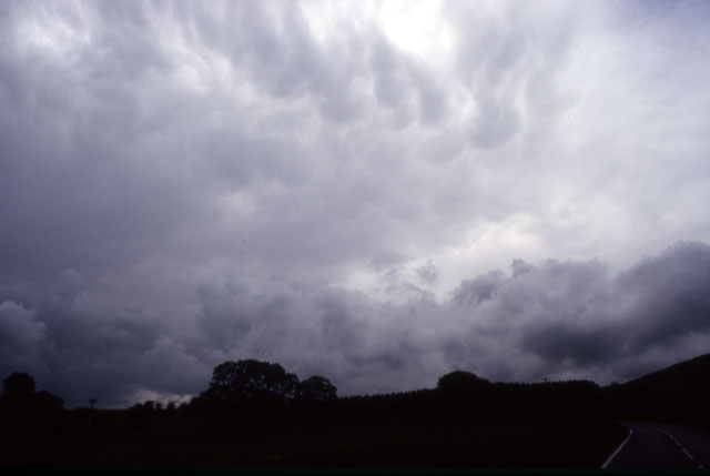 ...which is what happened here with the sky filling up with cumulonimbus anvils until blue sky was almost nonexistant! As can be seen here the Cbs were all mammatus-laden but the light was positively dreadful. This was quite simply a day that didn't cut it! |
|
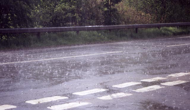 The chase ended in the Newtown area but this could have been the scene more or less anywhere I went! That type of rain that bounces into the air and makes 50p-sized splat-marks on the windscreen... in fact this picture pretty sums up May 2006 in many ways. Luckily June is making up for it. It's 1730 BST now and it's time to wander over to the beer-garden at my local for an after-work pint. This is where we all unwind after a day's work (well in summer, anyway!)....  Over the coming weekend (June 10th-11th) and into next week it looks like getting still hotter and then the plume of hot air will destabilise. Some big thunderstorms are thus a possibility! Watch this space! |
|
BACK TO WEATHER-BLOG MENU New! Fine Art Prints & digital images for sale- Welsh Weather & Dyfi Valley landscapes Slide-Library - Click HERE |