SUMMER
2004 - PART 4:
Spectacular August thunderstorms over Cardigan Bay (plus
a brief note about hurricanes)....
BACK TO WEATHER-BLOG MENU
New! Fine Art Prints & digital
images for sale-
Welsh Weather & Dyfi Valley landscapes Slide-Library
- Click HERE
The thundery August continued apace
after my experiences on the 12th, with a slow-moving
complex low-pressure system in residence over the UK.
This August has been an incredibly wet one, with more
thunder days than I remember in a single month. Some of
the rainfall has been exceptionally severe, as witnessed
by the poor people of Boscastle in N Cornwall. Why?
These low-pressure systems have either had a strong
southerly inflow into them, or have absorbed remnants of
tropical storms and/or hurricanes. Either way, they have,
because of this, become especially rich in warm, moist
air. When such air moves north into cooler climatic zones
(e.g. NW Europe) it can no longer hang on to the moisture
which basically means that when it rains, it really
chucks it down! So it's worth watching out for hurricanes
in their dying phase. Click HERE to find
out more about how ex-hurricanes can influence our
weather!
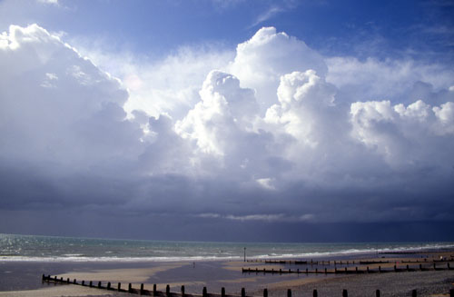
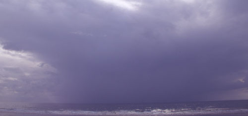 The 16th will go down as a date to remember for the people of North Cornwall. Here we had the fortune to miss out. I photographed this "messy" looking storm at Borth in the evening..... |
|
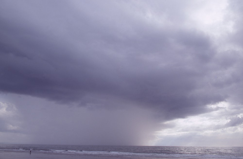
 ....trying some telephoto shots of the sunlit waters and the rumbling blackness beyond. Sort of works! |
|
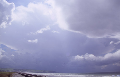
 On the 18th a more impressive band of thunderstorms moved up across Wales. Here's one of the first, once again seen from Borth, with a mean-looking core of torrential rain...... |
|
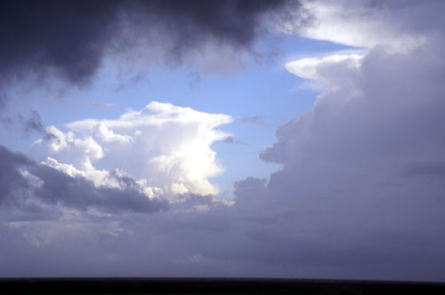
 ....with a real beastie working up from south of Aberystwyth. The anvil towers over the blackness beyond, its edges visible L and just about visible R. I waited until this got close, with sadly no better opportunities to get images. Too many other clouds in the way! The storm followed me back up the Dyfi valley to Machynlleth, where torrential rain and loud thunder lasted for a while. Some of the C-G lightning strikes were too close for comfort! |
|
 After it passed I drove northwards to Tywyn and beyond, stopping to photograph a half-hearted display of mammatus clouds from the bridge over Afon Dysinni. Just having gone "click", a 5lb sewin leapt from the inky waters into mid-air in my field of view! A second or two later and I'd have had a pic worth posting here! Looking inland greyness and low light - but to the coast brighter skies beckoned. North to my usual vantage point near Llwyngwiril and a mass of Cbs were visible, moving gradually up Cardigan Bay. Tywyn looked to be the place for an intercept..... |
|
 ...where vigorously building convection had established itself in a NE-SW line parallel to the coast. New towers shooting up on the landward side of already mature thunderstorm cells whose anvils form the backdrop... |
|
 ....this is for reference purposes a shot of a scud-funnel, under the cloudbase somewhat L of the field of view in the last image. These are not funnel clouds. They are bits of scud (tatty clouds that run along under the main cloudbase but are not attached to it). Sometimes, at a glance, they can resemble funnels, which is why binoculars are useful for checking such things when they are distant. |
|
 The truly mountainous clouds continued to grow - and in no time more torrential rain begins to fall from their bases. Note the faint line of paler clouds at the main cloudbase: now what happens next?? |
|
 This is what happened next! Cooled air dragged down by the rain pushed under and lifted warm moist air in a line parallel to the storm. The warm moist air then condensed out its moisture into a long straight, ominous-looking cloudbank, known technically as Arcus but generally as a roll-cloud. In this image the downdraft can actually be seen - it is making the rain shafts slant down and L. The roll-cloud thus marks the boundary between the outflow - the cooled air gusting down with the storm's downdraught - and the ambient surrounding air. Roll-clouds that are this well developed are unusual in the UK. |
|
 The roll-cloud rather lost its good definition shortly after as heavy rain and booming thunder once again took over. I headed back south along the coast, where at Aberdyfi a distant thunderhead was nicely framed by two nearer ones! This was the last decent break in the clouds that I was to see on this day. |
|
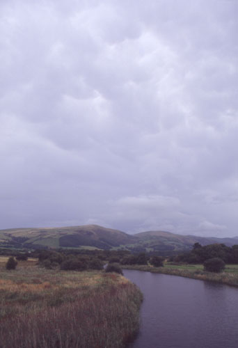
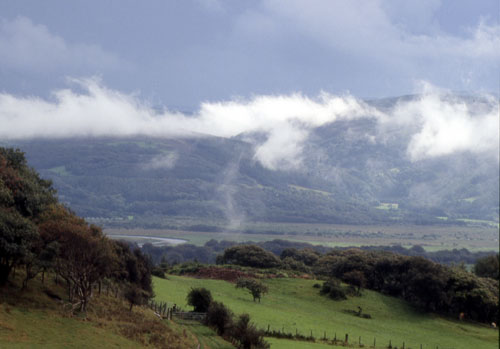 On the way back to Machynlleth, there was much evidence of low-level moisture condensing in the cooled outflow air and forming banks of foggy low cloud over the Dyfi Valley.... |
|
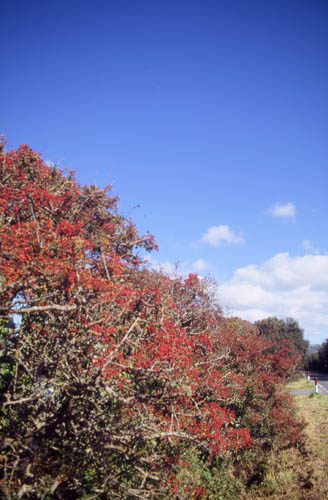 ...and finally a jump ahead by a few days to better weather and an incredible crop of hawthorn berries. In August!!! Will this mean a hard winter 2004-5? Ask me in December! |
|
BACK TO WEATHER-BLOG MENU New! Fine Art Prints & digital images for sale- Welsh Weather & Dyfi Valley landscapes Slide-Library - Click HERE |