August: damaging floods and less sunshine than February!
BACK
TO WEATHER-BLOG MENU
New!
Fine Art Prints & digital images for sale-
Welsh Weather
& Dyfi Valley landscapes Slide-Library - Click HERE
I don't know
whether to start this blog-entry with this:
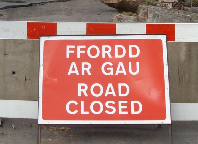 Or this: 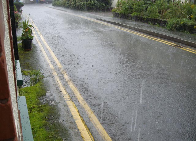 The latter being the view from my front door on many days in August and early September. Of the former (a significant flash-flooding event), more further down the page. August 2008 will go down in the records as very wet, very un-sunny (dullest since 1929) and, quite frankly, downright depressing as a consequence. As a consequence, there is cloud and rain in most of these images. Rather a lot of it in fact. On August 17th, I went on an organised field-trip to a quarry at Llansawel, between Lampeter and Llandeilo. These are no particularly fast routes from Machynlleth to that area, but plenty of shortcuts which I use frequently, one being the Nant-y-moch mountain road from Talybont to Ponterwyd. Bad move on this occasion as the heavens proverbially opened. This was the view in Cwm Ceulan above Talybont at 0800 on the morning in question: 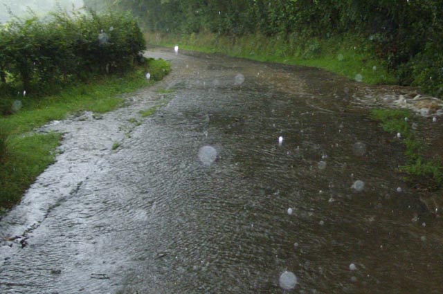 By a miracle, despite having to drive up rivers like that, the rendezvous was made in time and the field-trip was a success. On the way back I took another route, up past the Llyn Briane dam, with its spectacular overflow spillway.....  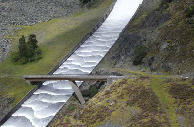 Sometime during this period, here is a shot of the Ystwyth raging across the harbour at Aberystwyth. Rapids are not included in the usual list of hazards to shipping here! 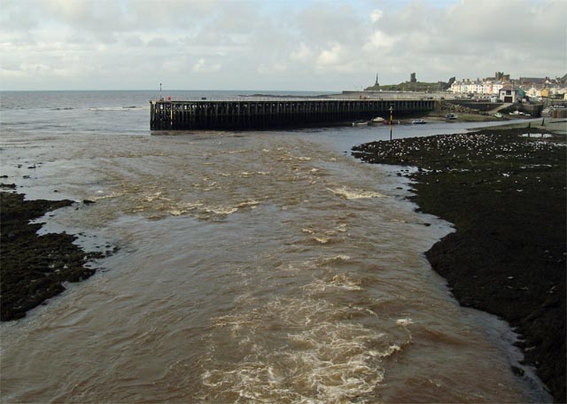 September arrived and the weather really cranked up a notch. On the 2nd, photogenic convective weather resulted in a few trips out to intercept various storm-cells, starting with this one just after sunrise at Ynyslas: 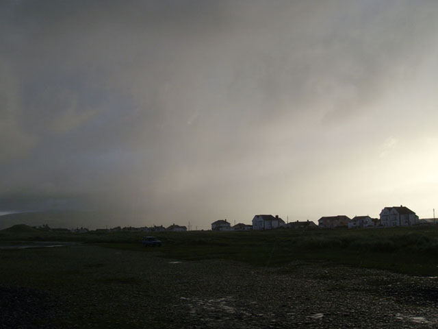 ....with a return visit in the early afternoon to watch this storm and the one following it drift by... 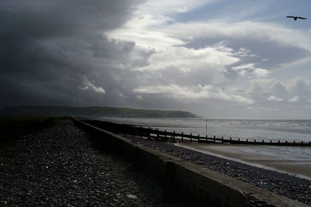 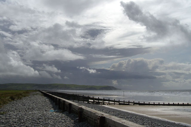 But once again it was torrential rain that featured most heavily. This is near Aberhosan on the afternoon of the 2nd: 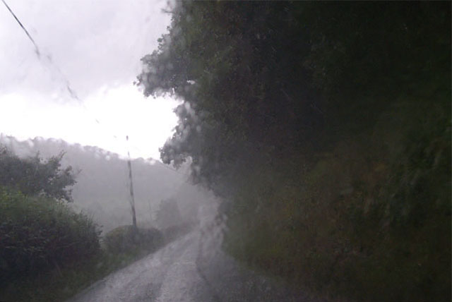 ...while this was the final visit to Borth of the day. The beach is normally still fairly busy with visitors at this time of year. Not so on this occasion! 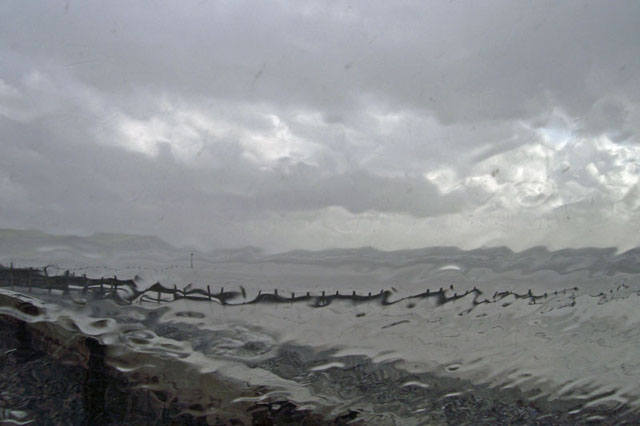 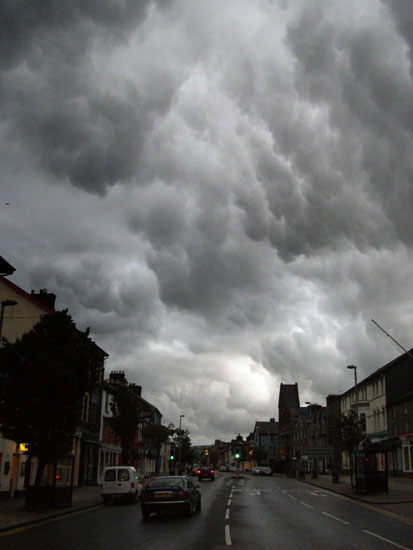 On the evening of September 3rd,
fizzling-out former thunderstorms drifted over Machynlleth at dusk,
giving a spectacular display of mammatus to anybody who happened to be
looking up (by now not many people as the risk of being hit in the eye
by a large raindrop was becoming increasingly familiar)... On the evening of September 3rd,
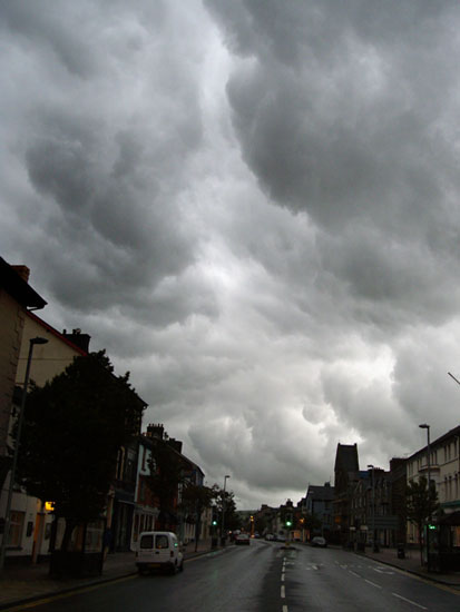
fizzling-out former thunderstorms drifted over Machynlleth at dusk,
giving a spectacular display of mammatus to anybody who happened to be
looking up (by now not many people as the risk of being hit in the eye
by a large raindrop was becoming increasingly familiar)... |
|
 An omen of things to come?? Maybe... An omen of things to come?? Maybe... |
|
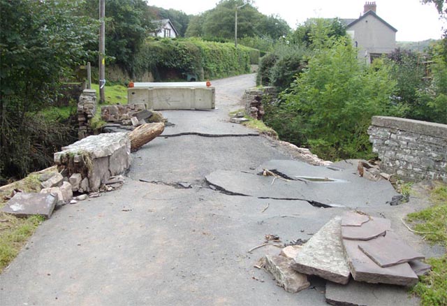
September 4th-5th 2008 will go down as an exceptionally wet 48 hours. Here's Dyfi Bridge on the 4th - with the river very close to topping its banks... 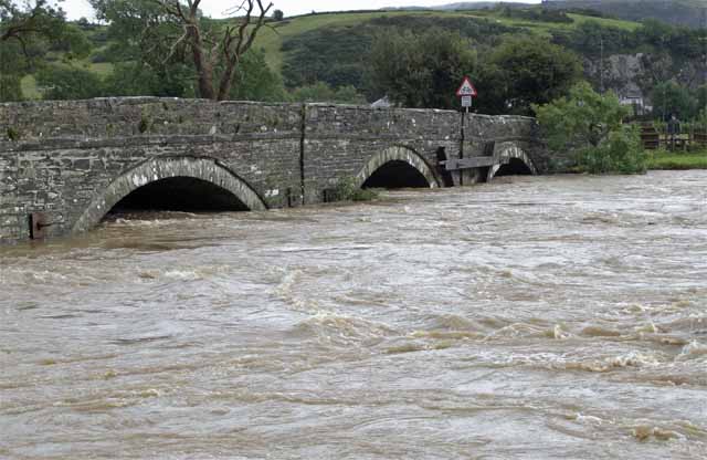 ....whilst the falls at Furnace were on good form: 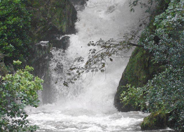 But the real story from this period unfolded very quickly indeed in a remote area to the north-west of Brecon. Here lies Mynydd Eppynt, home to extensive Army ranges, and beneath its drab, target-bedecked slopes, there lie gentle wooded valleys with scattered small villages amongst the farm pastures. This was the backdrop to a devastating flash-flood that came up in less than an hour. Two key rivers were affected - the Honddu and, especially, Afon Ysgirfawr, which flows down past the villages of Merthyr Cynog, Pontfaen, Battle and Aberysgir before joining the Usk as it flows down though Brecon. Here is a bridge between Merthyr Cynog and Pontfaen: |
|
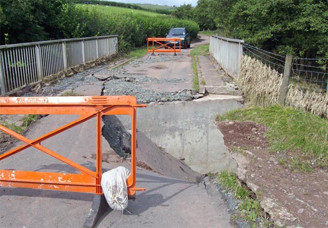 Afon Ysgirfawr has simply gone round the bridge and has torn the road away on its eastern side. Note the flood-borne grass trapped in the mesh fence on the R. Meanwhile, in Pontfaen, the damage was worse still: |
|
 |
|
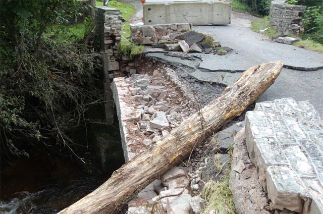 The parapets almost wholly demolished, tarmac ripped away and (out of view in this image) riverside houses badly flooded. I met the owner of the one nearest the bridge: the house had been done up and the job only completed weeks ago: now it was full of silt, mud, rocks and had a flood tidemark 3-4ft above floor level. I've been flooded myself once and I know how depressing it is, but to finish such a project then see it all ruined in just weeks is something that words cannot express adequately. 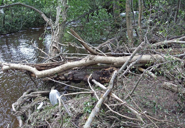 The reason for my visit to these catchments was to investigate this extreme rainfall event on behalf of TORRO (the Tornado and Storm Research Organisation). It appears that 116mm (over four and a half inches) of rain fell over the area between midday and 3pm: much of it clearly fell before 1330 because that was the approximate peak of the flood. In the image above, on the lower part of Afon Ysgirfawr, trees and branches are strewn across the wooded flood-plain. Flooding was reported widely across the UK on September 5th, but this localised event was quite exceptional in its ferocity and the destruction caused. Elsewhere in the catchment, there were small landslides, roads and gateways gullied deeply, rocks and gravel deposited feet deep on roads and debris generally strewn about. The clean-up and repairs will take some time to undertake and the scars from this flood will last for several years. About the best news from this period was being asked to cut up and remove a fallen ash-tree for someone, neatly solving the question of where the winter firewood was coming from. There's enough in this pile to do a cold winter, and if it's anything like recent ones, there's enough for two winters! 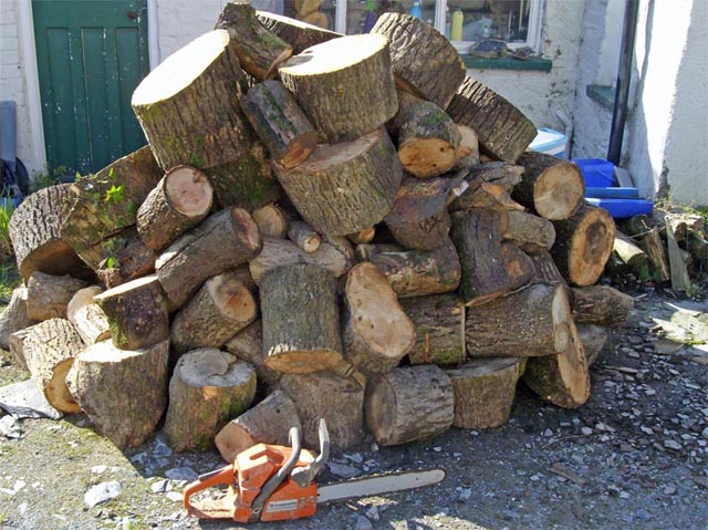 Meanwhile, after a dismal summer, the kids have gone back to school and almost immediately (typical, eh?) the weather has improved with a large anticyclone sitting over the UK and warm sunny days, mackerel being caught off the beaches and everything is gradually drying out. For the people who live along the Ysgirfawr catchment, it has come not a moment too soon. |
|
BACK TO WEATHER-BLOG MENU New! Fine Art Prints & digital images for sale- Welsh Weather & Dyfi Valley landscapes Slide-Library - Click HERE |