BACK
TO WEATHER-BLOG MENU
New!
Fine Art Prints & digital images for sale-
Welsh Weather
& Dyfi Valley landscapes Slide-Library - Click HERE
The second
half of June 2009 featured the first warm spell of 2009. Temperatures
crept up into the upper 20s widely and conditions became increasingly
humid with showers and thunderstorms featuring by the final week and
some notable storms on June 30th and July 1st, before fresher
conditions came in from the west.
The
storms gave me some mixed fortunes but with lots of lightning and loud
thunder booming around the hills and some satisfying photos. They also
brought brief flash-flooding to Machynlleth, squally damaging winds
and, for a friend in Artist's Valley, a very close encounter with
lightning!
Noctilucent clouds (sometimes referred to by the acronym - NLC) are very high cloud formations consisting of small ice particles. They occur in the mesosphere - at altitudes of around 75 to 85 kilometers (47 to 53 miles) and are thus quite set apart from all other types of clouds (e.g. a mighty thunderhead is still only 10-20km high). The key time to observe them is during the mid-May to mid-August period. At this time of year, it never gets truly dark in the northern sky but instead there is a deep twilight between sunset and sunrise. At this time, these normally invisible clouds become illuminated by the sun which remains over the horizon. Thus, the northern sky is the place to look.
News started circulating on the internet at about 11pm on the 17th that a good display was becoming visible, so I grabbed the camera and headed out of the door. This was the view across the road towards St Peters Church:
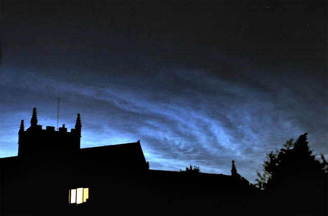 Incredible! This was the brightest display I have yet seen, with that classic "nocti-blue" as it's called by enthusiasts.... 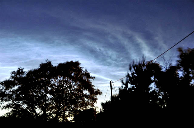 ...finding somewhere with a better view was not easy though - in the beer-garden of the White Lion, a stiff breeze affected the trees and made for a lot of motion-blur amongst their tops. I think the shot with the church worked better... 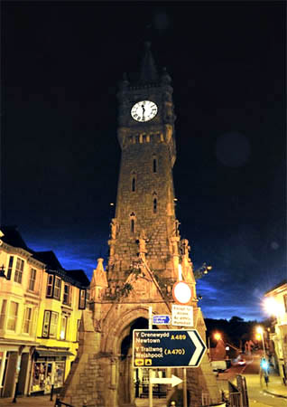 ...but this one shows how bright they were! The camera has exposed the scene correctly for the well-lit street and clocktower, yet towards the horizon that vivid electric-blue persists. There has been nothing like that since, although some likely displays (i.e. they were visible elsewhere in NW Europe) have been clouded-out here. But there are a few more weeks in which we might see something, so I'm not saying that's it for 2009. If it's a clear sky around sunset, keep checking the northern sky for the next hour or two. If they appear, you will have a job to mistake them for anything else! Now onto the thunder! 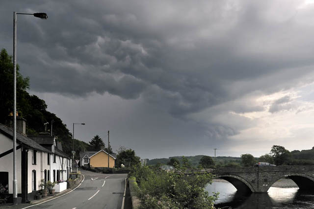 Activity commenced in earnest on June 29th, when an active trough moved north over Wales. This essentially took the form of an east-west narrow rainband from which sporadic thunder was ongoing. Its western end passed Machynlleth by just a few miles. The above shot shows a torrential raincore moving away northwards, from Dyfi Bridge. Instability and high temperatures looked to conspire to possibly produce some afternoon storms too, and I went out in the afternoon, following the most likely-looking towers and these took me northwards along the A470, past Dinas Mawddwy towards Dolgellau.... 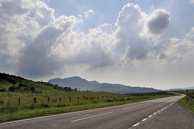 ...ending up at a vantage-point just west of the Bwlch, beloved spot for aviation photographers...  ....and indeed aviation was more in evidence than thunderstorms as the above image shows! F-15 heading over Cadair Idris. 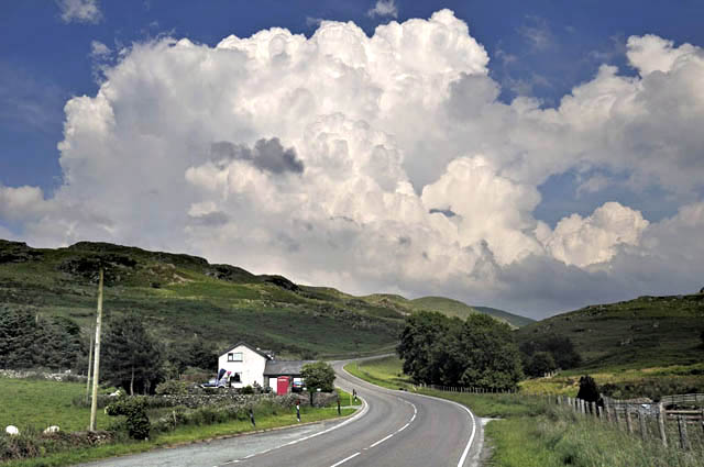 Finally the convection started to shoot up over the Arans....  ...the sharp-edged boiling-up clouds indicative of vigorous activity. These towering cumulus eventually produced brief heavy showers, but it was clear that the environment was not favourable for intense thunderstorm formation. The next day - June 30th - looked to offer a better possibility of this: 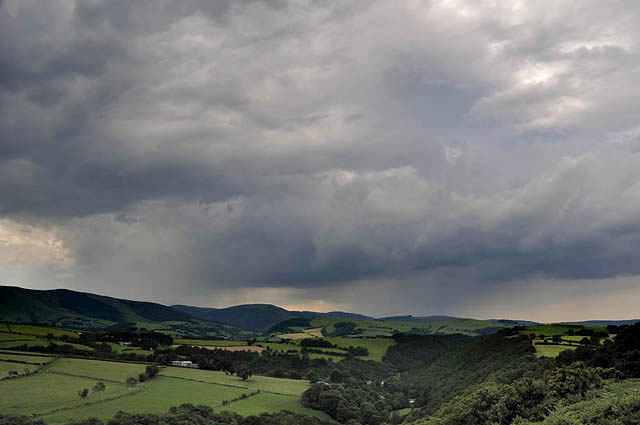 On the late afternoon of the 30th, radar indicated a N-S line of heavy showers building from near Swansea up to Dolgellau. Atmospheric profiles were indicative of very high moisture levels: this might lead to hazy conditions but also would result in the risk of torrential downpours, which developed quickly. The reason for the storms forming here was almost certainly due to convergence - coming together - of the synoptic airflow (S to SSE) and sea-breezes coming in from the coast - being cooler, a sea-breeze pushes under the warm air inland, lifting it to a height where it becomes very buoyant, and this allows rapid convection to initiate. The view above shows two cores of torrential rain approaching Machynlleth from the south.... whilst below is a sketch-diagram showing a typical convergence zone: 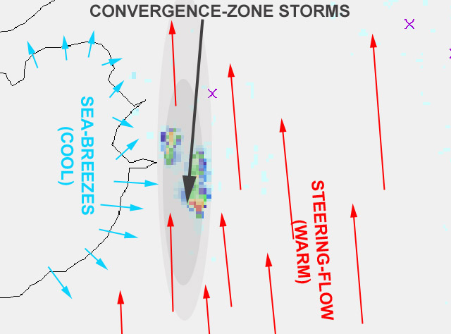  ...meanwhile, this Typhoon jet exited the "Mach Loop" low-flying circuit and climbed quickly, heading east away from the storms into clearer skies.... 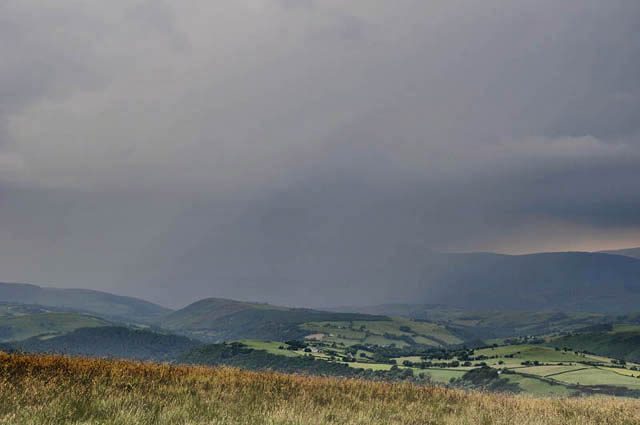 This is the view looking from near the top of the pass over to Llanidloes, looking straight towards Machynlleth. Obviously, it's bucketing down! Thunder was now audible every minute or two. 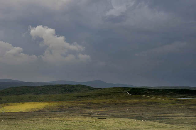 Coming up from the south was the next storm on the line, here approaching Plynlimon.... 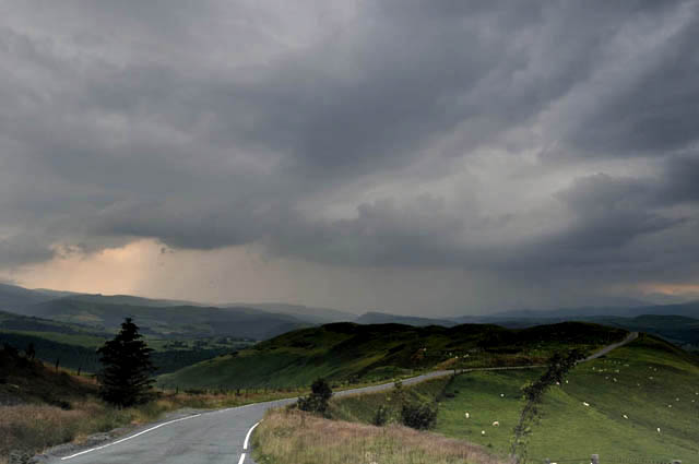 ...and back on the Machynlleth side of the pass, looking back homewards again. Lightning was visible every minute or so now. 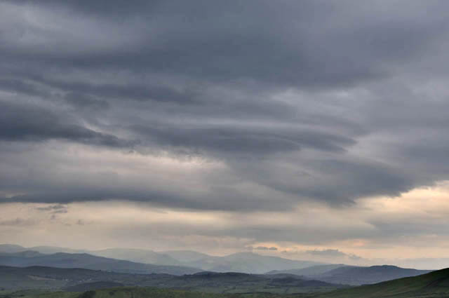 The visibility was not great and was deteriorating. This was the final shot, looking north towards the Arans, over which some stacked lenticular clouds had developed in the deck of stratocumulus pushing out east from the storms. A similar, but drastically narrower and more electrified convergence-line developed on the late afternoon of July 1st: 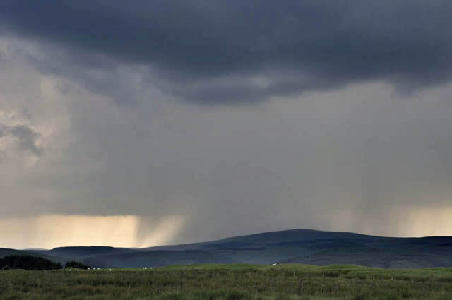 This began life around 1530BST when the growing cloud-tops became clear on visible satellite imagery. The profiles were still very moist and flash-flooding had looked likely from the morning onwards - not "if" but "where". The problem would be in pinpointing the "where" bit. Sea-breeze convergence would be important and perhaps a bit of orographic lift from the mountains too. When the narrow, N-S line became visible I headed out to investigate and storms developed explosively - this one is running up the line, just west of Plynlimon summit. The reason for flash-flooding in such situations is because storms typically form and move along convergence-lines, like trucks going along a railway. Therefore, if the convergence-line remains in the same place, areas beneath it will receive storm after storm so long as it endures. This is a process known by meteorologists as "Train-echoing" - the "echo" bit referring to the radar returns. Here's a composite showing half-hourly (BST) radar returns for the Machynlleth area from 1630 to 2030: 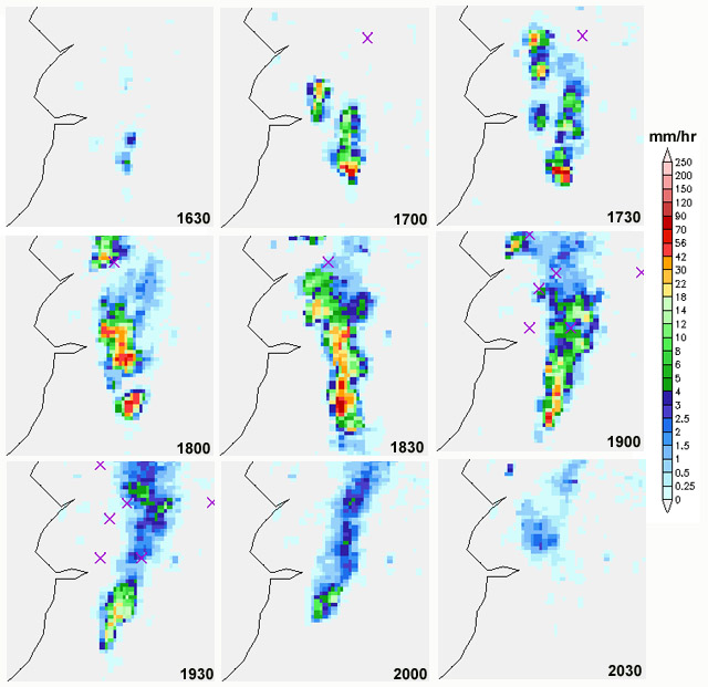 You can see how the storms explode into life by 1700, are intense for the following two hours as each one runs northwards, then begin to decay, with the final cut-off at source by 2030 BST. A note about the rainfall rates: on a normally "wet day", the radar might read up into the mid-greens (5-14 mm/hour) at the most. Here, at the most intense phase of development (shown further down the page) the rainfall intensity was up to ten times that! Let's have another look at what was happening out there: 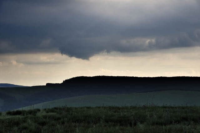 Lowerings like this along rain-free cloudbases are indicative of powerful convective updraughts. They are where to look out for funnel-clouds and tornadoes - today not to be, unfortunately! 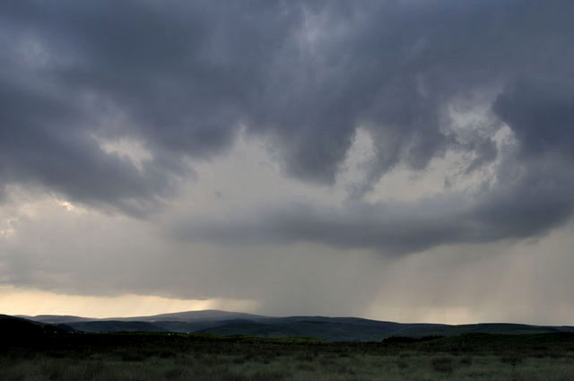 Another storm runs up past Plynlimon. Each precipitating cell spat out numerous cloud-to-ground lightning bolts..... 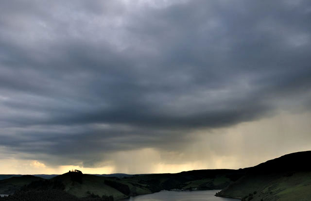 In this wideangle shot looking over Llyn Clywedog, core after core can be seen. Strikes were occurring right along the line now. 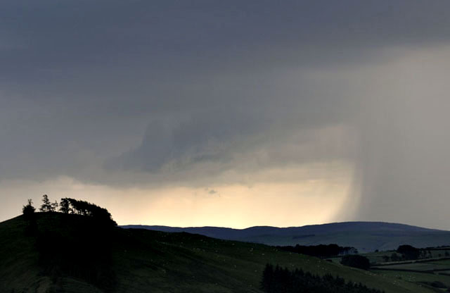 Telephoto showing the edge of a cloudburst! 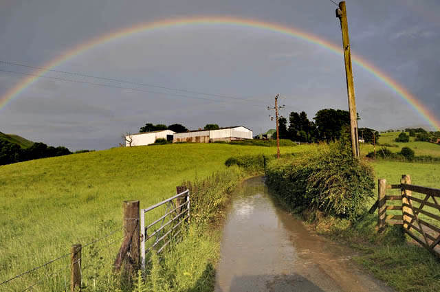 As activity eased up, I headed back homewards. Torrential rain visitations were evident in many places and muddy floodwater was encountered often, as were rocks and soil washed into roadways.... 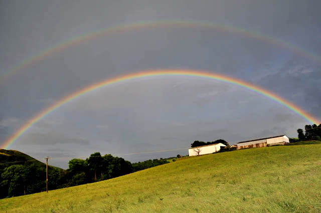 I liked this strong double-rainbow! On returning to Machynlleth, I started getting reports of a violent wind event associated with the heaviest storm of the evening just after 1800 BST, with stuff blown all over the place, branches & even trees down in places over quite a wide area. This sounds very much like a strong downburst - when cold air from way up in the stormcloud is dragged downwards by very intense rain or hail-fall, and due to its greater density, it forms a gravity-current that accelerates earthwards and fans out when it hits the ground, throwing debris in front of it . Here's the radar for 1810: 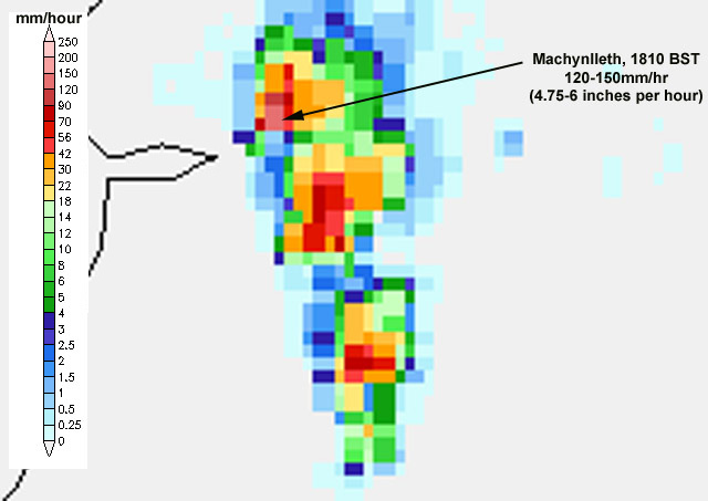 That is some rainfall! More than enough to cause a downburst. A sudden flash-flood also resulted, with some property damage and the Fire Brigade attending to matters. By the time I arrived back, it had drained away and the sun was out. It is worth noting at this point that the August 2004 great flood at Boscastle in North Cornwall happened precisely because a train-echo had developed over the hills above the town, although in that case it tipped it down from much earlier in the day - initiation occurred before lunchtime. But you can see how train-echoes can be potentially disastrous weather events: with Boscastle, the topography makes it far more prone to really big flash-floods because of the narrow, steep sided valleys that take the run-off and because settlements are situated within them. Machynlleth on the other hand is situated on slightly elevated fairly flat-lying ground just to one side of the broad flood-plain of the Dyfi. But had that intensity of rainfall gone on for several hours here on July 1st, there would doubtless have been much more extensive damage from flooding. More soon! |
|
BACK TO WEATHER-BLOG MENU New! Fine Art Prints & digital images for sale- Welsh Weather & Dyfi Valley landscapes Slide-Library - Click HERE |