BACK
TO WEATHER-BLOG MENU
New!
Fine Art Prints & digital images for sale-
Welsh Weather
& Dyfi Valley landscapes Slide-Library - Click HERE
It's
February 16th and I'm stuck in with a cold, so I thought I'd write a
post about the often neglected but beautiful range of hills that forms
the northern side of the Dyfi Valley. Often known as the Tarrens
(several of the summits are prefixed "Tarren" - meaning knoll), the
western part of the ridge is dominated by Tarrenhendre at 633m
(2076ft). On the 8th I joined the walking group from my local pub to
cross the ridge just east of Tarrenhendre, descending through conifers
and past the vast chasms of the Bryn-Eglwys slate quarries to
Abergynolwyn in the Dysinni valley for a pint or two at the Railway. On
that day, the weather was a bit grim with poor visibility, a cold wind
and light snow falling constantly. But the ascent route we had chosen
seemed an excellent way up onto the ridge and the following Thursday,
with beautiful weather expected all day, I set out from Machynlleth a
second time, parking at Pennel just 4 miles down the valley and setting
off just before 1pm along quiet lanes. The image below is Tarrenhendre
from the start of the walk. 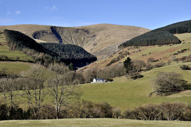 It's obviously steep-sided, but to its east there are extensive Forestry plantations extending almost up to the ridge, complete with a maze of forest roads. So I went to Google maps and zoomed in on the satellite imagery, where a route up became more obvious, allowing the first part of the walk, the climb from near sea-level to 400m, to be done at a gentle gradient. I recommend this Google facility: used in conjunction with OS maps, it adds another layer of useful information regarding terrain: 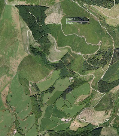 As with most forest tracks, there were limited views from lower down but from halfway up things began to open out: 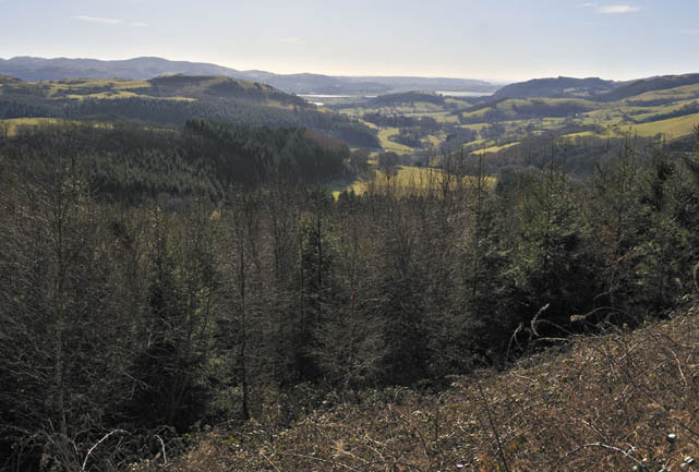 From the upper part of the track system, Borth was visible across the Dyfi Estuary (telephoto): 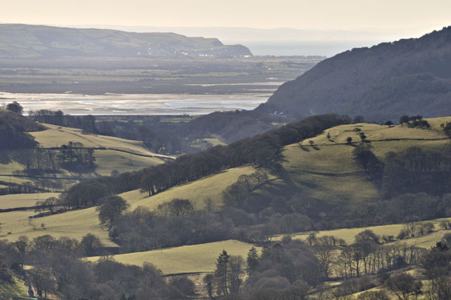 The gentle forest road ended with a steeper track leading up out of the woodland and onto the open hillside above. Tarrenhendre and the approach ridge L: 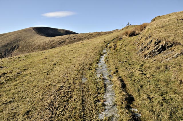 From this point, the northern side of Plynlimon (with quite a few residual snowdrifts) was visible, dominating the hills across the valley (telephoto): 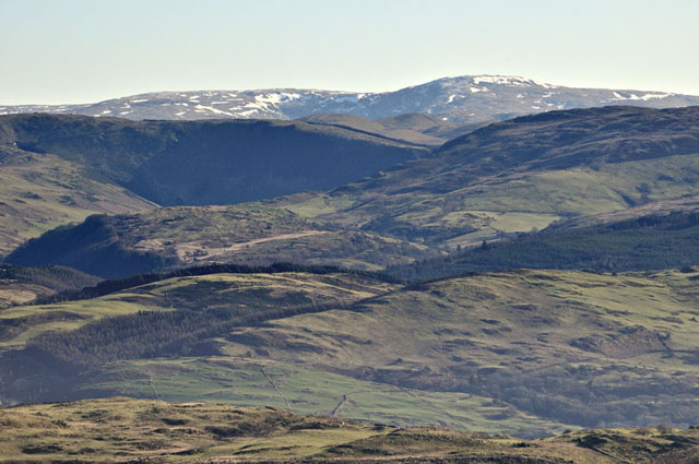 Zooming out to wideangle, here is the retrospective of the upper track curving around to the point where it meets the main ridge: 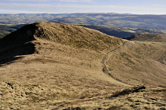 A chilly Northerly breeze greeted me on reaching the ridge. This was most welcome - on the windless afforested slopes below, it was quite warm and I had been going pretty quickly - thus working up such a raging thirst that my litre water bottle was getting low. Luckily I found an overhanging damp cutting in the forest from which I snapped enough icicles to half-replenish the water - although the bottle was then full of little floating bits of root etc as the ice melted! The ridge up to the summit of Tarrenhendre climbs only 200m in 1km, but after the gentle forest-roads it had a distinctly steep feel to it. Here's the view back down (with Tarren y Gesail L), taken during one of the not-so-occasional pauses! 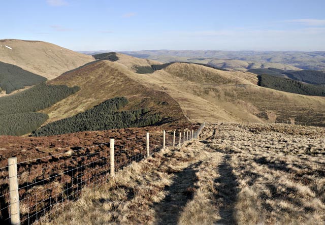 The summit of Tarrenhendre is a flattish, boggy area with a small cairn. Here I stopped for a bite and checked out the view to the west. It confirms what the OS map illustrates: a gently undulating ridge some five kilometres in length with an open S-shape so that the last summit, Trum Gelli, with its two distinctive large cairns, is just to the R of the sunlit strip of water in this image: 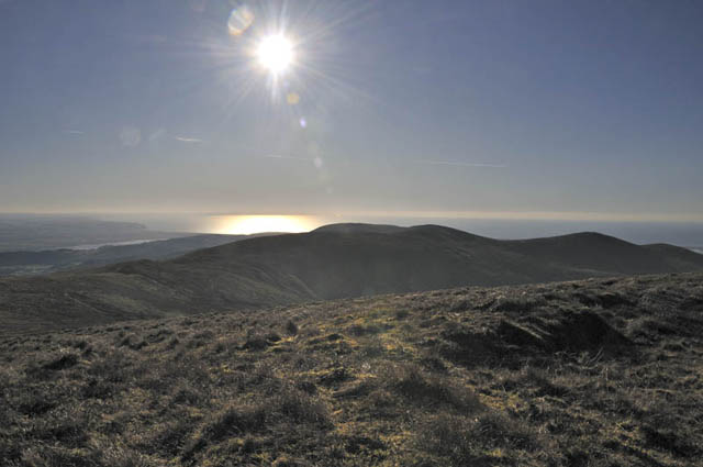 The traverse of this ridge is best done in afternoon light east to west as the views ahead are better that way, looking out along the ridge to Cardigan Bay. By contrast, here's the vista back east to Tarrenhendre. I think that justifies my comment! 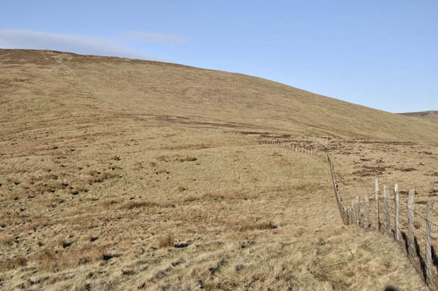 Along the ridge a bit to the west it narrows more and the views down into the Dyfi Valley are interesting (this is why afternoon light is an advantage) - this is a telephoto shot of Glandyfi: 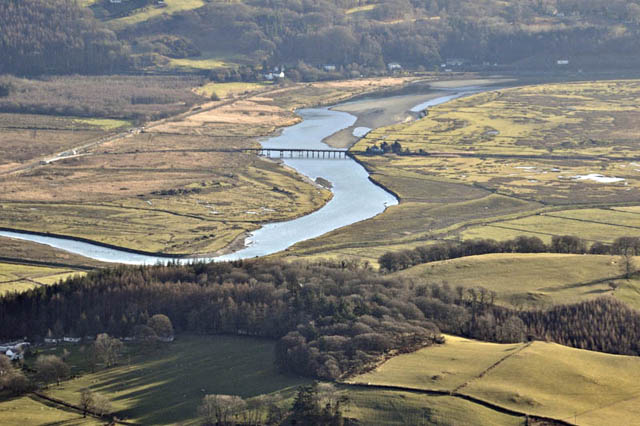 The view along the ridge from Tarren Rhosfarch. Although normally rather to very boggy, today the ground was frozen solid, making progress quick and pleasant.... 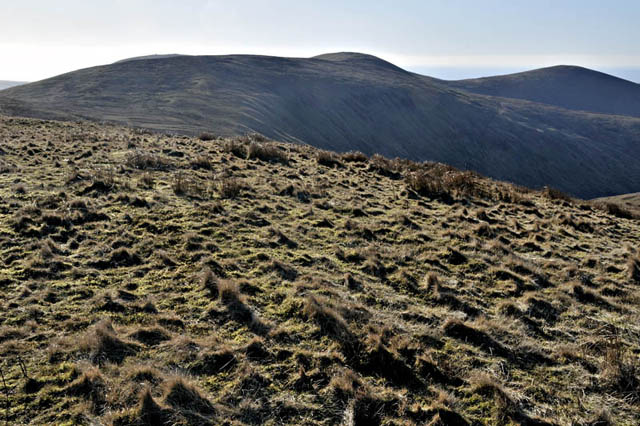 From Mynydd Esgairwedden, the ridge veers R a little and a short steeper section leads up onto Tarren Cwm-ffernol, from where the twin Bronze-age cairns of Trum Gelli dominate the view out to the south-west. They have a strangely powerful draw to me whenever I'm up here: 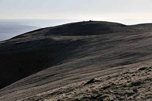 Although the cairns are ancient, I daresay that they have been added-to by walkers in more recent years. They are large: the northern one is about 15m across with a central pile 1.5m high. Here's a view of it with the ridge just traversed in the background and the tops of Cadair Idris popping up on the RH horizon: 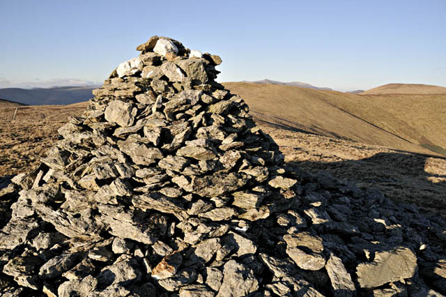 Looking west at this point, a neat little lenticular cloud made for a pleasing composition, getting in a position so that the cairn blocked out the sun: 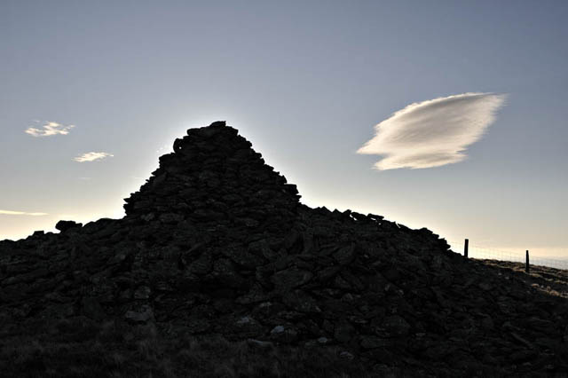 The south cairn has a classic "beehive" structure and again stands atop a broad area of boulders. Here it is, with the north cairn ~125m away across the almost flat ground: 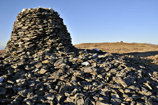 And again facing west with the lenticular: 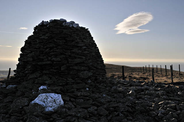 The southern slopes of Trum Gelli drop away steeply, allowing excellent views down to the Dyfi Valley, with most of Machynlleth visible here: 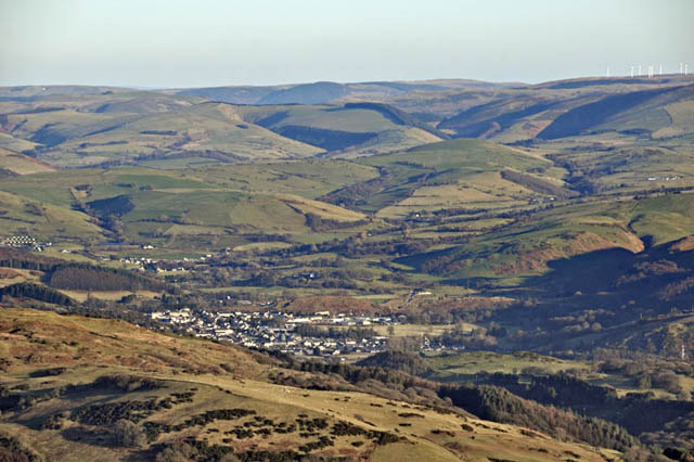 I wonder how much these views have changed since the cairns were built..... Glandyfi, with Plynlimon in the background: 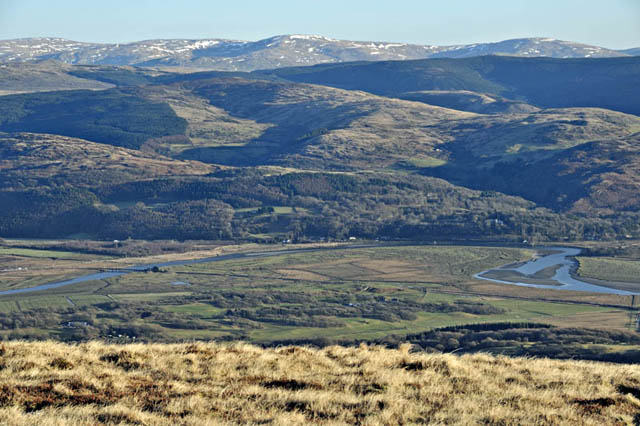 SSW looking towards Llyn Barfog (the Bearded Lake) above Happy Valley, with the Dyfi Estuary, Cors Fochno (Borth Bog) and Llancynfelyn beyond: 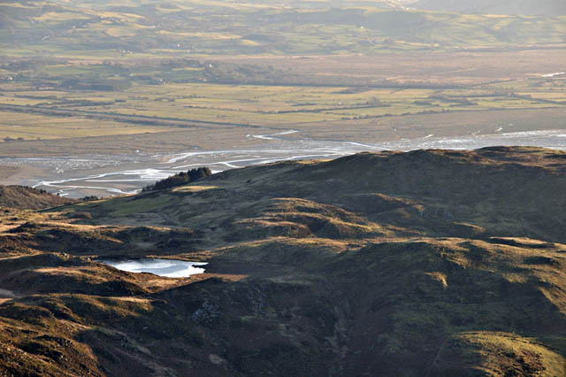 And more WSW, Happy Valley, the estuary and Borth with Cardigan Bay beyond. 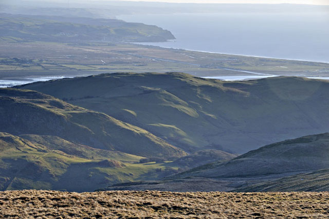 I had thought of staying up there until after sunset but the wind had now got up to about force 6-7 and it was biting with cold - too cold to hang around. I dropped down the ridge to meet the old trackway that reaches the Happy Valley road as the sun set and dusk approached.... 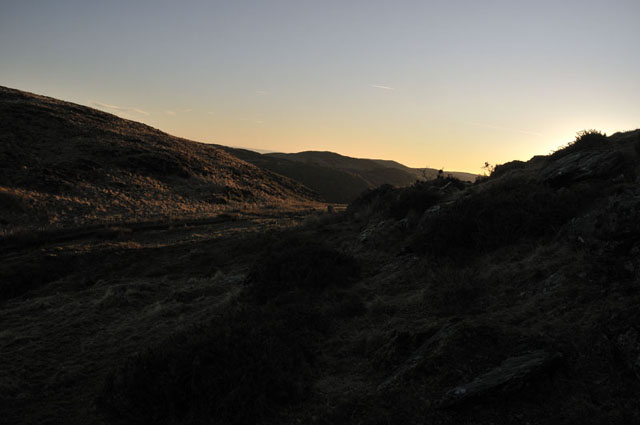 There then followed the only unpleasant bit of the day: 3km of road-walking which did a good job of giving me sore feet! It was 5.50pm and dark when I arrived back at the jeep, after 18km (11 miles) and an awful lot of photography-stops in just over 5 hours. But a great afternoon's tramping in these lonely hills - after Tarrenhedre I saw nobody at all - and a welcome blast of late Winter sunshine, something one has to make the most of at this time of year! |
|
BACK TO WEATHER-BLOG MENU New! Fine Art Prints & digital images for sale- Welsh Weather & Dyfi Valley landscapes Slide-Library - Click HERE |