the Aftermath......
BACK TO WEATHER-BLOG MENU
New! Fine Art Prints & digital images for sale-
Welsh Weather & Dyfi Valley landscapes Slide-Library - Click HERE
Few photographic forays were possible during this period as I was also without a vehicle a lot of the time, but given the violence of the weather at times it was not always safe to head out in any case. What was an exceptionally sustained period of stormy and wet weather peaked on February 12th with the most intense windstorm to affect Mid-Wales for many years, as the damage photos further down-page will show.
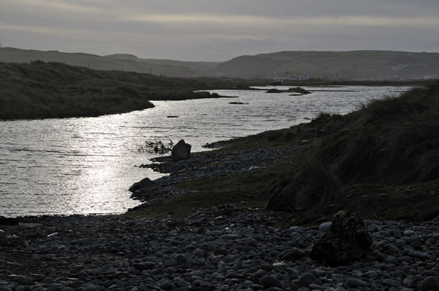
After the big storm-surge and huge swell we saw in early January, I headed down to Borth to see how things were in its aftermath, which is when I took the first set of photos. The Golf Course crossing car-park remained as an extensive saltwater lake...
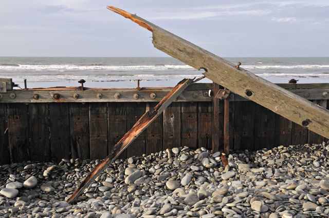
Damage to the sea-defences was widespread: this was a typical example out of many such scenes....
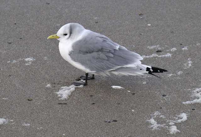
Walking along the beach at the tideline, I encountered this kittiwake: utterly exhausted from the conditions, it made only a half-hearted attempt to move away when I approached it. Kittiwakes tend to spend the winter months offshore, at sea - just where the conditions would have been at their worst....
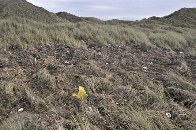
Ynyslas Dunes had fared relatively well in terms of coastal erosion, but waves had clearly overtopped their seaward parts, covering them in waterborne debris....
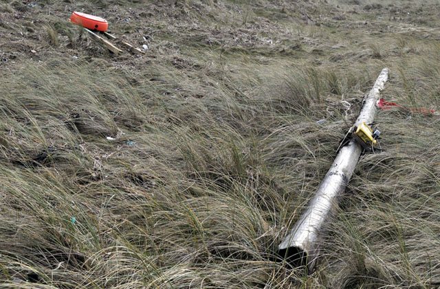
Here's the beach-head emergency telephone and buoyancy-aid, swept up into the dunes...
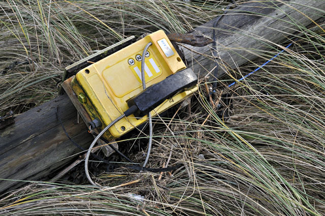
Detail of the phone. Normal service will be resumed as soon as possible, one would hope!
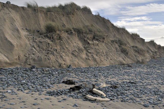
Elsewhere, dune erosion was severe. Aberdyfi golf-course was badly affected in places and there was much evidence of the sea having been hard at work...
That's the coastal damage: now onto the flooding. Ironically, given that it has been Wales' wettest winter, we didn't see any road closures due to the Dyfi bursting its banks. Although it was very wet, the rainbands moved through quickly and the Dyfi has only a short (37km) catchment, so it responds very quickly to heavy rain and it gets flushed out of the system rapidly. It is the multi-day rains associated with warm moist sou-westerlies that bring it into flood, and these have not really featured this winter.
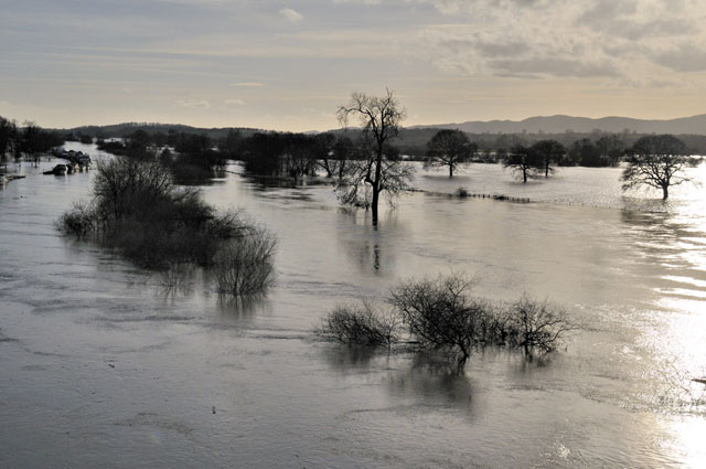
Elsewhere, though, it was a different story: with the major UK rivers having long catchments covering a great surface area, severe flooding was inevitable. The Somerset Levels, the Thames and Severn catchments have all been in the news: on one trip to the Midlands, on February 16th, I had the vehicle at last, so I drove over via Worcester to take a look for myself. The following shots were all taken from or close to the A4400 bypass bridge over the river:
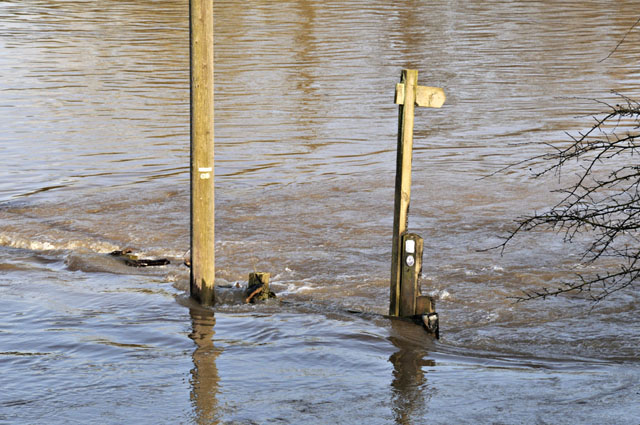
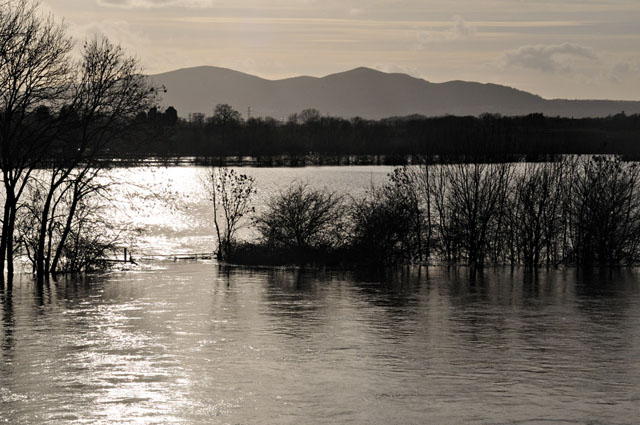
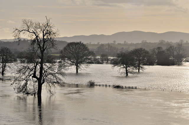
In the photo below, the main channel of the river is delineated by the lines of trees on the LHS:
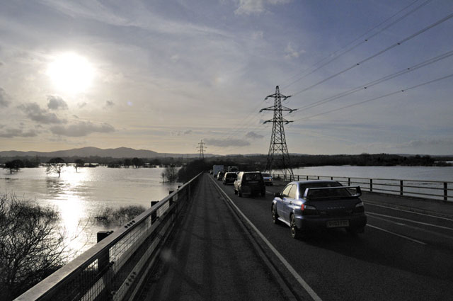
This was an interesting juxtaposition: cars nose-to-tail, pylon lines and concrete - all associated with carbon dioxide emissions, the sun blazing down and the CO2 trapping part of the energy re-emitted from Earth's surface and, all around, wall-to-wall flooding. An Age of Consequences?
For this was supposed to be a once-in-a-hundred year flood - near Severn Stoke, late December 2012:
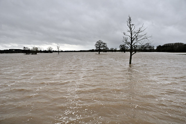
Yet just over a year later......
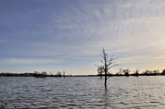
Down by Upton-on-Severn I watched as Army all-terrain vehicles ferried supplies through the floodwaters. Desperate times for the locals.
So onto the third part of the aftermath: the wake of the windstorm of February 12th. Model output charts had been indicating a bad one was on the way some days in advance and that morning, despite there being just a breeze, the warnings started to come in: Shipping for the Irish Sea warned of storm force 10 to hurricane force 12 winds and a rare Met Office Red Warning for the winds was in effect for western Wales.
The winds were forecast to peak in severity during the afternoon and they did precisely that: just after lunchtime they increased dramatically and for the next four hours Wales took an absolute pasting. In Machynlleth we hung on to our electricity, amazingly, with just a few brief outages: some friends in outlying areas went without power for 3 days or more. Looking out from my front door, debris flew through the air: at one point a recycling container zoomed past at head-height and there was the occasional clatter of falling slates. As the afternoon wore on, there were more and more reports of road-closures as trees fell across them. When the winds subsided (and at one point Aberdaron was reporting a ten-minute average of 81mph with gusts to 106mph - a phenomenal reading for the southern UK), I walked up the main street in Machynlleth, finding the pavement littered with slates in places. No doubt, this had been a humdinger.
Next day I walked out as far as Pennal, on the Aberdyfi road, for a recce. The clear-fell that had been taking place on the hillside above the veg-garden had extended itself quite a bit:
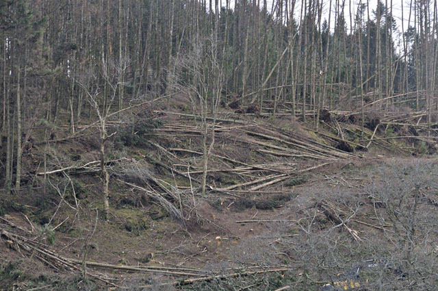
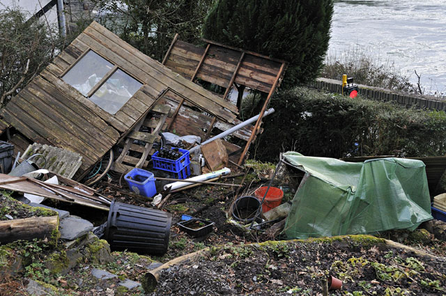
In the garden, this sorry sight greeted me: the shed was pretty frail in any case, but it looked as if someone had blown it up!
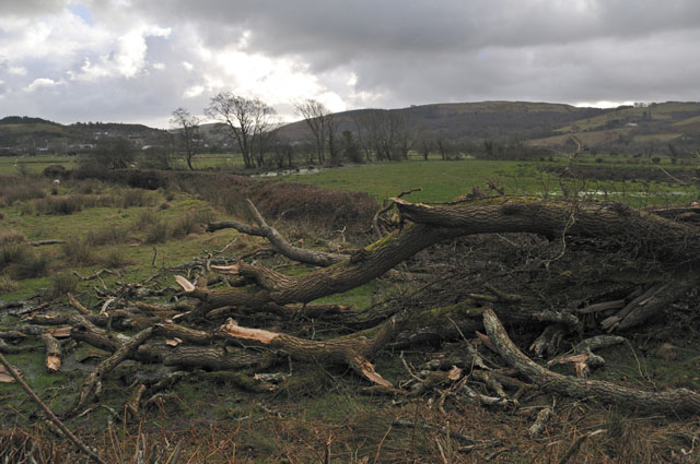
Out towards Pennal, a pattern of isolated fallen trees became apparent:
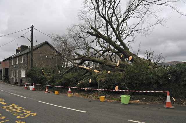
This beech was what closed the main road the previous afternoon:
Once I had transport again, it was possible to have more of a look around. What became apparent was that within the aforementioned pattern of damage, there were local areas that had been completely devastated. These two photos are adjacent plantations north of the Happy Valley road a little way out of Cwrt:
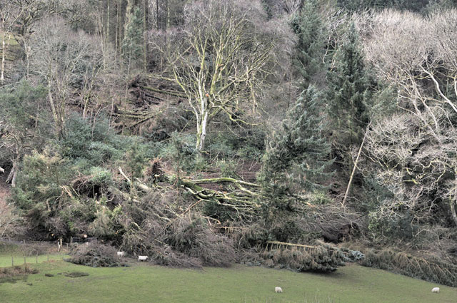
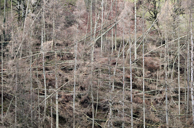
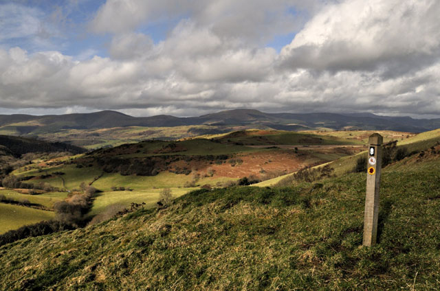
Interestingly, both are on lee-slopes. On the 24th, having discussed the location of the damage with an academic colleague, I set off on foot for a 10-km walk around the hills south of Machynlleth to seek out any other similar areas of damage. Through Forge and out towards Talbontdrain, I struck off into the extensive forestry, making my way towards the Bwlch that leads on down to the Llyfnant Valley. Here, I picked up the Glyndwr's Way footpath and headed south along the long ridge that lies above Machynlleth and Forge, with its fine views out to the north-west:
A few hundred metres along the ridge, I discovered this extensive area of devastation on its eastern slope:
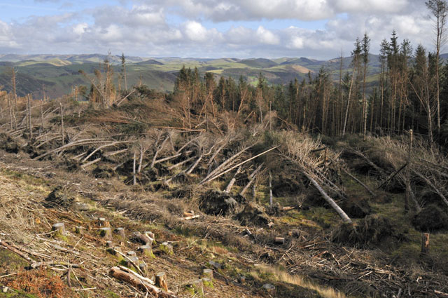
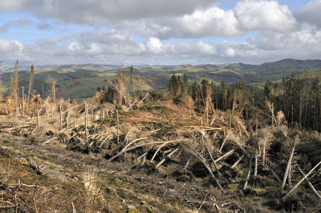
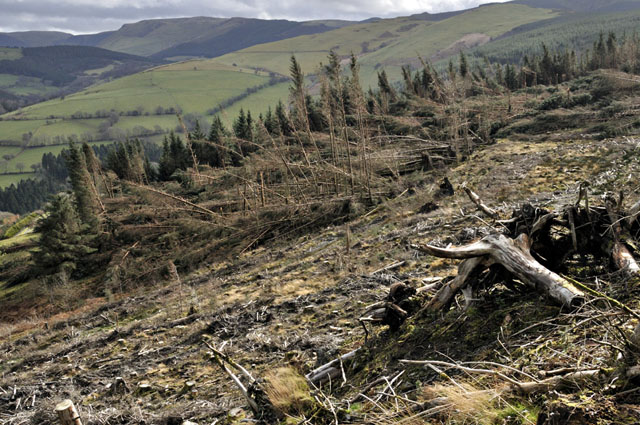
Another lee-slope area of severe destruction, perhaps partly due to the fact that the foreground area had been clear-felled a few years ago. Trees in the inner parts of plantations have less resilience to high winds than trees on their margins: nevertheless this was a major incidence of 'wind-blow', as it is referred to by foresters. It's a horrible job to sort such a mess out as the entangled trees can be under a lot of tension, sometimes springing back violently as they are being cut.
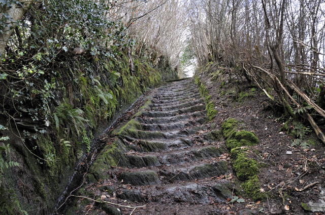
Continuing on my way, I came down through Bryn-glas and descended back to Machynlleth down the 'Roman Steps', where there was a definite feel of spring being just around the corner:
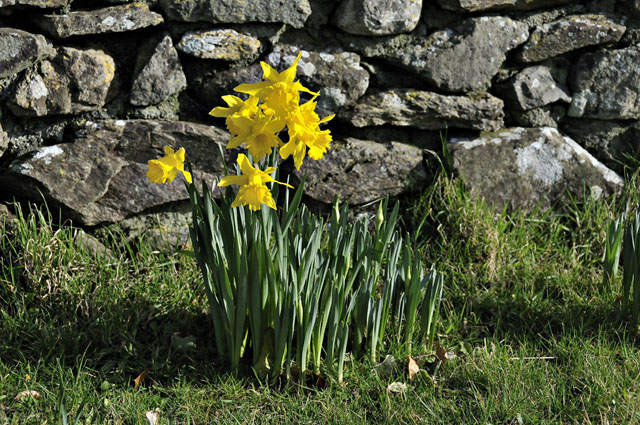
Towards the coast, the daffodils were in full bloom at some favourable spots on the 22nd, and the little golden stars that are the flowers of the Lesser Celandine are starting to stud the earthen banks of local lanes:
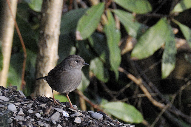
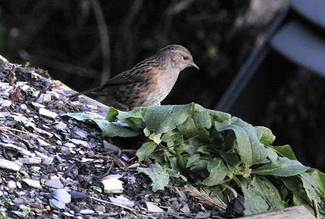
In the garden, the beds are all ready to plant. Whilst not contemplating the wreckage of the shed, I sat back and observed nature getting on with things and attempting to photograph it! Along the hedgeline this hedge-sparrow or dunnock was hopping in and out - a shy and well-camouflaged bird, it proved a difficult subject, coming out into the open only occasionally:
The birdfeeder makes it easier to photograph the less bashful birds, although this nuthatch insisted on feeding on its 'wrong' side!
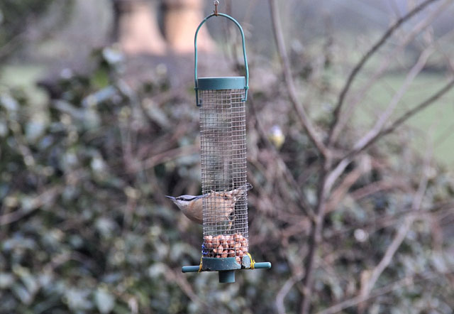
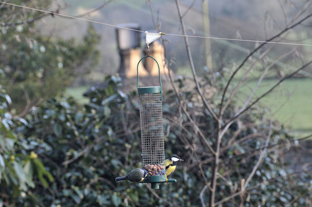
The squirrel-proofing has proved most effective to date - they can't get out on this 50lb fishing line and they can't get at it to chew through it either as each end is tensioned onto a wire trace!
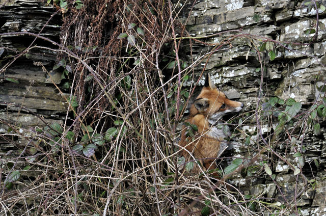
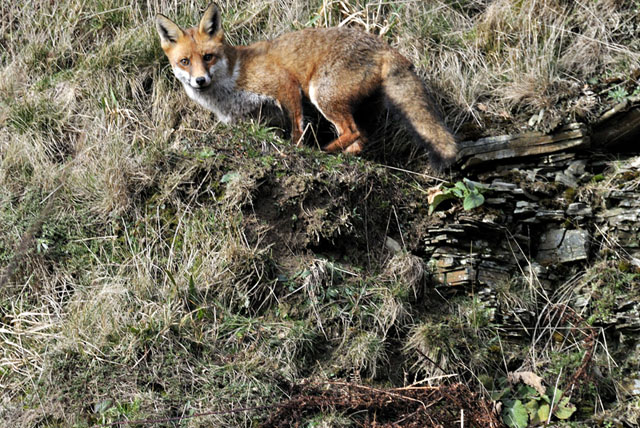
To finish with this time round, on the 16th I stopped at a roadside quarry on the A44 and whilst having a geological look around I flushed out this fox from a bramble-patch: the only way it wanted to go was upwards....
...which it did surprisingly easily!
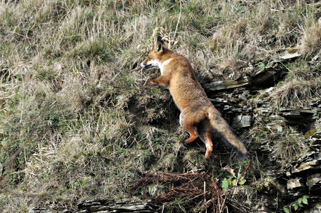
A final parting glance, before it trotted off up the hillside and disappeared among the conifers....
Winter 2013-14 has certainly been exceptional for its storminess, the complete opposite of what some self-appointed long-range forecasters were, erm, 'forecasting'! Personally, I've never been someone who buys into long-range weather forecasting, and Daily Express headlines such as "100 DAYS OF HEAVY SNOW: Britain now facing worst winter in SIXTY YEARS warn forecasters" (17th November 2013) are frankly rubbish. Yesterday was Day 100, by the way!
March can bring almost any weather-type, depending on the source of the air that finds its way to us. 2012 saw an early minor heatwave: 2013 saw one of the worst blizzards to hit Mid-Wales in years. It'll be interesting to see what we get, for sure: but I'll stick to the forecast models and the more accurate short-to-medium term forecasts given out by the mainstream forecasting organisations, thanks!
TBACK TO WEATHER-BLOG MENU
New! Fine Art Prints & digital images for sale-
Welsh Weather & Dyfi Valley landscapes Slide-Library - Click HERE