SUMMER
2004 - PART 3
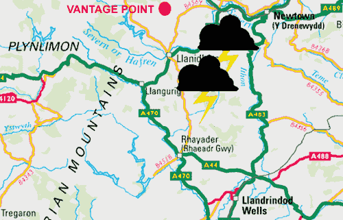
AWESOME STORMS - LLANDINAM AREA, MID-WALES 12th Aug 2004
BACK TO WEATHER-BLOG MENU
New! Fine Art Prints & digital
images for sale-
Welsh Weather & Dyfi Valley landscapes Slide-Library
- Click HERE
With excellent instability forecast
plus clear skies this looked to be a good day to leave
the desk and get out there. I left at midday and headed
on up into the mountains. Picked up on a developing storm
to the SE, and turned off the Machynlleth-Llanidloes road
down towards Trefeglwys and a host of useful vantage
points....
....where I was treated to a remarkable half-hour display
of natural forces (note - I have rescanned the most
interesting images with a better scanner - July 2006).
The images are shown sequentially and all are included up
until the point where the storm gusts out:
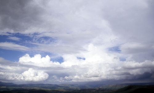
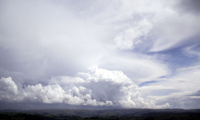 Approaching the whole lot on the back-road to Trefeglwys.... |
|
 The steering flow was drifting the storm slowly NNW, and this is its southwestern corner, where a flanking tower is rapidly developing, feeding moisture and warmth into the storm..... |
|
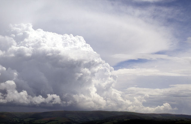
 Zoom-in to the floanking tower building. Rapid convection is underway and the tower walls are developing a rather smooth appearance.... |
|
 Going up! Portait shot to get it all in! |
|
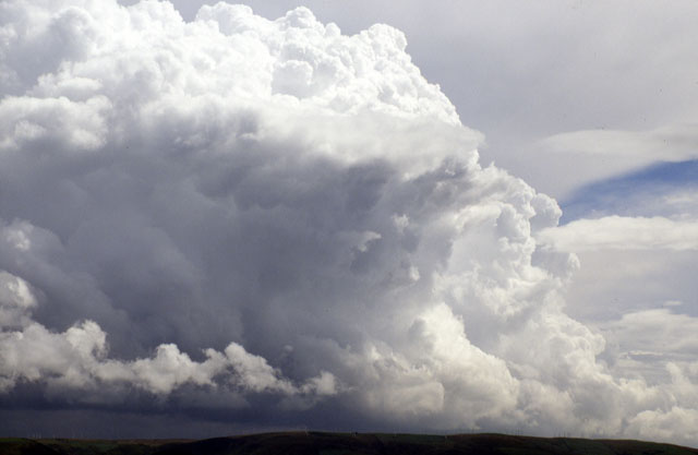
 ....to the north, over the Llandinam windfarm, the edge of some very heavy rain (or possibly hail) is visible and thunder boomed out of the darkness..... |
|
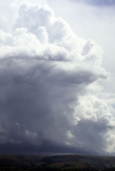
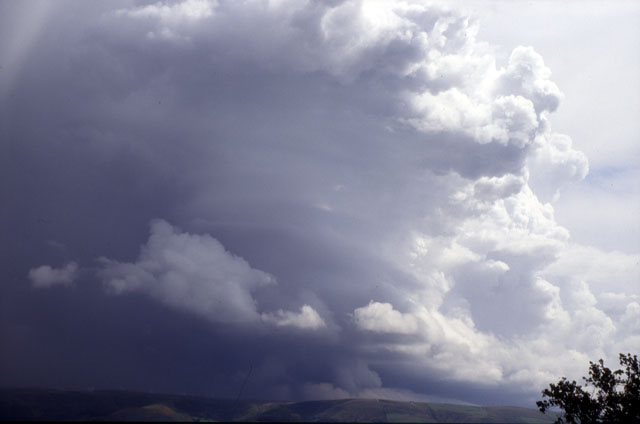
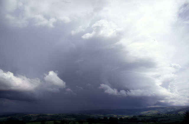
 ...zoom back out: as the convective tower R intensified, its sides became remarkably smooth.... |
|
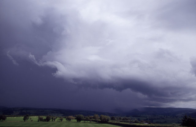
 ....with marked horizontal striations indicative of rotating air currents in the updraught - the rain free area under the cloudbase marks the updraught base position. It appears that this could have been a short-lived (say 30 minutes) mesocyclone - the smooth and striated lower part of the updraught is certainly what one sees in organised rotating updraughts..... |
|
 Another zoom-in showing the striated tower now with lowerings beneath the updraught-base... |
|
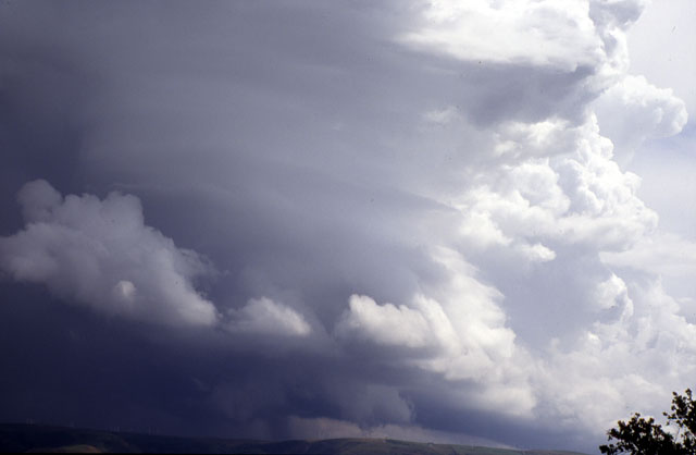 .....quite a sight! Pity I couldn't get closer - however any vantage-point is better than none!! |
|
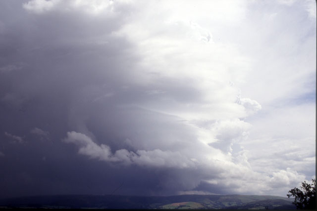
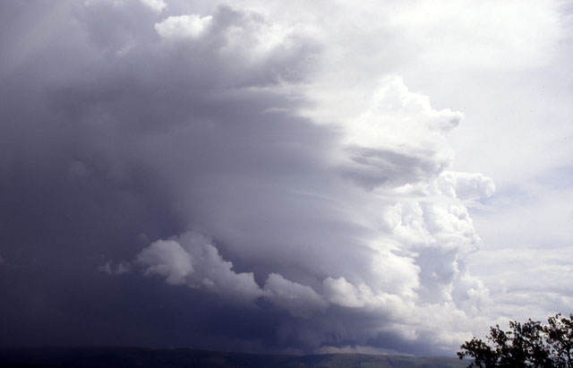 ....tilting over L a little now, with more lowerings beneath.... |
|
 ...zoom-in under the cloud. Hard to know what's going on here. The ragged cloud could be a shallow gust-front due to the torrential rain to the N, but the silhouetted funnel-shaped structure might just be one! Not confirmable however... |
|
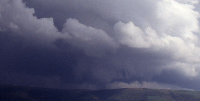
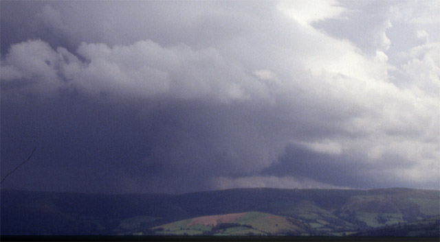
 ....zooming back out a while later, the rain-free base is less extensive and the organisation less obvious... |
|
 ....but those lowerings are still there.... |
|
 ....as this zoom shows. |
|
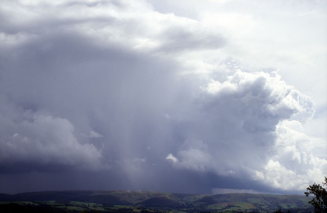
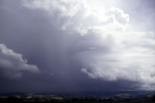 Here, the building storm has finally matured. Rain has started cascading down through the updraught tower, choking the storm's ability to sustain itself via this updraught. A new one may begin and thus sustain the storm for another 30 minutes, but visibility was about to make it impossible to see whether this would happen.... |
|
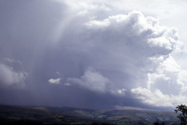
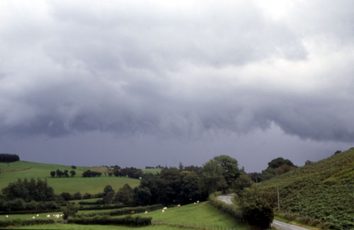
 ....as out from its flank raced a much larger gust-front. Gust-fronts typically occur ahead of the rain and hail. What happens is that cool air dragged down by the precipitation surges ahead of the storm and lifts the warm moist air around it. This then condenses to form long, low, fast-moving cloud-banks like this, which in severe storms may be associated with damaging winds... |
|
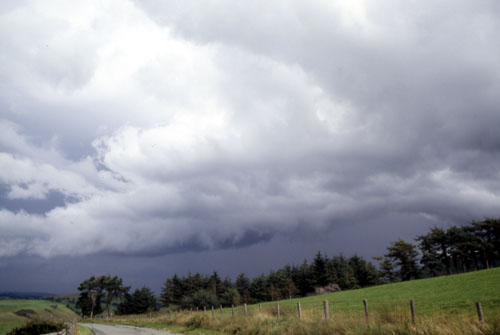
 ...leaving the scene I drove 3 miles west and stopped again, but the gust-front was hot on my heels... |
|
 ...a little further west again. Lightning flickered in the darkness beyond as the storm exploded westwards - side-on to its overall motion. It was just expanding wildly... |
|
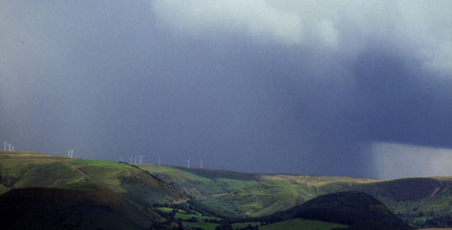
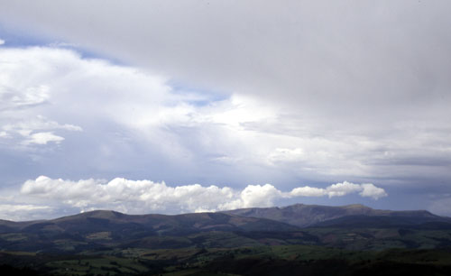
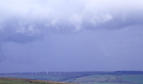 ...several miles westward again above Dylife the front is over Trannon windfarm... |
|
 ...while looking N from the top of the pass the storm's western side can be seen R. Big and mean! With deteriorating visibility I gave up on it but returned to the scene three hours later.... |
|
 ...its anvil had merged with those of other storms to form a great canopy over North, Mid and East Wales... |
|
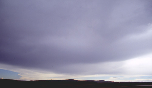 ...This is under the anvil, looking out S over Glaslyn and Plynlimon. Storms like this are awesome things to behold, well-deserving of respect and admiration....... |
|
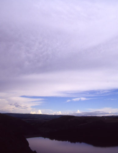 ...and a final shot looking SE under this great canopy, and to further storms over the Borders. The quiet of evening descends over Llyn Clywedog - in marked contrast to the violence that has been going on in the skies through this memorable day. |
|
BACK TO WEATHER-BLOG MENU New! Fine Art Prints & digital images for sale- Welsh Weather & Dyfi Valley landscapes Slide-Library - Click HERE |