SUMMER
2006 - part 4: The coming of the anti-drought!
BACK TO WEATHER-BLOG MENU
New! Fine Art Prints & digital
images for sale-
Welsh Weather & Dyfi Valley landscapes Slide-Library
- Click HERE
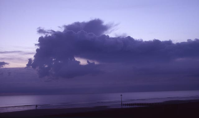
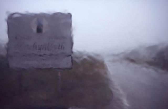 I thought I'd start this new page off with a photo because it demonstrates how the drought ended in Mid-Wales far better than words can do! This was taken on the Forge road, on the outskirts of Machynlleth on an August afternoon. August 2006 began with the bone-dry conditions continuing, but welcome rain in the shape of thunderstorms affected the area on several occasions during the second half of the month, with the Bank Holiday Monday deluges even bringing a tornado with them. More about that below.... |
|
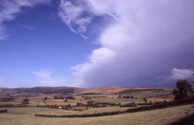 This gave the chance to get out there and find a few big clouds to photograph instead of peering at flowers, butterflies and mudcracks through the "macro" bit on my lens. The first thunder-day - the 17th - was rather weird in that storms fired to my east, and later on to my west, with nothing in between. I drove SE almost to the Welsh border only to find storm-clouds like this one becoming more and more obcured by low-level murk as I got closer to them.... |
|
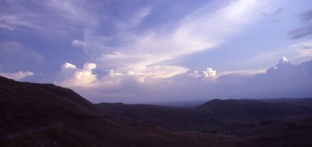 ...with, by evening, distant anvils to the SW and still clear skies over the Cambrian Mountains - was I wearing storm-repellant? These cells are giving rain over the Cardigan area and out in the bay beyond... |
|
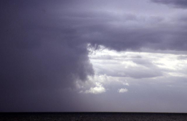
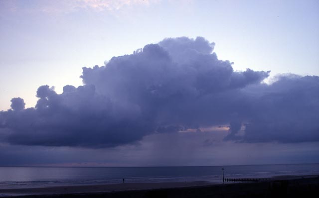 ...whilst finally at Borth a cell tried to get going out to sea. There is evident wind-shear at work here. The updraught part of the cell is the hard-edged, dark rain-free cloudbase to the L. The updraught then rises diagonally for a few thousand feet until rain begins to fall from the cloud in the centre of the photo - the fallstreaks can just be made out. This is happening because winds aloft are stronger than those lower down - to the extent that the updraught has been tilted to the R. If no shear was present the cloud would simply have bubbled up vertically. |
|
 The cell fizzled almost as quickly as it formed. The disintegrated updraught remnants are to the L while above and R of them there is what must be the tiniest Cb anvil I have ever seen! |
|
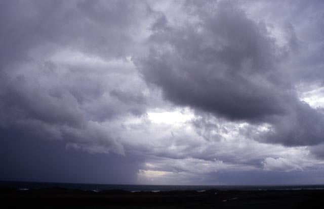
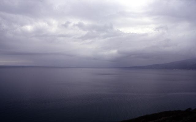 The 18th saw me at a meeting in Tremadog in North Wales whilst to the SE a cluster of multicell storms grew. These were messy affairs. On my way home I stopped above Penrhyndeudraeth and watched the lightning and listened to the unique echoing boom that thunder always makes in the mountains. Roads are busy at this time of year and many of the drivers are visitors who don't know them well: with torrential rain added in, they can be quite hazardous. Thus, shunning the quicker inland route, I headed S on the coast-road through Harlech and Barmouth as the cells drifted NW. Coming inland up the Mawddach Estuary to get to the Penmaenpool bridge, I ran into extremely heavy rain at Bontddu and pulled off the road for 10 minutes while it passed. This was the view further SW again, from above the Friog cliffs S of Fairbourne, under the edge of the storm. Very gloomy, murky skies, from which odd deep rumbles continued, cover NW Wales. Not all storms are beautiful things! |
|
 The 23rd saw some modest convection in the evening, so I headed up into the mountains, stopping en-route to grab this and several other images of the multilayered clouds over the hills above Aberdyfi... |
|
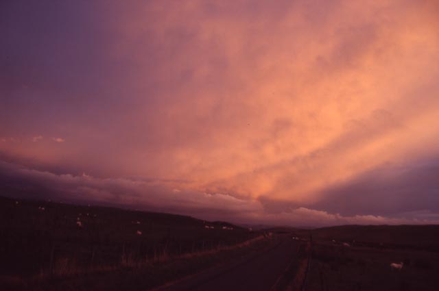 ....before continuing SE, to eventually shoot this post-sunset glowing anvil throwing an eerie light over my vantage-point. |
|
 On the way back home, the layered clouds were still there. High up, cirrus was still illuminated although the sun had long since dropped over the horizon. |
|
 Bank Holiday Monday, August 28th, finally brought some meaner-looking stormclouds to Mid-Wales in the late afternoon, on an unstable nor-Westerly airflow. Eager to get the chance of some action, I headed to the coast north of Aberdyfi. I was not to be disappointed.... |
|
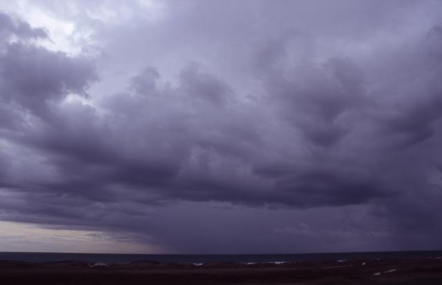
 Multiple cells, giving sporadic rumbles of thunder, were scattered around out to sea with clearly some very heavy rain-cores... |
|
 Telephoto of the edge of a precip-core.... |
|
 Some interesting layering was present, giving the clouds some nice perspective. This cell went on to hit Aberystwyth, where a right old deluge was reported, together with gusty squally winds. The wedge-shaped clouds, ahead of the rain in the middle of the image, probably mark that cell's gust-front, whilst to the left at the back of another cell out-of-view, is an apparent wall-cloud - a steep sided lowering of the condensation (i.e. cloud) base. Such things can be the precursor to waterspouts or tornadoes.... |
|
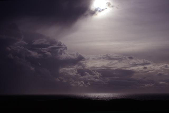 This one is a case of the camera being fooled! The cell has passed now, and the sun has broken through the cirrus of the anvil; the camera's light-meter has metered for the very strong patch of incident light and thus taken a fast exposure, thereby underexposing the foreground. It's created quite a moody effect.... |
|
 ...and again, some time later. Storm-light is often very contrasty and, because the subject is the sky, the foreground does not necessarily matter that much, especially at this place, where it is a golf-course with sand-dunes in the background. Later that evening, further small but potent storms made landfall in the Llanrhystud district, about 10 miles S of Aberystwyth. Heavy rain, thunder and lightning were reported..... |
|
 ....and, right at the end of the storm's passing, a sudden increase to torrential rain and an unbelievable, furious, roaring wind which, upon its passing, left clear starry skies. The wind - a tornado - passed through the Morfa Farm caravan-site just S of Llanrhystud. In a characteristically narrow path, caravan-awnings were ripped away, poles and all, and much plastic garden furniture became airborne. The following morning, I attended the site in my TORRO capacity to find that the residents had cleared most of the damage away. They showed me the destroyed awnings and the path the tornado had taken, pointing out, down-path, the area of debris fallout. Here, in open farmland, they had picked up ripped-up bits of awning, broken poles and the remains of their garden furniture.... |
|
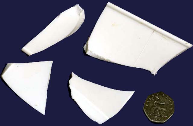 ....most of which was smashed into small pieces like these! This was only a very weak tornado - a T1 on the intensity scale with winds of 55-72mph and damage likely to be: "deckchairs, small plants, heavy litter becomes airborne; minor damage to sheds. More serious dislodging of tiles, slates, chimney pots. Wooden fences flattened. Slight damage to hedges and trees." It is possible that it was a waterspout that came ashore, given the proximity of the site to the coast: the apparent heavy rain that accompanied it also supports this albeit unproven notion. It clearly died quickly, with only a short path and a 200m long fallout zone. Waterspouts often die out quickly on landfall. It does not take much imagination to figure what a tornado with the power of the July 2005 one (T4 to T5) that hit Birmingham would have done here, with almost all caravans in occupation. One would expect multiple casualties. Luckily, this was just a weak version - yet the two children who were asleep under an awning that was ripped away over their heads will remember that particular Bank Holiday Monday for the rest of their lives! |
|
BACK TO WEATHER-BLOG MENU New! Fine Art Prints & digital images for sale- Welsh Weather & Dyfi Valley landscapes Slide-Library - Click HERE |