SUMMER
2007(?!) - part 2: Watery!
BACK TO WEATHER-BLOG MENU
New! Fine Art Prints & digital
images for sale-
Welsh Weather & Dyfi Valley landscapes Slide-Library
- Click HERE
Summer officially begins at the
onset of June and ends with August's passing. Normally.
Oh, I said that in my last entry, didn't I! Hmmmm!
This is proving to be the wettest summer since about 1998
in my reckoning: it's not been that cool though so there
has been a profusion of plant and insect growth (the
latter extensively featuring midges). This has delighted
the climate change sceptics, who typically have cited a
single non record-breaking Summer in terms of warmth to
be absolute and certain proof that the whole theory of
global warming is cobblers and we are in fact going to
have a ice-age next month, or something. Keeps 'em happy
I guess!
June and July have seen appalling flooding: firstly in
late June there were disastrous floods in N England
primarily, but these were followed by an even more
intense rainfall event over July 19-20, when a colossal
(for the UK lowlands) 100-150mm of rain fell over about
12 hours. First, flash-floods affected the whole area,
with Evesham being particularly badly hit. Then, the
rains that had fallen over the headwaters to the various
catchments made their way into the main river basins over
two or three days. The Severn basin saw a flood more
severe than most of the winter floods it has experienced
over the centuries: peaking some days after the rain
event, it caused chaos on a massive scale, and, on a
personal scale, bitter misery and despair to many.
On the photo-front I've been busy with a
"proper" slide-scanner - an Epson V750 - and a
powerful new PC system. Next month should see the Dyfi
Valley/Welsh Weather Slide Library online. Prints, in
stretched canvas and archival heavy photographic papers,
and digital images on CD for multimedia use, will be
available via an easily-browsed system of galleries. It
has long been a hope that I could start making a living
(or part of a living) from my photography. Now there is
sufficient material available (I have scanned over 450
slides) I can at last give it a go. I'll put an
anouncement on here when it's up and running - it has
involved considerably more work than I had first guessed
it would, like most new projects tend to!
The offerings on this page, like the previous ones,
consist of a mixture of images that might appear in the
Library, and ones that most certainly won't: they begin
with the wet weather, go on to cover a neat rainbow that
saved a chase-day and finish with a chase from July 19th
which produced at last a funnel-cloud for 2007 - albeit
not a photogenic one! So, with no further waffling:
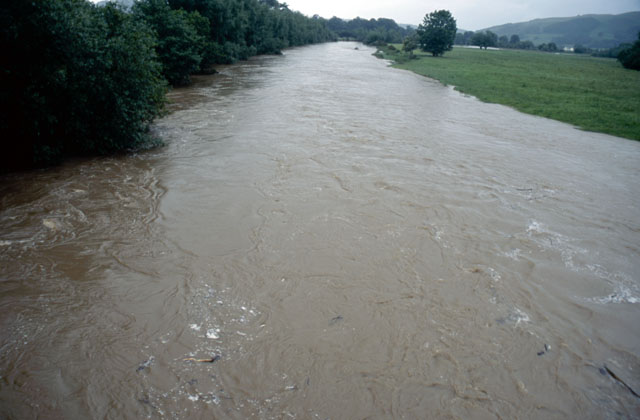 In a scene that would be more fitting with leafless trees in the depths of winter, water surges down the Severn at Caersws. Branches and other debris float along. |
|
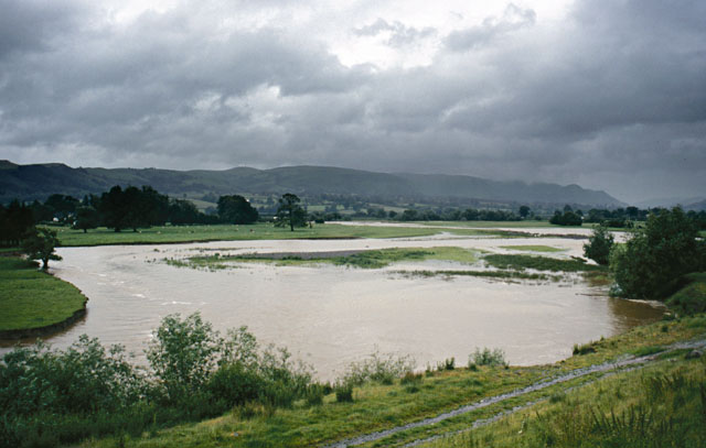 Near Aberhafesp, it is coming out over its banks.... |
|
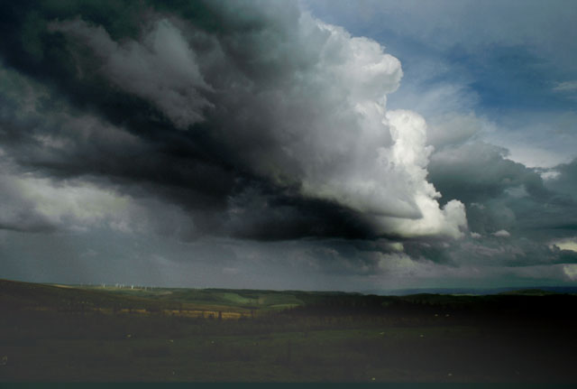 This was back in July. I had been chasing round all over the place trying to pinpoint convection initiating when it finally got going quite close to home. Lousy image this, but it shows the cloudbank that went on to create a natural work of art.... |
|
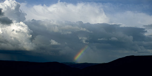
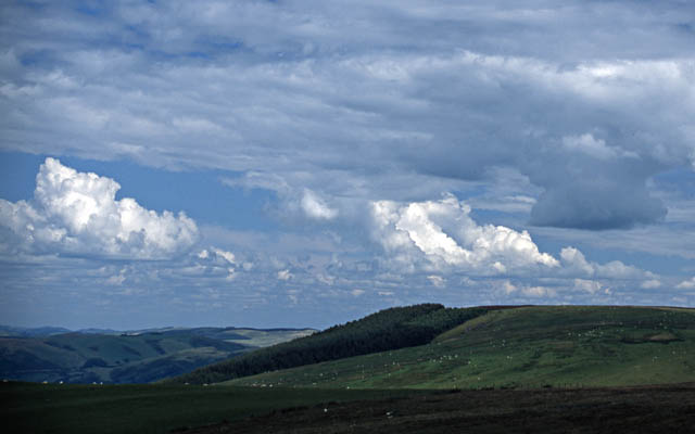
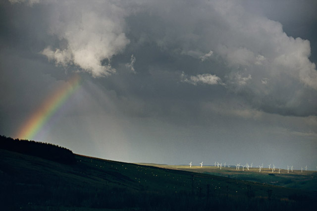 I was very pleased to get this. One of those occasions where the light is perfect, with excellent highlight/shadows distribution. Even the forestry and wind turbines don't detract from it: they actually give interest to the image. As the showers moved northwards, I followed to see if I could get any more little gems.... |
|
 ...and was further rewarded with this wideangle shot.... |
|
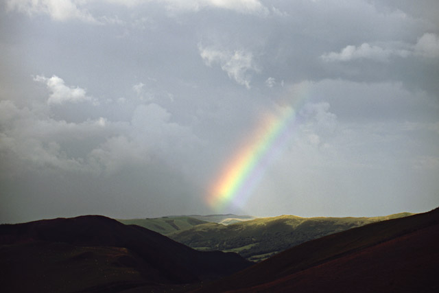 ...and this close-up! That made up for an otherwise unsuccessful day (I have had a few poor trips this Summer).... |
|
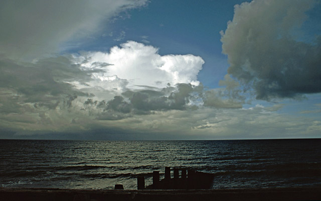 On another July day, this was the only decent view of the numerous convective storms that occurred. For the rest of the day, low-level cloud ruined things.... |
|
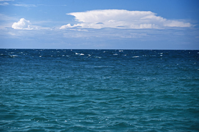 Probably the best view I had of a Cumulonimbus cloud was on a rare sunny day when we went fishing at Porth Iago on the Lleyn Peninsula. This storm was over eastern Eire at the time - over 140 kilometres away! Soundings on the day indicated cloud-tops would reach 30,000 feet or so. Thus, if Everest (at 29,000-odd feet) was in Eastern Eire it would look almost this high from the NW Wales coast! |
|
 July 19th had a lot of promise in the forecasts. Slack low pressure over the UK, solar heating, sea-breezes coming in causing strong low-level shear along convergence-lines: it all screamed "FUNNELS"! As forecast, by late morning convection fired off strongly, as seen here from Machynlleth golf-course on the Forge road. Those clouds are really boiling up - I couldn't wait to get up into the mountains! |
|
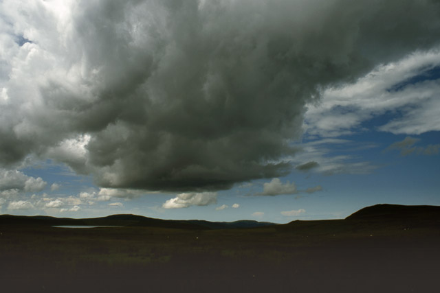 On arrival up there, it became clear that the convection was spreading against a midlevel capping inversion so although showers were breaking out, they were not building to full thunderstorm height... |
|
 ....but look at the shear! That is what is tilting the towers: here if you look carefully you can see the precipitation from the towers falling out on the RHS of the image - some considerable distance from the cloud (and thus updraught) bases on the LHS. Distant anvils beyond are over SE Eire.... |
|
 ...the forecast bore fruit at last when I noticed this smooth-sided structure below one of the cloud-bases. Funnel ahoy! It is in poor contrast against the grey cloud behind: enhanced version below. |
|
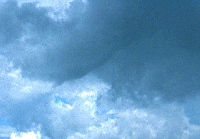 Having savaged the photo with Adobe Photoshop it is clearly a funnel with a collar-cloud at the top. Sadly it didn't last very long or get any more photogenic. Pity. At least it saved the "bust" for 2007! |
|
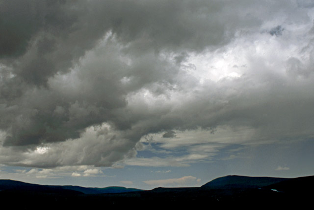
 The convection then waned. Here, though it's not too well-defined, you can see the grey updraught-base R, the tower above and then the midlevel spread of cloud beneath the pesky capping-inversion, going right across the top of the photo. Interesting technical shot if not very pretty! |
|
 Later, whilst the Machynlleth area basked in sunshine, a proper storm finally fired up to my NE. NE of where I lived is difficult chase-country: miles of mountain and moor with just the occasional road. But I thought I'd give it a go. I should have remembered my Irish storms above! Although I could see the anvil from the Dyfi Valley, as I headed N the storm wasn't getting much closer. I finally reached the top of the Bwlch y groes pass between Dinas Mawddwy and Llanuwchllyn near Bala, from where it looked such a mess that I decided to save diesel and leave it be! |
|
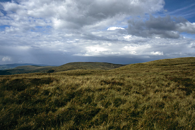
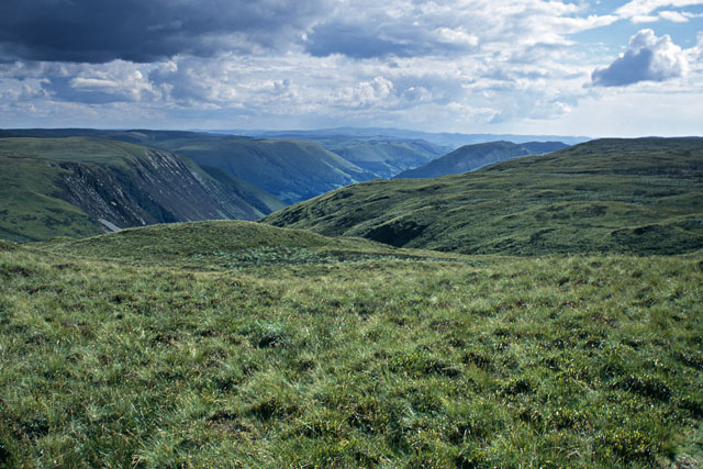 The light was good though. Climbing the hill just above the road, this was the view south down the Dyfi Valley, with the Plynlimon massif in the distance... |
|
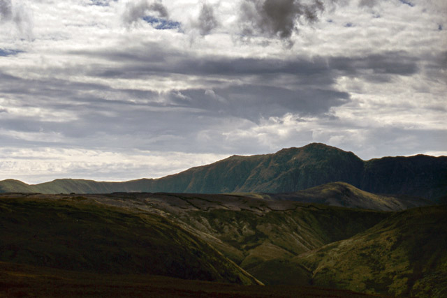 ...whilst to the west, the craggy East Face of Aran Fawddwy dominated the scene, stood frowning over the swelling moorland. I lingered here for some time, watching as the patterns of sunlight and shadow moved across the hills, aware that work beckoned but unwilling to go back "down there" to the world of the Internet and everyday news and politics. Must spend more time in the hills, or mental note made to that effect! |
|
BACK TO WEATHER-BLOG MENU New! Fine Art Prints & digital images for sale- Welsh Weather & Dyfi Valley landscapes Slide-Library - Click HERE |